Petnjica
Municipal town in Bihor, 17 km from Berane
Northern Region · 518 people (settlement)
Raining now · 6 °CPhoto: Planeti · CC BY-SA 4.0
About Petnjica
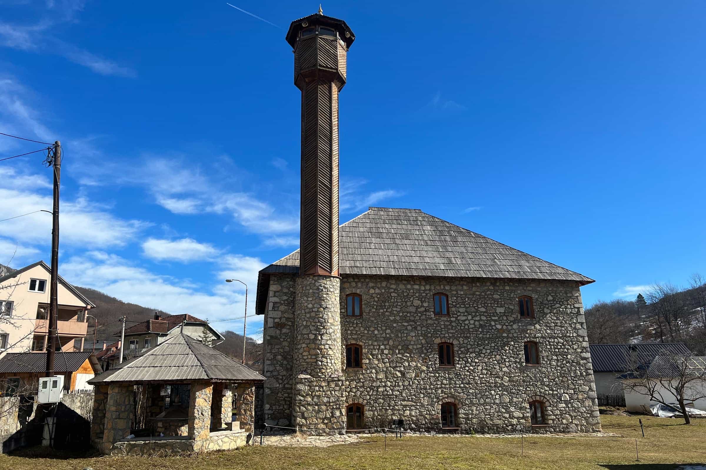
Petnjica is a small town in the north-east of Montenegro and the seat of a municipality in the historic area of Bihor, 17 km from Berane by road, about 25 minutes. The town had 518 residents at the 2023 census and the municipality 4,957. The reason to stop is the three-storey mosque with its wooden pillars and its collection of Bihor rugs; in the Radman gorge above the village of Radmanci lies Turin, a prehistoric site whose finds are in the museum in Berane. There is no tourist office, no railway and no published bus line, so come by car from Berane, Rožaje or Bijelo Polje, each under an hour away.

Key facts
| Status | Municipality since 19 June 2013 (earlier 1945-1957) |
| Population, 2023 | 518 in the settlement; 4,957 in the municipality (24 settlements) |
| Municipality area | 174 km² |
| Region | Northern Montenegro, Bihor |
| Municipal day | 4 August |
| Postcode | 84312 |
Getting there
Petnjica has no railway, no border crossing and no published bus timetable. The nearest station on the Bar-Bijelo Polje railway is in Bijelo Polje, and the train guide covers it. By car, Berane is 17 km away; the times below are free-flow routing, without snow or road works, so check the road conditions in winter.

| From | Distance | Driving time |
|---|---|---|
| Berane | 17.0 km | about 25 min |
| Rožaje | 30.3 km | about 42 min |
| Andrijevica | 32.7 km | about 44 min |
| Bijelo Polje | 33.9 km | about 40 min |
| Mojkovac | 51.6 km | about 1 h 04 |
| Kolašin | 52.9 km | about 1 h 06 |
| Plav | 57.9 km | about 1 h 19 |
| Gusinje | 66.0 km | about 1 h 30 |
| Podgorica | 110.7 km | about 2 h 04 |
| Podgorica Airport | 121.0 km | about 2 h 19 |
| Žabljak | 120.3 km | about 2 h 42 |
The mosque and the Bihor rugs
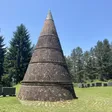
The Petnjica mosque has three storeys and hand-carved wooden pillars, and it keeps a large collection of rugs from different periods; the municipal coat of arms shows it as a 16th-century mosque, beside the fortress where the town began, the Radman gorge and the Petnjica basin with the river Popča and its four tributaries. The Bihor rug (ćilim) is the craft of the area, once used in sworn brotherhoods, marriage arrangements and the handing down of an inheritance. Visiting hours and rules for the mosque are not published; ask locally.
The Radman gorge and the Turin site
In the gorge above Radmanci, a village of 380 people, lies Turin, a prehistoric site with a walled cave known locally as Jerina's Cave (Jerinina pećina). Finds include arrowheads, bronze coins, iron tools, pottery, a 5,000-year-old female figure and a house set half a metre into the ground; they are kept in the Polimski muzej in Berane, so the museum is the place to see them. The path and access rules are not published; other caves are on the caves page. On the Popča, Bratimin vir is a pool with a local legend of treasure hidden in a cave beside it.
Practical information
- Municipality: Ul. Centar III br. 11, Monday-Friday 08:00-16:00 (customers until 14:00), +382 51 248 208, info@opstina-petnjica.me. There is no tourist office; Berane is the nearest larger base.
- Post office: 84312 Petnjica, Petnjica bb, 08:00-14:30.
- Pharmacy and health: Montefarm, in the health station, Monday-Friday 07:00-15:00, Saturday 08:00-13:00; see pharmacies. Ambulance 124; the nearest hospital is in Berane (hospitals).
- Cash: an Erste ATM at Centar 1C and a bank counter with an ATM on Crnogorsko-turskog prijateljstva; see ATMs and banks.
- Languages: of residents aged 15 and over, 13.74% know English and 9.05% German; the municipality has a large diaspora in Germany, Luxembourg and Turkey.
- Stay and eat: no official list of accommodation or restaurants is published.
History in brief
The Bihor area has been settled since prehistory, as the finds at Turin show. Ottoman rule began in the 15th century and lasted more than four centuries, a time when the villages, farming, herding and trade took shape, and the area became part of Montenegro in 1912. Petnjica was a municipality from 1945 to 1957, then part of Berane municipality, and became one again under a law in force from 19 June 2013. The municipal day, 4 August, marks the day of the municipal referendum and is celebrated with a concert in the centre; the municipality gives its 4. avgust award on the same day. The largest villages are Gornja Vrbica (945 residents), Trpezi (690), Lagatori (406) and Radmanci (380).
Questions
How far is Petnjica from Berane?
17 km, about 25 minutes by car.
What is the postcode of Petnjica?
84312.
How many people live in Petnjica?
518 in the town and 4,957 in the municipality at the 2023 census.
When did Petnjica become a municipality?
Under a law in force from 19 June 2013; it had been a municipality before, from 1945 to 1957.
Is this the Petnjica in Šavnik municipality?
No. This page covers the municipal seat in Bihor; a hamlet of the same name lies in Šavnik municipality.
Town facts
- Postcode
- 84312
- Municipality area
- 174 km²
- Municipality population (2023 census)
- 4,957
Sources
Postcode: postacg.me
Municipality area: monstat.org
Municipality population (2023 census): monstat.org
Bus, parking, services
Nearest hospital
- Kliničko-bolnički centar Berane
- Svetosavska 33, Berane
- +382 51 230 630
- 25 min by car (16.8 km)
Sources
Nearest hospital: data.gov.me
Health
Emergency medical service, Petnjica
Open 24 hoursEmergency medical service · Public
Zdravstvena stanica Petnjica
Health centre · Public
Petnjica bb, Petnjica
Sources
hitna.me: Zavod za hitnu medicinsku pomoć: Organizaciona struktura (list of units) · Zavod za hitnu medicinsku pomoć: Kontakt (124 for all municipalities) · Zavod za hitnu medicinsku pomoć: Djelatnost zavoda (service 00-24, every day)
data.gov.me: Ministry of Health open data: Domovi zdravlja i ambulante u CG (updated 2025-05-12)
Town hall and tourist information
Opština Petnjica
Town hall
Petnjica, 84 312 Petnjica
Draft, not yet checked · How we check facts
Sources
Ministry of the Interior, Law on Territorial Organisation, consolidated text (item 12; Sl. list CG 27/2013, in force 19 June 2013), read 2026-11-01 · MONSTAT, 2023 census, population by settlement and sex (xlsx), read 2026-11-01 · MONSTAT, 2023 census, population by municipality (Release 133/2024), read 2026-11-01 · MONSTAT, Statistical Yearbook 2025, table 1-2 (area), read 2026-11-01 · MONSTAT, 2023 census, knowledge of foreign languages (Release 160/2024), read 2026-11-01 · Municipality of Petnjica, History and geographic position, read 2026-11-01 · Municipality of Petnjica, Demographic data, read 2026-11-01 · Municipality of Petnjica, Symbols of the municipality: coat of arms, flag, municipal day, read 2026-11-01 · Municipality of Petnjica, municipal day concert announcement, read 2026-11-01 · Municipality of Petnjica, Location and working hours, read 2026-11-01 · National Tourism Organisation, Charming mountain towns (Petnjica), read 2026-11-01 · National Tourism Organisation, Speleological objects (Turin, Jerina's Cave), read 2026-11-01 · Uprava policije, Granični prelazi (archived gov.me page), read 2026-10-16 · ŽICG, Network statement 2026 (stations on the Bar-Bijelo Polje line), read 2026-10-15 · Pošta Crne Gore, post office 84312 Petnjica, read 2026-10-15 · Montefarm, pharmacy locations, read 2026-10-31 · Ministry of Health open data, health centres and clinics (Zdravstvena stanica Petnjica) · Zavod za hitnu medicinsku pomoć, organisational structure (124) · Erste Bank, branches and ATMs, read 2026-10-15 · Lovćen banka, locations, read 2026-10-15 · OpenStreetMap relation 19157334 Petnjica, ODbL, read 2026-11-01 · Routes computed with OSRM on OpenStreetMap data (ODbL), queried 2026-11-01