Plužine
New town on the shore of Piva Lake, base for the Piva nature park and the west side of Durmitor
Northern Region · 1,083 people (settlement) · New town built at the end of the 1970s
Raining now · 5 °CPhoto: Julian Nyča · CC BY-SA 4.0
About Plužine
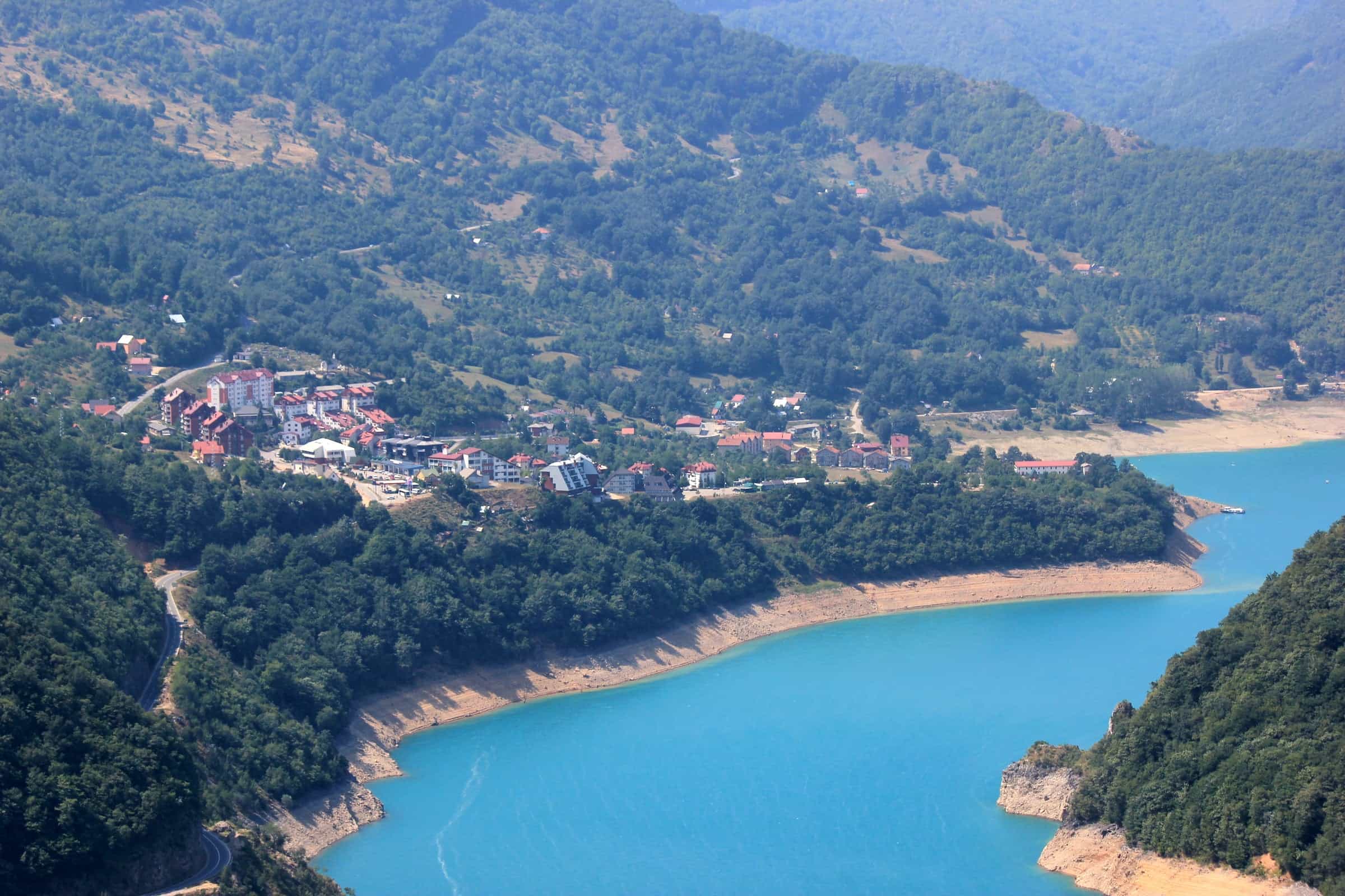
Plužine is a small town on the shore of Piva Lake in the north-west of Montenegro, built new at the end of the 1970s beside the reservoir that flooded the old town. It is the base for the lake and its 1,400 m zip line and via ferrata, for the canyon road down to Šćepan Polje and the Bosnian border, and for the western side of Durmitor National Park over the Sedlo pass. The town has 1,083 residents and the municipality 2,177 (2023 census), spread over 853 km²: the second smallest population in Montenegro, after Šavnik, on the seventh largest municipal area. Nikšić is 58 km away, Žabljak 49 km in summer and Podgorica 109 km.
Getting there
The M-3 Podgorica-Sarajevo road runs through the middle of the municipality and through the town; from Podgorica it is 109 km, about 2 h 20, via Nikšić. The border crossing to Bosnia and Herzegovina is at Šćepan Polje, 26 km down the canyon, with Hum on the other side. The second road in, Plužine-Trsa-Žabljak over the Sedlo pass, is closed by snow in winter; check the road conditions before relying on it. There is no railway, and no bus timetable for Plužine is published: the nearest main bus stations are Nikšić (+382 40 213 018) and Podgorica (+382 20 620 430); the buses guide explains the network. For roadside help call AMSCG on 19807. Distances by car from the town, without traffic:
| To | Distance | Driving time |
|---|---|---|
| Piva Monastery | 8.3 km | about 13 min |
| Mratinje dam | 16.3 km | about 24 min |
| Šćepan Polje border crossing | 26.1 km | about 38 min |
| Sedlo pass | 34.8 km | about 42 min |
| Žabljak (over Sedlo, closed in winter) | 49.1 km | about 58 min |
| Nikšić | 58.4 km | about 1 h 22 |
| Šavnik | 61.1 km | about 1 h 13 |
| Podgorica | 109.0 km | about 2 h 21 |
| Podgorica Airport | 117.4 km | about 2 h 33 |
| Tivat Airport | 140.7 km | about 3 h 04 |
| Budva | 147.4 km | about 3 h 02 |
On the lake
Park prirode Piva, the nature park run from the town, offers a cruise on the lake and rents out four kayaks; in summer the water is warm enough to swim, though no official bathing site is listed and the level rises and falls with the power plant. The figures for the lake are on the Piva Lake page, paddling on the kayaking and SUP page.

The Piva Lake zip line, 1,400 m and the longest in Montenegro, runs from the Eko-Piva guesthouse across the lake to the bridge. Via Ferrata Piva, about 4,500 m long, starts near the bridge and opened in October 2024. The Piva climbing crag, about 2 km from town, has 61 equipped routes of 10-80 m in two zones. The Endless Landscapes (Top Trail 4) cycling route passes through Plužine, and the park recommends the ride Unač-Barni Do-Babići-Žeično-Crkvičko Polje.

Down the canyon to Šćepan Polje
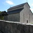
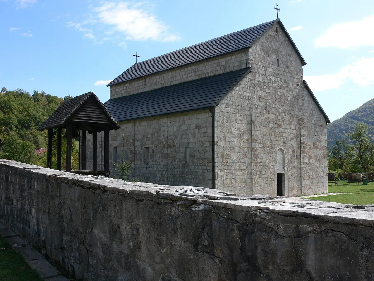
Piva Monastery at Goransko is 8.3 km from town, about 13 minutes by car. It stood at Sinjac, at the source of the Piva, and between 1970 and 1982 it was taken down and rebuilt at Goransko, frescoes included, to save it from the reservoir. No official opening hours are published.

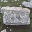
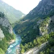
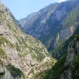
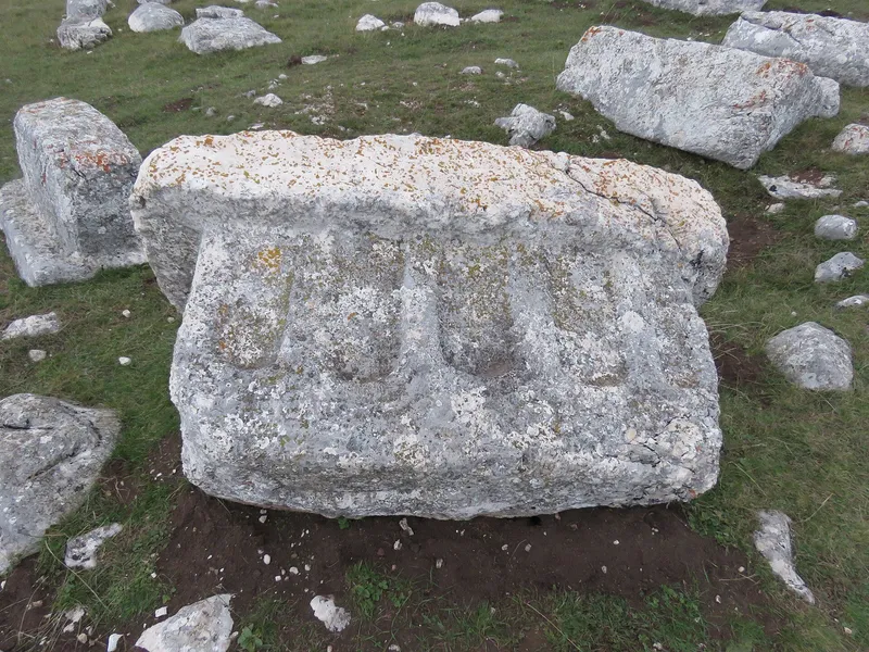
From town the M-3 follows the lake to the Mratinje dam (16.3 km), a 220 m concrete arch whose crest carries the road, then passes the Piva canyon viewpoint at Babići (18.4 km) and reaches Šćepan Polje (26.1 km, about 38 minutes), where the Piva meets the Tara at 433 m, the lowest point of the municipality, on the border with Bosnia and Herzegovina. The Zagrađe monastery viewpoint looks over the confluence, and Grčko groblje at Zagrađe is one of Montenegro's three sites on the UNESCO list of stećci graveyards. One-day Tara rafting trips start at Brštanovica, in Plužine municipality, and end at Šćepan Polje; the season runs from April to October (see rafting in Montenegro).
Up to Durmitor
The Plužine-Trsa-Žabljak road climbs from the lake to the Sedlo pass (1,907 m, 34.8 km, about 42 minutes), on the boundary with Žabljak municipality, and on to Žabljak. It is part of the Durmitor Ring, also a cycling route, and the snow closes it in winter; in a light winter it has reopened in mid-April, in others not until late spring. Sedlo is a trailhead for Bobotov kuk (2,522 m), the highest peak of Durmitor and the highest point of Plužine municipality, and for the Škrčka lakes.
On the way up, the Kruška viewpoint looks over the lake, the town, Ledenice and Bioč, and the Nedajno viewpoint (1,480 m), 5 km from the Trsa junction, looks into the canyon of the Sušica. On the Pišče plateau and Pivska planina, try pivski skorup, prljo (a skimmed-milk cheese), sour milk and grušavina; see local food. Soko peak, Maričina greda and Muratovica, in the south of the municipality, are the other viewpoints with their own pages.
Maglić, Bioč and the mountain lakes
Much of the municipality between the Bosnian border and Durmitor National Park is Park prirode Piva, Montenegro's first nature park: almost 32,500 ha linking Durmitor with Sutjeska National Park in Bosnia and Herzegovina, with more than 1,500 plant species, forests of pine, beech, fir and spruce, bears, wild boar and roe deer, and about 20 small villages and many katuns. On the border rise Maglić (2,386 m), Bioč and Volujak, climbed from June to the end of October; Veliki Vitao on Bioč, 2,396 m or 2,397 m depending on the survey, is the park's highest point. Trnovačko jezero, a heart-shaped lake at 1,517 m (825 by 715 m, 9 m deep), is reached only on foot. The two Stabanjska lakes, Veliko at 1,319 m and Malo at 1,194 m, lie 4.5 km from the village of Stabna, with marked trails to Veliki Vitao and back by the Kručica katun.
A town built for a lake
Plužine belongs to historic Old Herzegovina and was joined to Montenegro after the Congress of Berlin in 1878; with Šavnik and Žabljak it forms the Durmitor region of northern Montenegro. In 1975 the 220 m arch dam at Mratinje closed the Piva, and the Piva hydropower plant dates from 1976. The reservoir, 42 km long, drowned most of the Piva and Komarnica canyons and split the municipality in two. Old Plužine, then the municipal centre, lay lower down and went under the water; the new town was built right beside it at the end of the 1970s, which makes it one of the youngest towns in the region.
Practical information
The Nature Park Piva tourist information centre is at Baja Pivljanina 10 (+382 40 270 069). The town has a health station (Plužine bb, +382 40 271 135), an emergency unit (124), a Montefarm pharmacy at Marka Kulića 2, ATMs (CKB at the IDEA supermarket among them), a post office (81435; Donja Brezna 81432, Trsa 81437) and a Jugopetrol station; the nearest general hospital is in Nikšić, 58 km away. Places to stay range from hotels, hostels and private rooms to bungalows, campsites on the lake and in Goransko, eco and ethno villages and rural households; the park's own listings are the fullest directory.
When to visit
Summer and early autumn are the season: the Sedlo road to Žabljak is open, the Tara is rafted from April to October, the border mountains are climbed from June to the end of October, and the lake is warm enough to swim. In winter the lake road through Nikšić stays the way in and out, and the Sedlo road is closed by snow. The Žabljak in 3 days plan and the 7-day and 10-day loops pass this way.
Questions
What is there to do in Plužine?
The nature park's lake cruise and kayaks, the 1,400 m zip line, Via Ferrata Piva and the climbing crag, all in or near town. Piva Monastery is 8.3 km away, the Babići canyon viewpoint 18.4 km, and Tara rafting trips start at Brštanovica in the same municipality.
How far is Plužine from Žabljak?
49.1 km over the Sedlo pass, about an hour by car. That road is closed by snow in winter; the all-year way round is through Nikšić and Šavnik.
How far is Plužine from Podgorica?
109 km by the M-3 through Nikšić, about 2 h 20 without traffic.
Was the old town flooded?
Yes. Old Plužine, then the municipal centre, went under the reservoir after the Piva was dammed in 1975; the new town was built beside it at the end of the 1970s.
Can you swim in Piva Lake?
In summer the water is warm enough, but no official bathing site is listed and the level changes with the power plant. Swim from the shore near the town.
Where is the border crossing to Bosnia?
At Šćepan Polje, 26.1 km down the canyon road, where the Piva meets the Tara; Hum is the crossing on the Bosnian side.
How many people live in Plužine?
1,083 in the town and 2,177 in the municipality at the 2023 census. The municipality's average age, 47.32 years, is the highest in Montenegro.
Places to visit
Local cuisine
Town facts
- Postcode
- 81435
- Elevation (weather station)
- 780 m
- Municipality area
- 853 km²
- Municipality population (2023 census)
- 2,177
Sources
Postcode: postacg.me
Elevation (weather station): data.gov.me
Municipality area: monstat.org
Municipality population (2023 census): monstat.org
Bus, parking, services
Nearest hospital
- Opšta bolnica Nikšić
- Nikca od Rovina bb, Nikšić
- +382 40 231 204
- 80 min by car (57.3 km)
Sources
Nearest hospital: data.gov.me
Health
Emergency medical service, Plužine
Open 24 hoursEmergency medical service · Public
Zdravstvena stanica Plužine
Health centre · Public
Plužine bb, Plužine
Sources
hitna.me: Zavod za hitnu medicinsku pomoć: Organizaciona struktura (list of units) · Zavod za hitnu medicinsku pomoć: Kontakt (124 for all municipalities) · Zavod za hitnu medicinsku pomoć: Djelatnost zavoda (service 00-24, every day)
data.gov.me: Ministry of Health open data: Domovi zdravlja i ambulante u CG (updated 2025-05-12)
Town hall and tourist information
Opština Plužine
Town hall
Trg Vidoja Žarkovića 4, 81435 Plužine
Turistički info centar, Park prirode Piva
Tourist information centre
Baja Pivljanina 10, Plužine
- Tourist information1 tourist information office
- Post offices in Plužine3 post offices
- Gas stations1 fuel station
- Vets1 vet clinic
- Campsites4 campsites
- EV chargers: 1
Sources
pluzine.me: Opština Plužine: home page (Kontakt i adresa)
data.gov.me: data.gov.me: Lista opština Crne Gore (Ministry of Public Administration, CC BY, updated 2025-05-30) · data.gov.me: Turističke organizacije (Ministry of Tourism, CC BY, updated 2025-09-30)
parkpiva.com: Park prirode Piva: Kontakt · Park prirode Piva: Turistički info centar
Sources
MONSTAT, 2023 census, first results: population by municipality and average age (release, EN) · MONSTAT, 2023 census, population by settlement and sex (xlsx), read 2026-11-01 · MONSTAT, Statistical Yearbook 2025, table 1-2 (area) and table 1-8 (mountain peaks) · Municipality of Plužine, basic information (position, roads, history, dam, old Plužine), read 2026-11-01 · Nature Park Piva, brochure Plužine (municipalities of Plužine and Foča, EU-funded), read 2026-11-01 · Nature Park Piva, O parku (area, link between Durmitor and Sutjeska), read 2026-11-01 · Nature Park Piva, Kako doći (distances, nearest bus stations), read 2026-11-01 · Nature Park Piva, important phone numbers (AMSCG 19807), read 2026-11-01 · Nature Park Piva, home page (accommodation categories), read 2026-11-01 · Nature Park Piva, contact (tourist information centre, Baja Pivljanina 10) · Nature Park Piva, Krstarenje (lake cruise), read 2026-10-18 · Nature Park Piva, Kajak (kayak hire), read 2026-10-18 · Nature Park Piva, Zip Line · National Tourism Organisation, zipline in Montenegro · EU Delegation to Montenegro, Via Ferrata Piva open to tourists · Nature Park Piva, Penjalište Piva (climbing crag) · National Tourism Organisation, Top Trail 4 GPX (route through Plužine) · RTCG, 1 Feb 2020, Prije pola vijeka prenesen manastir Piva (relocation 1970-1982) · Government of Montenegro, Registar voda od značaja (2024), Pivsko jezero (water level range) · Nature Park Piva, Piva canyon viewpoint at Babići (HE Piva) · Nature Park Piva, Zagrađe monastery viewpoint, Šćepan Polje (Tara and Piva confluence) · Stećci World Heritage, Grčko groblje, Plužine · UNESCO World Heritage Centre, Stećci Medieval Tombstone Graveyards (1504), components · National Tourism Organisation, rafting (Tara season) · Nature Park Piva, Kruška viewpoint over the Piva canyon · Nature Park Piva, 19 Apr 2025, Plužine-Žabljak road reopened after the winter closure · TO Žabljak, panoramic roads (Durmitor Ring, Sedlo) · National Parks of Montenegro, Durmitor active holidays (trails from Sedlo) · National Tourism Organisation, GPS file of the panoramic road Kruna Crne Gore (Nedajno, Sedlo) · National Tourism Organisation, mountain towns (Pišče plateau, local produce) · National Tourism Organisation, hiking and trekking (mountain season June to end of October) · Law on National Parks (Durmitor National Park municipalities) · Ministry of Health open data, health centres and clinics (Zdravstvena stanica Plužine) · Institute for Emergency Medical Aid, organisational structure (emergency unit Plužine) · Montefarm, pharmacies · CKB, branches and ATMs · Pošta Crne Gore, post office 81435 Plužine, read 2026-10-15 · Jugopetrol, station finder · Health Insurance Fund of Montenegro, health institutions in the network (general hospitals) · OpenStreetMap node 255352645 Plužine (place=town), ODbL · Routes computed with OSRM on OpenStreetMap data (ODbL), queried 2026-11-01