Need a car in Tivat?
Rent a car for day trips and compare pick-up points in one search.
on Localrent
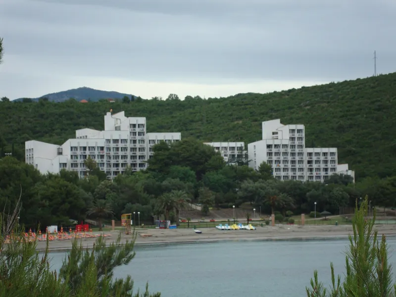
Photo: Корнет Кларнет · CC BY-SA 4.0
Marina and airport
Coastal Region
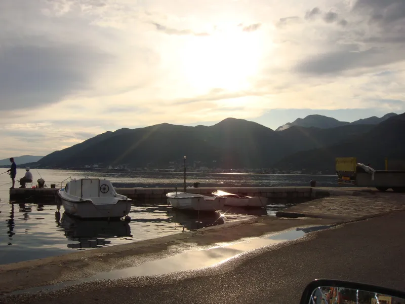
Photo: Корнет Кларнет · CC BY-SA 4.0
Generated using E.U. Copernicus Marine Service Information, DOI 10.48670/moi-00172
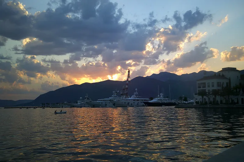
Tivat is the town on the Bay of Kotor with the airport: Tivat Airport is 4.7 km from the centre by road, about 7 minutes, and from there Kotor is about 8 km and Budva about 20 km. The settlement had 10,743 residents at the 2023 census and the municipality 16,338. The town sits below the Vrmac ridge, the Luštica peninsula belongs to the municipality, and the largest sandy beach in it is Plavi horizonti in Pržna bay. The former Austro-Hungarian naval arsenal on the waterfront is now the Porto Montenegro marina.


Three islands lie off Tivat. Sveti Marko (Stradioti) is the largest in the whole Bay of Kotor, 34 ha, about 20 minutes by boat from the Pine jetty. It was the Orthodox monastery of St Gabriel in the Nemanjić era, then a camp of Greek stradioti soldiers under Venice, and from 1962 to 1991 the Club Méditerranée "San Marco" with 300 Polynesian-style reed huts. Today it is deserted and wooded, with a hidden beach.
Gospa od Milosti (Our Lady of Mercy, also called Školj) is the smallest of the three, about 100 by 50 m. Celestine monks arrived in 1479, Franciscans took over in 1524 and built the present monastery and church; the Ottomans sacked it in 1620 and lightning struck it on 27 January 1844. A 15th-century wooden statue of the Virgin draws pilgrims, the monastery library is among the richest in the region, and a Roman altar to Juno Lucina survives on the island.
The Luštica peninsula closes the bay to the south and holds the largest beach in the municipality. The panoramic road "Life on Luštica" is a winding 40 km route from the big roundabout on the Tivat-Budva road through Bjelila, Krašići, Zabrđe, Klinci, Mrkovi, Tići, Mardari and Begovići to Luštica Bay. Allow a full day; stretches are narrow and steep, and cyclists do better on e-bikes.
Luštica Bay is the resort in Trašte bay next to Radovići, about 10 km from Tivat Airport and 80 km from Podgorica Airport. Its developer, Luštica Development AD, was founded in 2008 and is owned 90% by Orascom Development and 10% by the Government of Montenegro. The Chedi hotel beach there held a Blue Flag in 2026.
Tivat had two Blue Flag holders in 2026: Plavi horizonti (two areas in Pržna bay) and the Chedi hotel beach at Luštica Bay.
The oldest dated site is the monastery on the Island of Flowers (6th century). The Buća-Luković residence is the town's 14th-century landmark; its tower dates from 1548. In 1888 the Luković heirs ceded part of their estate to the municipality and the Austro-Hungarian navy for a naval arsenal, and in 1889 the municipal council transferred the use of the land for its construction. The arsenal shaped the modern town: the City Park was laid out in 1892 under the same Austro-Hungarian rule, and the yard itself became Porto Montenegro.
Tivat Airport is the coast's airport and the closest to the Boka. There is no railway; the car ferry at Lepetane, near Opatovo beach, shortens the road to Herceg Novi. Driving times below are road times without traffic.
| From Tivat centre to | Distance | Driving time |
|---|---|---|
| Tivat Airport | 4.7 km | about 7 min |
| Kotor | 11 km | about 16 min |
| Herceg Novi | 20 km | about 34 min, via the Lepetane-Kamenari ferry (crossing and waiting not included) |
| Budva | 25 km | about 31 min |
| Podgorica | 88 km | about 1 h 50 min |
| Podgorica Airport | 89 km | about 1 h 55 min |
Luštica beaches are about 30 minutes by car from town; Velja špilja and Plavi horizonti are also reached by boat, and Sveti Marko island by boat from the Pine jetty.
The sea bathing season runs from May to October and the coastal walking season from mid-April to the end of October. The year's fixed dates:
About 8 km to Kotor and about 20 km to Budva; from Tivat itself the airport is 4.7 km by road, about 7 minutes.
Plavi horizonti (fine sand, the largest), Kalardovo (sand, shallow) and Velja špilja (sand). Opatovo is described both as sand and as mostly pebble.
By boat from the Pine jetty, about 20 minutes. The island is uninhabited.
Yes. Entry is free, and there are trails with benches and two bird-watching towers.
Rent a car for day trips and compare pick-up points in one search.
Postcode: postacg.me
Elevation (weather station): data.gov.me
Municipality area: monstat.org
Municipality population (2023 census): monstat.org
Emergency medical service · Public
Health centre · Public
Radovići, Tivat
Mon-Sat 07:00-21:00
Health centre · Public
Istarska bb, Tivat
Mon-Sun 07:00-21:00
hitna.me: Zavod za hitnu medicinsku pomoć: Organizaciona struktura (list of units) · Zavod za hitnu medicinsku pomoć: Kontakt (124 for all municipalities) · Zavod za hitnu medicinsku pomoć: Djelatnost zavoda (service 00-24, every day)
dztivat.com: Dom zdravlja Tivat: home page
data.gov.me: Ministry of Health open data: Spisak svih zdravstvenih institucija u CG (xlsx, updated 2025-05-12)
gov.me: Government of Montenegro: Primary health care centres in Montenegro
fzocg.me: Health Insurance Fund: contracts with institutions in the health network
Town hall
Trg magnolija 1, 85320 Tivat
Tourist board office
Palih boraca 19, 85320 Tivat
+382 32 660 165 · +382 32 671 324 · +382 32 671 323
Mon-Sun 07:00-14:00
MONSTAT, 2023 census, population by municipality (Release 133/2024) · MONSTAT, 2023 census, population by settlement · Tourist Organisation Tivat · Tourist Organisation Tivat, Buća-Luković residence · Tourist Organisation Tivat, Porto Montenegro · Tourist Organisation Tivat, Island of Flowers · Tourist Organisation Tivat, beaches · Tourist Organisation Tivat, calendar 2026 · Tourist Organisation Budva, how to get there (airport distances) · Tourist Organisation Herceg Novi, about the city (airports) · National Tourism Organisation, Bay of Kotor · National Tourism Organisation, family beaches · National Tourism Organisation, hidden beaches (Pecka) · National Tourism Organisation, hiking and trekking (coastal season) · Kotor Tourist Organisation: boat tours · Morsko dobro, The Beaches of Montenegro (brochure) · Blue Flag Montenegro, flagged bathing areas by season · National Parks of Montenegro, Lovćen active holidays (viewpoints) · Tourist Organisation Podgorica, how to get there (road distances) · Wikipedia, Tivat · Tourist Organisation Tivat, Gornja Lastva · Tourist Organisation Tivat, Sveti Marko island · Tourist Organisation Tivat, Gospa od Milosti · Tourist Organisation Tivat, Luštica panoramic road · Tourist Organisation Tivat, Luštica Bay · Tourist Organisation Tivat, Solila · Tourist Organisation Tivat, City Park · Tourist Organisation Tivat, Vrmac · Tourist Organisation Tivat, festivals and events · OSRM routing (car, OpenStreetMap data, ODbL; times without traffic)
Google Analytics counts visits without cookies. With your consent it also sets cookies that show us how the site is used. Nothing is used for advertising. Privacy