Need a car in Pljevlja?
Rent a car for day trips and compare pick-up points in one search.
on Localrent
Photo: Julian Nyča · CC BY-SA 3.0
Northernmost town
Northern Region · First mentioned 822 · Historic
Photo: Julian Nyča · CC BY-SA 3.0
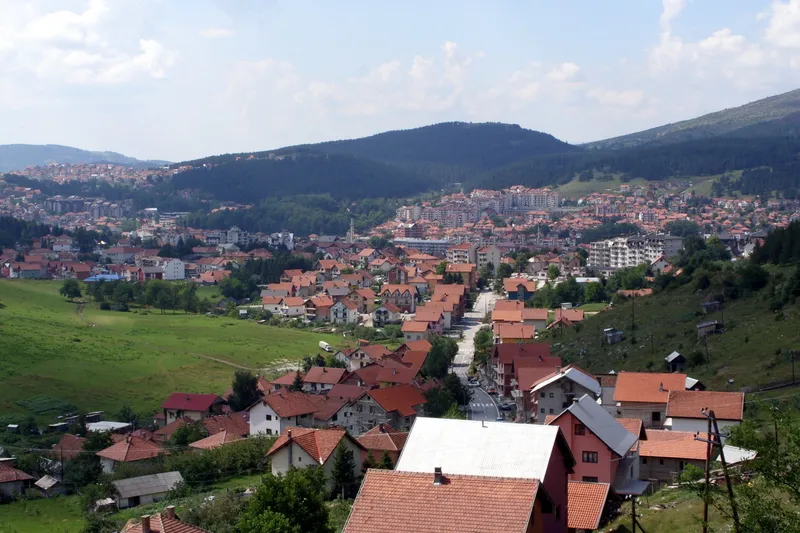
Pljevlja is the northernmost town in Montenegro, in a basin at the foot of Golubinja where the Breznica, the Ćehotina and the Vezišnica meet. The settlement had 16,111 residents at the 2023 census and the municipality 24,134, with an average age of 46, among the oldest in the country. The municipality covers 1,343 km², the third-largest in Montenegro, about 70% of it forest, and borders Bosnia and Herzegovina and Serbia. The weather station in town stands at 784 m. There is no railway: Podgorica is 161.1 km away by road, about 3 h 18 min, and Žabljak 60.2 km, about 1 h 17 min. Visitors come for the Husein-pasha Mosque of 1569, the Holy Trinity monastery, the Đurđevića Tara bridge on the edge of Durmitor National Park, the Ćehotina meanders and the town's cheese, pljevaljski sir.


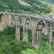
Pljevlja is one of the five municipalities of Durmitor National Park, with Žabljak, Mojkovac, Plužine and Šavnik, and the canyon of the Tara, 78 km long and 1,333 m deep at its deepest point between Obzor and Štuoc, forms its southern edge. The Đurđevića Tara bridge stands on the municipal border where the Pljevlja, Žabljak and Mojkovac roads meet, 37.2 km from town, about 45 min: 365 m long with a main arch of 116 m, 170-172 m above the river, built between 1937 and 1940 by the engineer Mijat Trojanović. Its arch was blown up in 1942, during the Second World War, and the bridge was rebuilt in 1946. The park sells its ticket at the bridge, €5 per person per day and free under 15. Two zip lines cross the canyon beside it, 1,050 m and 824 m long and about 150 m above the gorge, with no advance booking; multi-day rafting trips put in just below the bridge. The season on the river runs from April to October, with the safest window from 1 July to 15 September, a minimum age of 7 and about €70 for a day; the routes and operators are on the rafting page. The Ćurevac viewpoint at 1,625 m on the Žabljak side is the classic canyon lookout, and Bobotov kuk, the highest peak of Durmitor, is 2,522 m in the official survey (2,523 m in the park's figures).

The Ćehotina itself is 125 km long, 100 km of them in Montenegro: it rises at 1,020 m, passes the Otilovići dam above the town, leaves the country at 380 m and joins the Drina at Foča in Bosnia and Herzegovina. The Pljevlja fly-fishing zone on it holds grayling, huchen and brown trout, runs from June to November and is catch and release only, with daily permits from the local sport-fishing club; huchen must be released on every water in the country until 1 April 2029. The other zones are on the fly-fishing page, and the country's rivers are compared on the rivers page.
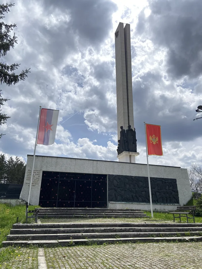
Paleolithic traces were found in a cave below Gospića vrh in the Ćehotina valley, and the Roman town at Komini held municipal status by the middle of the 2nd century. The town is first mentioned as Breznik in 822 and was renamed Taslidža, the stone bath, in 1465 under the Ottomans; the monastery recorded in 1537 and the mosque of 1569 date from that period. The Battle of Pljevlja on 1 December 1941 was the largest battle of the first year of the war in Yugoslavia. The Stražica memorial of 1961 and the Garibaldi monument of 1983 mark the 20th century.
Road distances below are free-flow routing on OpenStreetMap data, without traffic or snow.
| To | Distance | Time |
|---|---|---|
| Đurđevića Tara bridge | 37.2 km | about 45 min |
| Žabljak | 60.2 km | about 1 h 17 min |
| Bijelo Polje | 68.5 km | about 1 h 51 min |
| Berane | 102.6 km | about 2 h 23 min |
| Kolašin | 104.5 km | about 2 h 24 min |
| Nikšić | 132.5 km | about 2 h 56 min |
| Podgorica | 161.1 km | about 3 h 18 min |
| Podgorica Airport | 172.0 km | about 3 h 34 min |
| Cetinje | 197.6 km | about 4 h 02 min |
| Bar | 216.5 km | about 4 h 20 min |
| Kotor | 221.6 km | about 4 h 48 min |
Spring and summer are the season for the town and the Tara: rafting runs from April to October, fly fishing on the Ćehotina from June to November, and the meanders, Vodice and the canyon viewpoints are at their best between May and October. The mosque and the monastery can be visited in any season. In winter the Durmitor slopes above Žabljak, an hour and a quarter away, are the nearest skiing; the centres are compared on the skiing page.
On the border of the two municipalities, where the Pljevlja, Žabljak and Mojkovac roads meet; it is 37.2 km from Pljevlja and both towns count it as theirs.
1,333 m at its deepest, between Obzor and Štuoc; the round figure of about 1,300 m is also in use. The Tara page has the canyon in detail.
Yes, in the Pljevlja zone: from June to November, catch and release, with a daily permit from the sport-fishing club. The closed seasons by species are set by the national fishing order.
By road, 161.1 km and about 3 h 18 min, or by bus; there is no railway. The nearest station is Bijelo Polje, 68.5 km away.
Rent a car for day trips and compare pick-up points in one search.
Postcode: postacg.me
Elevation (weather station): data.gov.me
Municipality area: monstat.org
Municipality population (2023 census): monstat.org
Emergency medical service · Public
Hospital · Public
Vuka Kneževića bb, Pljevlja
Health centre · Public
Lovćenskog bataljona bb, Pljevlja
hitna.me: Zavod za hitnu medicinsku pomoć: Organizaciona struktura (list of units) · Zavod za hitnu medicinsku pomoć: Kontakt (124 for all municipalities) · Zavod za hitnu medicinsku pomoć: Djelatnost zavoda (service 00-24, every day)
data.gov.me: Ministry of Health open data: Spisak svih zdravstvenih institucija u CG (xlsx, updated 2025-05-12) · Ministry of Health open data: Opšte bolnice i kliničko-bolnički centri (updated 2025-05-12)
fzocg.me: Health Insurance Fund: contracts with institutions in the health network
gov.me: Government of Montenegro: Primary health care centres in Montenegro
Town hall
Kralja Petra 36, 84 210 Pljevlja
Tourist board office
Kralja Petra I 43, Pljevlja
MONSTAT, 2023 census, population by municipality (Release 133/2024) · MONSTAT, 2023 census, population by settlement · MONSTAT, Statistical Yearbook 2025, rivers and peaks · Tourist Organisation Pljevlja, town overview · Tourist Organisation Pljevlja, Husein-pasha mosque · Tourist Organisation Pljevlja, Holy Trinity monastery · Tourist Organisation Pljevlja, Đurđevića Tara bridge · Tourist Organisation Pljevlja, Stražica monument · Tourist Organisation Pljevlja, Ćehotina meanders · National Tourism Organisation, mountain towns · National Tourism Organisation, sacral objects (mosque carpet) · National Tourism Organisation, Tara Canyon · National Tourism Organisation, rafting · National Tourism Organisation, fly fishing · National Tourism Organisation, zipline · UNESCO MAB, Tara River Basin Biosphere Reserve · National Parks of Montenegro, Management Plan NP Durmitor 2026-2030 (municipalities, checkpoints) · National Parks of Montenegro, Durmitor price list · National Parks of Montenegro, Durmitor active holidays (rafting season, Ćurevac) · Law on National Parks (Durmitor municipalities) · Onogošt portal, 6 Jul 2026, new fishing order · Wikipedia, Đurđevića Tara Bridge (length, arch, rebuilt 1946) · Wikipedia, Ćehotina (mouth) · Željeznički prevoz Crne Gore, stations · Wikipedia, Pljevlja (elevation, coordinates) · Tourist Organisation Pljevlja, Ćehotina meanders viewpoint · Tourist Organisation Pljevlja, viewpoint above motel Vodice · Tourist Organisation Pljevlja, contact · MONSTAT, Statistical Yearbook 2025, table 1-2, area of municipalities · ZHMS, Meteorological and hydrological yearbook 2023, station list (Pljevlja 784 m) · Ministry of Health, list of health institutions (data.gov.me) · Pošta Crne Gore, post offices · Ministarstvo poljoprivrede, šumarstva i vodoprivrede, Naredba o ribolovnim zabranima, lovostaju i minimalnim veličinama riba (Sl. list CG 75/2026) · eMontenegro routes API (OSRM on OpenStreetMap data), road distances from the town point
Google Analytics counts visits without cookies. With your consent it also sets cookies that show us how the site is used. Nothing is used for advertising. Privacy