Need a car in Bijelo Polje?
Rent a car for day trips and compare pick-up points in one search.
on Localrent
Photo: Steffpop · CC BY-SA 4.0
Photo: Steffpop · CC BY-SA 4.0
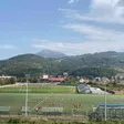
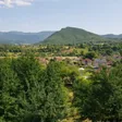
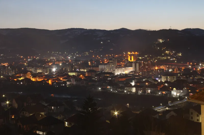
Bijelo Polje is the main town of the Lim valley in northern Montenegro and the last station on the Bar-Belgrade railway before Serbia. The municipality had 38,662 residents at the 2023 census, the fourth-largest in the country; the town itself is counted in several census settlements (Centar grada 2,790, Resnik 2,752, Nikoljac 2,227 and others), so it has no single figure. It lies at about 606 m on the north-east side of Bjelasica, 106.7 km from Podgorica by road, about 2 h 06 min, and 34.9 km from Berane. The name means white field, after the daisies that cover the meadows in spring. Visitors come for the Church of Saints Peter and Paul, the Homeland Museum, Đalovića cave, the longest in Montenegro, fly fishing on the Lim and the Bjelasica slopes.

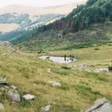
The town sits on the north-east side of Bjelasica, whose highest point, Crna glava, is 2,137 m in the official survey. The local slope is Majstorovina on Bjelasica at 930 m, with a surface lift from 2009 and a 300 m piste. The state company Skijališta Crne Gore is building the Cmiljača ski centre on Bjelasica about 14 km from Bijelo Polje, with a base at 1,570 m and a six-seat Leitner chairlift, planned to link with Žarski above Mojkovac and the Kolašin centres; a mountain hut at the base is open to hikers, and Torine, about 25 km from town, is a further planned resort. Until those open, the working resorts are Kolašin 1450 and Kolašin 1600, 50.1 km away by road; all centres are compared on the skiing page. Biogradska gora National Park, with Biogradsko jezero at 1,094 m, lies on the Kolašin side of the massif, and its buffer zone reaches Bijelo Polje municipality. The hiking season on Bjelasica runs from June to October.

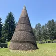
The Church of Saints Peter and Paul ties the town to the medieval manuscript tradition of Miroslav's Gospel. Under Ottoman rule a ruždija secondary school opened in 1871, and in 1905 it moved into the building that has housed the Homeland Museum since 1957. The town was freed from Ottoman rule in 1912. The Đalovića gorge was protected in 1968, and the survey of the cave that made it the country's longest took 29 years.
Road distances below are free-flow routing on OpenStreetMap data, without traffic or snow.
| To | Distance | Time |
|---|---|---|
| Berane | 34.9 km | about 45 min |
| Kolašin | 50.1 km | about 1 h 12 min |
| Rožaje | 65.3 km | about 1 h 19 min |
| Pljevlja | 68.5 km | about 1 h 53 min |
| Plav | 75.4 km | about 1 h 38 min |
| Žabljak | 92.5 km | about 2 h 16 min |
| Podgorica | 106.7 km | about 2 h 06 min |
| Podgorica Airport | 117.6 km | about 2 h 22 min |
| Bar | 162.1 km | about 3 h 09 min |
| Budva | 170.3 km | about 3 h 25 min |
| Kotor | 180.7 km | about 3 h 36 min |
The town's events run through the year: Ratkovićeve večeri poezije (Ratković's Poetry Evenings), held since 1970; the International Festival of Tamburica Orchestras in August; Dani riblje čorbe (Days of Fish Soup); Ušće Fest in summer; Bjelopoljski bazar; the Festival of Amateur Drama of Montenegro; and a New Year bazaar. The organisers announce the dates each year. June to October is the season for Bjelasica and the walk to Đalovića; the Kolašin ski centres open in December.
Only the approach: 48 km by road to the village of Đalovići, the last 8 km on gravel, then about two hours on foot to the main entrance at 764 m in the Đalovića gorge. The cave itself is reserved for experienced cavers with a permit; there is no tourist route inside.
Yes. The station is on the Bar-Belgrade line, the last in Montenegro before Serbia, with four local trains a day from Podgorica.
106.7 km by road, about 2 h 06 min; Podgorica Airport is 117.6 km, about 2 h 22 min.
Rent a car for day trips and compare pick-up points in one search.
Postcode: postacg.me
Elevation (weather station): data.gov.me
Municipality area: monstat.org
Municipality population (2023 census): monstat.org
Train station: zicg.me
Emergency medical service · Public
Hospital · Public
Medanovići bb, Bijelo Polje
Health centre · Public
Voja Lješnjaka bb, Bijelo Polje
hitna.me: Zavod za hitnu medicinsku pomoć: Organizaciona struktura (list of units) · Zavod za hitnu medicinsku pomoć: Kontakt (124 for all municipalities) · Zavod za hitnu medicinsku pomoć: Djelatnost zavoda (service 00-24, every day)
data.gov.me: Ministry of Health open data: Spisak svih zdravstvenih institucija u CG (xlsx, updated 2025-05-12) · Ministry of Health open data: Opšte bolnice i kliničko-bolnički centri (updated 2025-05-12)
fzocg.me: Health Insurance Fund: contracts with institutions in the health network
gov.me: Government of Montenegro: Primary health care centres in Montenegro
Town hall
Ulica Slobode 5, 84000 Bijelo Polje
MONSTAT, 2023 census, population by municipality (Release 133/2024) · MONSTAT, 2023 census, population by settlement · MONSTAT, Statistical Yearbook 2025, rivers, lakes and peaks · National Tourism Organisation, mountain towns · National Tourism Organisation, fly fishing · National Tourism Organisation, paragliding · Tourist Organisation Bijelo Polje, cultural heritage · Tourist Organisation Bijelo Polje, Đalovića cave · Tourist Organisation Bijelo Polje, events · Tourist Organisation Bijelo Polje · Tourist Organisation Kolašin, Mount Bjelasica · Skijališta Crne Gore, Cmiljača · Skijališta Crne Gore, Torine · Government of Montenegro, Informacija o skijalištima u Crnoj Gori (2014, Majstorovina) · National Parks of Montenegro, Management Plan NP Biogradska gora 2026-2030 (buffer zone) · Željeznički prevoz Crne Gore, stations · Tourist Organisation Bar, transport (rail line) · Wikipedia, Bijelo Polje (coordinates) · Wikipedia, Berane (distance to Bijelo Polje) · Ministarstvo poljoprivrede, šumarstva i vodoprivrede, Naredba o ribolovnim zabranima, lovostaju i minimalnim veličinama riba (Sl. list CG 75/2026), Art. 3 · National Tourism Organisation, caves (speleological objects) · National Tourism Organisation, hiking and trekking · eMontenegro routes API (OSRM on OpenStreetMap data, ODbL), car table 2026-10-22 · ZHMS, Yearbook of meteorological and hydrological data 2023, station list (Bijelo Polje 606 m) · Government of Montenegro, list of health institutions (data.gov.me) · Pošta Crne Gore, post office locations (84000 Bijelo Polje) · Hitna medicinska pomoć, organisational structure (Bijelo Polje unit, 124)
Google Analytics counts visits without cookies. With your consent it also sets cookies that show us how the site is used. Nothing is used for advertising. Privacy