Need a car in Žabljak?
Rent a car for day trips and compare pick-up points in one search.
on Localrent
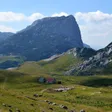
Photo: Julian Nyča · CC BY-SA 3.0
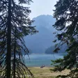
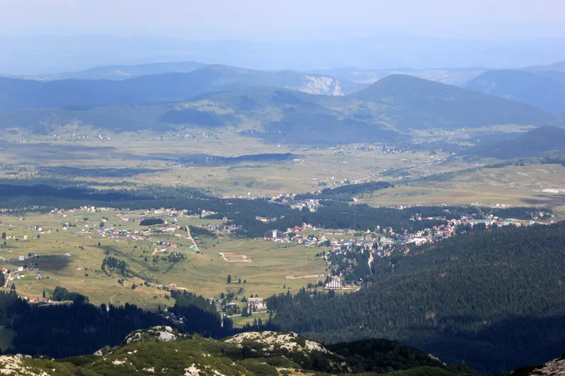
Photo: Julian Nyča · CC BY-SA 3.0
Measured snow at the Žabljak station: 11 cm (02.11.2026)Town weather station, not the pistes.
Model forecast, not a measurement; no snowfall in cm and no snow depth on the pistes.
Žabljak is the base for Durmitor National Park and, at about 1,450 m, the highest town on the Balkan peninsula. It is small, 1,440 residents in the settlement and 2,941 in the municipality at the 2023 census, and everything a visitor needs lies within a few kilometres: the park's visitor centre in the park administration building in town, Black Lake 3 km to the south-west, the Savin kuk ski lifts 5 km away and the Tara canyon with its rafting put-ins to the north and east. The park ticket costs €5 a day. Podgorica is 124 km away, about 2 h 20 by bus.
 Durmitor National Park Hiking TourRating 4.8 (5)from €125
 Tara Packrafting: Unique adventure in Europe's deepest canyonRating 4.8 (38)from €165
 Montenegro Snowshoeing DurmitorRating 5 (1)from €80
 River Tara Long Rafting TourRating 4 (4)from €200
Tours, ratings and prices: Viator.
All tours in Žabljak
The park was declared on 20 August 1952 and covers 32,519 ha across five municipalities; with part of the Tara canyon it has been a UNESCO World Heritage site since 1980. Inside are 18 glacial lakes, more than 48 peaks above 2,000 m and 25 marked trails totalling about 150 km. Tickets are sold online at ulaznice.nparkovi.me and at the checkpoints, among them Black Lake, Zminje jezero, Sedlo, Ćurevac and the Đurđevića Tara bridge; the visitor centre in Žabljak rents bikes and snowshoes.
| Ticket | Price |
|---|---|
| Entrance, per person per day | €5 |
| Children under 15 | free |
| Organised groups of 20 or more | 50% off |
| Annual ticket for all five national parks | €13.50 |
| Rowing boat on Black Lake, per hour | €10 |
| Bike, per hour / per day | €3 / €8 |
| Snowshoes, per day | €4 |
| Park guide, 4 h / 8 h | €40 / €80 |
| Tent pitch at a designated site, per day | €3 |
| Fishing permit, Black Lake, per day | €20 |
| Parking, car, per hour | €1 |
Entry is free on 6 September, Durmitor Day, and on 22 April, 21, 22 and 24 May, the second Sunday of June, 13 July and 31 July. Camping is allowed only at the designated sites (Žugića luka, Radovan luka, Škrka, Sušica, Šarban and Lokvice) and fires only at designated places. The Škrka and Sušica huts open from mid or late June to the end of September (Sušica €10 per person a day); the Lokvice bivouac (1,800 m) and the Kalice shelter (2,020 m) stay open all year. Drones need permits from the Environmental Protection Agency, from the Civil Aviation Agency above 249 g, and from the park. July to mid-September is the busiest period, with Black Lake and the Tara the busiest zones.

The Savin kuk ski centre, about 5 km from town, is run by the state company Turistički centar Durmitor: two two-seat chairlifts (Savin kuk I to 1,907 m, Savin kuk II to 2,213 m), three surface lifts, one of them floodlit for night skiing, a children's lift and 4.6 km of pistes (three blue, one red, one black). A beginner carpet and a tubing run were added for 2024/25 and the first two snow guns for 2025/26. In winter a marked snowshoe route runs 6.7 km from the ski centre to Black Lake, about 2 hours; snowshoes are rented at the visitor centre (€4 a day). Other centres are on the skiing hub.
After a fatal accident on the Savin kuk II chairlift on 20 December 2025, the surface lifts reopened after inspection, Savin kuk I reopened on 31 January 2026 and Savin kuk II did not run that season. The government has announced a complete replacement of the lift system, so check which lifts are running before you book a ski week.

The Tara canyon is 1,333 m at its deepest and about 80 km long; the river itself runs 146.4 km. Rafting on the Žabljak side starts at Splavište: 14 km to Žugića luka (3-4 hours), 24 km to Radovan luka (5-6 hours) or 60 km to Šćepan Polje over two or three days; one-day trips from the Plužine side start at Brštanovica. The season runs from April to October, with the wildest water in April and May and the calmest, safest window from 1 July to 15 September; a day on the river costs around €70. By law nobody under 7 may board, under-18s need written parental consent, everyone wears a helmet, a neoprene suit and a life jacket, and only a certified raft leader may steer. Two zip lines of 1,050 m and 824 m cross the canyon at the Đurđevića Tara bridge, 365 m long, built 1937-1940 and rebuilt in 1946, about 150 m above the river.
 SponsoredRafting on the Taraon Viator
The Durmitor partisan republic held the plateau from October 1941 to June 1942. The park was declared in 1952, inscribed by UNESCO in 1980 and extended in 2005 to match the park boundaries; the same year the government cancelled a dam that would have flooded part of the Tara canyon. The first recorded ascent of Bobotov kuk is linked to the Austrian geographer Oscar Baumann in 1883, and the stećci graveyards joined the UNESCO list in 2016.
Three roads lead up: from Mojkovac and from Pljevlja over the Đurđevića Tara bridge, and from Nikšić either over the Jezerska plateau past Vražje jezero (the old road) or via Šavnik. There is no railway; the nearest airport is Podgorica. Buses run from Podgorica (124 km, about 2 h 20), Nikšić (74 km, about 1 h 20), Pljevlja (60 km, about 1 h 10) and Mojkovac (70 km, about 1 h 25), with tickets online at busticket4.me. Driving distances and free-flow times, without snow or traffic:
| From | Distance | Time |
|---|---|---|
| Podgorica | 123.4 km | about 2 h 39 min |
| Kolašin | 86.2 km | about 1 h 44 min |
| Nikšić | 73.2 km | about 1 h 38 min |
| Plužine | 49.1 km | about 58 min |
| Šavnik | 26.5 km | about 32 min |
In town everything is within walking distance. Black Lake is 3 km on foot or by bike (2.7 km by road, about 6 min by car) and the Sedlo pass 14.3 km, about 17 min; bikes (€3 an hour, €8 a day) and snowshoes are rented at the visitor centre. Parking inside the park costs €1 an hour for a car.
July and August are the months for the lakes and the peaks; the Škrka and Sušica huts are open from mid-June to the end of September and Bobotov kuk is climbed from June to October, depending on snow. July to mid-September is also the busiest period. The ski season depends on snow and opens in December. Fixed dates in the year:
Yes: 3 km south-west of Žabljak, then a 3.6 km loop around the lake, about an hour. Entry is the €5 park ticket.
€5 per person per day, children under 15 free, €13.50 for a year in all five parks, free on 6 September and the other listed dates. A rowing boat on Black Lake is €10 an hour.
2,522 m in the official survey, 2,523 m in the park's figures. It is the highest point of Durmitor and the highest peak lying entirely in Montenegro; Zla kolata in Prokletije is higher, at 2,534 m.
Yes, from Podgorica (about 2 h 20), Nikšić, Pljevlja and Mojkovac, with tickets online at busticket4.me. There is no railway to Žabljak.
Rent a car for day trips and compare pick-up points in one search.
Postcode: postacg.me
Elevation: montenegro.travel
Municipality area: monstat.org
Municipality population (2023 census): monstat.org
Nearest hospital: data.gov.me
Emergency medical service · Public
Health centre · Public
Žabljak bb, Žabljak
hitna.me: Zavod za hitnu medicinsku pomoć: Organizaciona struktura (list of units) · Zavod za hitnu medicinsku pomoć: Kontakt (124 for all municipalities) · Zavod za hitnu medicinsku pomoć: Djelatnost zavoda (service 00-24, every day)
data.gov.me: Ministry of Health open data: Domovi zdravlja i ambulante u CG (updated 2025-05-12)
Town hall
Trg durmitorskih ratnika 1, 84220 Žabljak
Tourist board office
Vuka Karadžića bb, 84220 Žabljak
MONSTAT, 2023 census, population by municipality (Release 133/2024) · MONSTAT, 2023 census, population by settlement · MONSTAT, Statistical Yearbook 2025, lakes, rivers and peaks · Tourist Organisation Žabljak · Tourist Organisation Žabljak, Black Lake · Tourist Organisation Žabljak, Zminje jezero · Tourist Organisation Žabljak, Vražje jezero · Tourist Organisation Žabljak, Ćurevac trail · Tourist Organisation Žabljak, Savin kuk trail · Tourist Organisation Žabljak, peaks of Durmitor · Tourist Organisation Žabljak, ski areas · Tourist Organisation Žabljak, rafting and kayaking · Tourist Organisation Žabljak, outdoor activities (zip line) · Turistički centar Durmitor, ski centre · Ministry of Tourism, answer to MP question on ski centres (2026) · RTCG, 31 Jan 2026, Savin kuk 1 reopened · Portal Analitika, 18 Jan 2026, lift status · N1, 23 Dec 2025, Savin kuk accident · National Parks of Montenegro, Management Plan NP Durmitor 2026-2030 · National Parks of Montenegro, Durmitor price list · National Parks of Montenegro, Durmitor active holidays · National Parks of Montenegro, Durmitor education page · National Parks of Montenegro, online tickets and exemptions · National Parks of Montenegro, decision on fees (consolidated text) · National Parks of Montenegro, rules on filming and drones (1 Jul 2026) · Law on National Parks (camping and fire rules) · National Tourism Organisation, Durmitor National Park · National Tourism Organisation, mountain towns · National Tourism Organisation, cultural heritage UNESCO (stećci) · National Tourism Organisation, rafting · National Tourism Organisation, Tara Canyon · National Tourism Organisation, zipline · National Tourism Organisation, paragliding (Savin kuk take-off) · National Tourism Organisation, Prokletije National Park (Zla kolata) · Zakon o raftingu (consolidated 2021) · UNESCO MAB, Tara River Basin Biosphere Reserve · UNESCO WHC news, Apr 2005, Tara dam cancelled · Stećci World Heritage, Grčko groblje and Bare Žugića (Žabljak) · Tourist Organisation Kolašin, Mount Sinjavina · Tourist Organisation Pljevlja, Đurđevića Tara bridge · Wikipedia, Đurđevića Tara Bridge · Wikipedia, Žabljak · Tourist Organisation Žabljak, how to reach us (bus routes) · Tourist Organisation Žabljak, Bobotov kuk peak page (routes, times, first ascent) · Naredba o ribolovnim zabranama, lovostaju i minimalnim veličinama, Sl. list CG 75/2026 (Durmitor fishing hours) · OSRM routing (car, OpenStreetMap data, ODbL; times without traffic)
Google Analytics counts visits without cookies. With your consent it also sets cookies that show us how the site is used. Nothing is used for advertising. Privacy