Gusinje
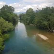
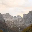
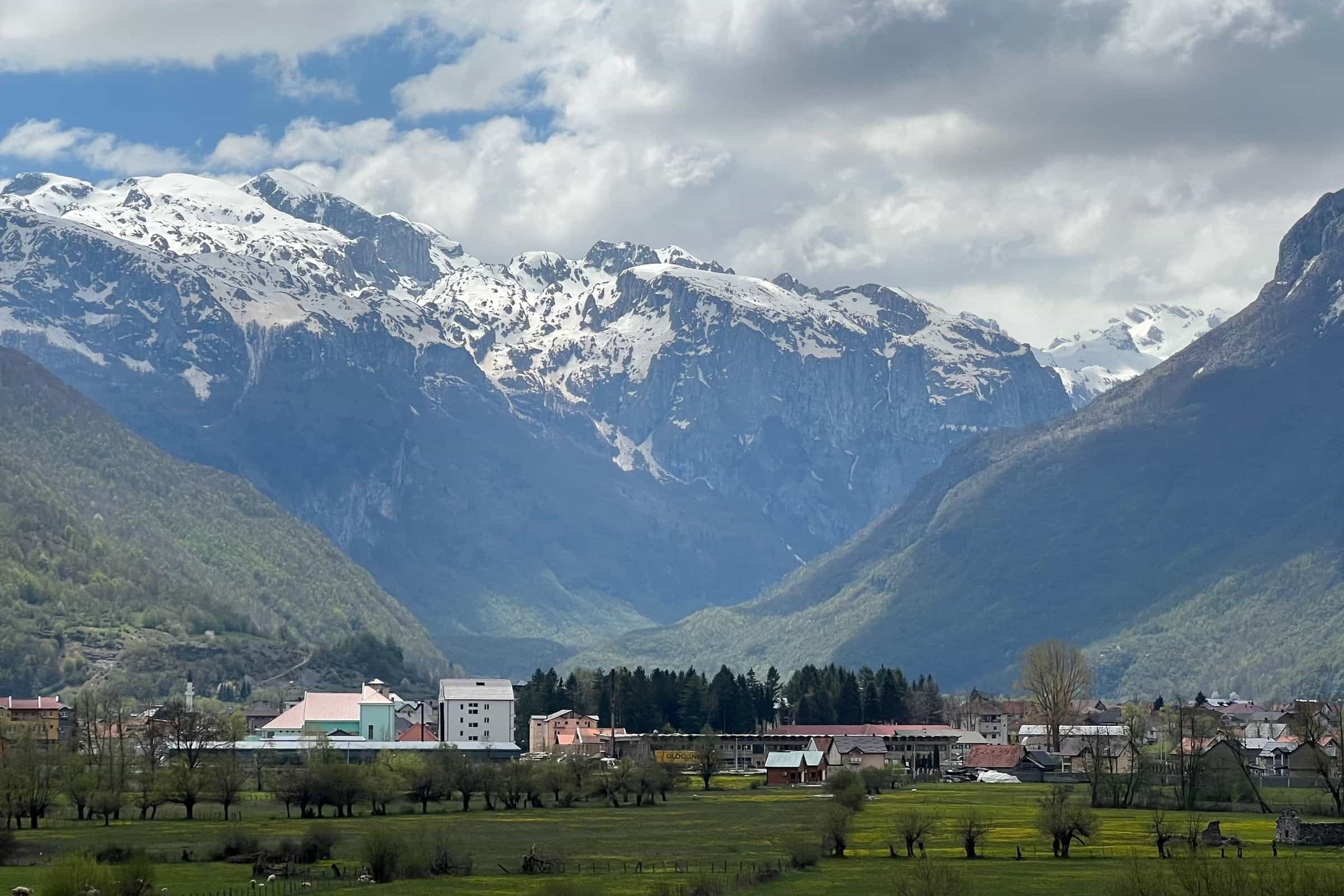
Town below Prokletije, by Ali Pasha's Springs and the Grebaje valley
Northern Region · 1,877 people (settlement) · Historic
Raining now · 7 °CPhoto: Planeti · CC BY-SA 4.0
About Gusinje
Gusinje is a small town at about 920 m close to the Albanian border, where the Vruja and the Grnčar meet below the steep wall of Prokletije. It is the base for the Gusinje side of Prokletije National Park: Ali Pasha's Springs are 2.2 km away by road, the Grebaje valley 7.2 km and Vusanje, on the road into the Ropojana valley, 5.1 km. The town had 1,877 residents at the 2023 census and the municipality 3,933. Plav is 13.5 km away at the other end of the basin, Podgorica 139 km through Kolašin or about 80 km through Albania, and the Grnčar border crossing 7 km. A mosque of 1626, two churches, stone towers and a Thursday market fill a morning in town; the valleys take the rest of a stay.

Key facts
| Elevation | about 920 m |
| Population, 2023 | 1,877 in the settlement; 3,933 in the municipality (9 settlements) |
| Municipality | 157 km²; re-established on 8 March 2014, after being abolished in 1953 |
| Region | Northern Montenegro, the Plav-Gusinje basin |
| Border crossing | Grnčar-Vermosh (Albania), 7 km, road, passengers only |
| Postcode | 84326 |
| Market day | Thursday |
Getting there
By car from Podgorica. Two routes. Inside Montenegro the road runs via Kolašin and Andrijevica to Murino, then on the R-9 through Plav: 139 km, about 2 h 40. Through Albania, via the Božaj crossing, Vermosh and Grnčar, it is about 80 km and 2 h 15, with two border crossings and the usual passport checks. Grnčar-Vermosh, 7 km from the town, is a road border crossing for passengers only, with no published opening hours; Shkodër is about 100 km that way. Winter equipment is compulsory in winter, and the road conditions page carries the daily report.
| From | Distance | Driving time |
|---|---|---|
| Plav | 13.5 km | about 21 min |
| Andrijevica | 33.3 km | about 46 min |
| Berane | 49.1 km | about 1 h 06 |
| Rožaje | 79.6 km | about 1 h 49 |
| Kolašin | 81.3 km | about 1 h 41 |
| Bijelo Polje | 83.5 km | about 1 h 48 |
| Podgorica (via Kolašin) | 139.2 km | about 2 h 39 |
| Podgorica Airport | 149.5 km | about 2 h 54 |
| Budva | 201.8 km | about 3 h 56 |
By bus. Buses link Gusinje and Plav with Podgorica; timetables and fares change with the season, so check busticket4.me or the carrier, and read the buses guide for how the network works. There is no railway: the nearest station is in Bijelo Polje. The nearest airports are Podgorica, Tirana and Priština. The times in the table are free-flow routing, without snow or border queues.
What to see in town
The Vizier's mosque (Vezirova džamija) was built in 1626 by the Vizier of Skadar from the Bušatlija family. It has been adapted twice, and the white-stone šadrvan (fountain) in front of it dates from 1994. Three more mosques stand in the municipality: Čekića, Carska (the Imperial mosque) and Đulbegova Šabanagića.

The Orthodox church of St George (Sv. Đorđe) was built in 1926. The Catholic church of St Anthony (Sv. Anton), from 1936, stands in Dolja, 1 km from the town, with a museum of cultural and historical heritage beside it. None of them publishes opening hours; ask locally.

The old core keeps the stone towers (kule) of the Balić, Čekić, Radončić and other families, and the Balić house has been protected since 1988; the Kršla fortification stands in the town and Jerinin grad at Zagrađe. Thursday is market day, when dairy products, sheep's cheese and skorup (clotted cream) come in from the villages; burek, baklava and boza are the local snacks. The Krš Čekića picnic spot just outside the town looks across to Bjelič, Brada, the Ropojana valley and Plav Lake.
Ali Pasha's Springs and the waters
Ali Pasha's Springs (Ali-pašini izvori) rise at 925 m at the foot of Vezirova brada, 2.2 km from the town by road, about 4 minutes. Described as the largest permanent karst spring in Montenegro, they flow strongest in spring and drain into the Vruja. Once a resting place for caravans, they are the town's best-known excursion, with a local belief that the water keeps you young; the Plav page covers the customs linked to them. Up to 65 sport-climbing routes are equipped on the rock near the springs.
Near Vusanje are the Oko Skakavice spring (Savino oko), at 1,000 m with water at about 5 °C all year, and the 15 m Skakavica waterfall at the entrance to the Grlja canyon, with the Bajrovića vrelo and Dragija springs close by. The Kusija waterfalls, 2 km from Gusinje, dry up for part of the year; a circular path links the falls. At Gusinje the Grnčar, coming from Albania, joins the Vruja (itself formed by the Dolja and the Grlja) to form the Ljuča, which flows into Plav Lake and leaves it as the Lim; the Ljuča is a fly-fishing water.
Grebaje, Ropojana and Vusanje
The Grebaje valley, at about 1,100 m, is the main starting point for mountaineering and climbing: 6.9 km of asphalt through Dolja and about 1.5 km of gravel bring you to the Branko Kotlajić and Karanfil huts, 7.2 km and about 14 minutes from the town, where the 10.2 km Volušnica-Popadija loop begins. On Volušnica, at about 1,700 m, a rock slab carries a prehistoric carving of a mother with children, the Magna Mater. The road into the Ropojana valley passes Vusanje, a village of 594 people with many guesthouses, and continues inside the park to Ropojansko jezero on the Albanian border, 12 km from Gusinje; the lake often dries out in summer. Entry to Prokletije National Park is paid; the fees are on the park page. Volušnica is one of the park's two nature reserves, with Hridsko jezero on the Plav side.
Hiking, climbing and cycling
Marked trails start in the town, and the tourist board publishes GPX tracks for Zla Kolata (9 km), Maja Rosit (4.4 km) and Gusinje-Velji vrh (6.5 km); the Bjelič group above the Ropojana holds the highest peaks in Montenegro, listed with their heights on the Prokletije page. Mountain routes into Albania need prior permission from the border police of both countries, as on the Peaks of the Balkans; the Via Dinarica White Trail arrives from Vermosh (12.8 km) and goes on over Maja Jezerce to Theth and Valbona. Prokletije has more than 100 marked sport-climbing routes, 60 of them in Gusinje municipality, with a season from April to October. The park's bike route Gusinje-Vusanje-Ropojana and back is about 23 km with 290 m of ascent on asphalt and gravel, and the Osmica race rides through Gusinje and Plav; more rides are on the cycling page, and the Visitor massif rises on the north side of the basin.
Events
- July and August: Gusinjsko ljeto, the summer festival held since 2002, roughly from 10 July to 10 August.
- 13 July, Statehood Day: a group hike to Zla Kolata, followed by more themed hikes through the summer (Hamdova staza, Popadija-Talijanka-Volušnica, Trojan).
- January: the winter programme, with ice competitions and a winter bazaar.
The tourist board's calendar lists the dates each season.
History in brief
Remains of a Roman-era water supply and sewer have been found in the town, and Roman traces near Kruševo, Dolja and Višnjevo. In the early 14th century Gusino and its mountains belonged to the Banjska monastery estate, and in the 14th century the town was a caravan station on the Dubrovnik-Kotor-Skadar-Peć-Constantinople route. In the first half of the 17th century it became the centre of the Gusinje nahija in the Sanjak of Skadar, in 1724 a captaincy in the Bosnian pashaluk, and from 1862 to 1878 the seat of the Gusinje kaza. After the Balkan wars the area had two town municipalities, Plav and Gusinje. The border with Albania, drawn in the early 20th century, left the area on the edge, and waves of emigration followed in 1914-1936 and 1945-2003. The municipality, abolished in 1953, was restored after a consultative referendum by a law in force from 8 March 2014, the 23rd in Montenegro.
Practical information
- Tourist office: Turistička organizacija Gusinje, Čaršijska bb, Monday-Friday 07:00-15:00, turizam@opstinagusinje.me. Municipality: Bosanska bb, +382 51 250 154.
- Post office: 84326 Gusinje, Čaršijska bb, 08:00-14:30.
- Health: health station at Grebajska bb with the Montefarm pharmacy inside (Monday-Friday 07:00-14:30, Saturday 07:00-12:00). Ambulance 124, emergency 112.
- Cash: ATMs of CKB (Bosanska bb), Erste (Čaršijska 56) and Hipotekarna banka (Čaršijska 20, also a branch); see ATMs and banks. No EV charger is recorded (EV charging).
- Languages: beside the official language, Bosnian and Albanian are in official use in the municipality, so place and street names appear in them too.
- Stay and eat: hotels, guesthouses, apartments, bungalows, camps, eco-katuns and mountain huts in Gusinje, Vusanje, Grebaje and Kruševo; restaurants, grills, a pizzeria and a pastry shop in Gusinje, Vusanje and Grebaje; four food shops and a bakery in the town.
When to visit
Park visits run from May to October and peak in August; the hiking season lasts from June to the end of October, and snow can fall even in summer. Ali Pasha's Springs are fullest in spring, while Ropojansko jezero and the Kusija falls often dry up in summer. The climbing season is April to October. Summers are moderately warm and winters cool and snowy, with the Mediterranean felt through the Prokletije passes; the winter programme runs in January. See also Plav in 3 days and the 10-day loop.

Questions
How far is Gusinje from Plav?
Plav is 13.5 km away on the R-9, about 21 minutes by car.
How do I get to Gusinje from Podgorica?
By car it is 139 km via Kolašin, Andrijevica and Plav, about 2 h 40, or about 80 km through Albania via Božaj, Vermosh and Grnčar, with two border crossings. Buses also run from Podgorica.
Is there a border crossing at Gusinje?
Yes: Grnčar-Vermosh into Albania, 7 km from the town, a road crossing for passengers only.
How far are Ali Pasha's Springs?
2.2 km by road from the centre, about 4 minutes by car or a short walk; they are strongest in spring.
How do I get to the Grebaje valley?
By the road through Dolja: 6.9 km of asphalt and about 1.5 km of gravel to the huts, 7.2 km in all, about 14 minutes. The park entry fee applies; see the Grebaje valley page.
How high is Gusinje and how many people live there?
The town lies at about 920 m. The 2023 census counted 1,877 people in the settlement and 3,933 in the municipality.
What is Gusinjsko ljeto?
The town's summer festival, held every July and August since 2002.
Town facts
- Postcode
- 84326
- Elevation
- 920 m
- Municipality area
- 157 km²
- Municipality population (2023 census)
- 3,933
Sources
Postcode: postacg.me
Elevation: opstinagusinje.me
Municipality area: monstat.org
Municipality population (2023 census): monstat.org
Bus, parking, services
Nearest hospital
- Kliničko-bolnički centar Berane
- Svetosavska 33, Berane
- +382 51 230 630
- 65 min by car (48.6 km)
Sources
Nearest hospital: data.gov.me
Health
Emergency medical service, Gusinje
Open 24 hoursEmergency medical service · Public
Zdravstvena stanica Gusinje
Health centre · Public
Grebajska bb, Gusinje
Sources
hitna.me: Zavod za hitnu medicinsku pomoć: Organizaciona struktura (list of units) · Zavod za hitnu medicinsku pomoć: Kontakt (124 for all municipalities) · Zavod za hitnu medicinsku pomoć: Djelatnost zavoda (service 00-24, every day)
data.gov.me: Ministry of Health open data: Domovi zdravlja i ambulante u CG (updated 2025-05-12)
Town hall and tourist information
Opština Gusinje
Town hall
Bosanska b.b, 84 300 Gusinje
Turistička organizacija Gusinje
Tourist board office
Čaršijska bb, 84326 Gusinje
Mon-Fri 07:00-15:00
Sources
Ministry of the Interior, Law on Territorial Organisation, consolidated text (item 5a; Sl. list CG 12/2014, in force 8 March 2014), read 2026-11-01 · MONSTAT, 2023 census, population by settlement and sex (xlsx), read 2026-11-01 · MONSTAT, 2023 census, population by municipality (Release 133/2024), read 2026-11-01 · MONSTAT, Statistical Yearbook 2025, table 1-2 (area), read 2026-11-01 · Municipality of Gusinje, About Gusinje (O Gusinju), read 2026-11-01 · Municipality of Gusinje, History (Istorijat), read 2026-11-01 · Municipality of Gusinje, Culture (Kultura), read 2026-11-01 · Municipality of Gusinje, Statute, flag and coat of arms (official use of languages), read 2026-11-01 · Tourist Organisation Gusinje, home page (office address), read 2026-11-01 · Tourist Organisation Gusinje, Contact, read 2026-11-01 · Tourist Organisation Gusinje, How to get here (Kako doći), read 2026-11-01 · Tourist Organisation Gusinje, Geographical position, read 2026-11-01 · Tourist Organisation Gusinje, Prokletije National Park, read 2026-11-01 · Tourist Organisation Gusinje, Ali-pašini izvori, read 2026-11-01 · Tourist Organisation Gusinje, Valleys (Doline), read 2026-11-01 · Tourist Organisation Gusinje, Oko Skakavice, read 2026-11-01 · Tourist Organisation Gusinje, Waterfalls (Vodopadi), read 2026-11-01 · Tourist Organisation Gusinje, Rivers and lakes, read 2026-11-01 · Tourist Organisation Gusinje, Walking (Krš Čekića), read 2026-11-01 · Tourist Organisation Gusinje, Mountain trails with GPX, read 2026-11-01 · Tourist Organisation Gusinje, Peaks of the Balkans (border permission, emergency numbers), read 2026-11-01 · Tourist Organisation Gusinje, Accommodation (Smještaj), read 2026-11-01 · Tourist Organisation Gusinje, Restaurants (Restorani), read 2026-11-01 · Tourist Organisation Gusinje, Markets (Marketi), read 2026-11-01 · Tourist Organisation Gusinje, Summer (Gusinjsko ljeto, Osmica), read 2026-11-01 · Tourist Organisation Gusinje, Winter (Zima), read 2026-11-01 · Tourist Organisation Gusinje, Events, read 2026-11-01 · Tourist Organisation Gusinje, Blog (Statehood Day hike to Zla Kolata), read 2026-11-01 · National Tourism Organisation, Charming mountain towns (Gusinje), read 2026-11-01 · National Tourism Organisation, Prokletije National Park, read 2026-11-01 · National Tourism Organisation, Sport climbing, read 2026-11-01 · National Tourism Organisation, Hiking and trekking, read 2026-11-01 · JPNPCG, Management Plan NP Prokletije 2026-2030 (PDF), read 2026-10-14 · JPNPCG, Prokletije, active holidays (bike route Gusinje-Vusanje-Ropojana, Grebaje loop, Magna Mater), read 2026-10-14 · JPNPCG, Prokletije price list · Uprava policije, Granični prelazi (archived gov.me page), read 2026-10-16 · Municipality of Plav, About Plav (roads M-9 and R-9, nearest railway), read 2026-10-16 · Via Dinarica trail portal, White Trail route page (stage Vermosh-Gusinje) · Pošta Crne Gore, post office 84326 Gusinje, read 2026-10-15 · data.gov.me, Tourist organisations (Ministry of Tourism, CC BY), read 2026-10-15 · data.gov.me, list of municipalities of Montenegro (municipality address and phone), read 2026-10-15 · Montefarm, pharmacy locations, read 2026-10-31 · Ministry of Health open data, health centres and clinics (Zdravstvena stanica Gusinje) · CKB, branches and ATMs, read 2026-10-15 · Erste Bank, branches and ATMs, read 2026-10-15 · Hipotekarna banka, branches and ATMs, read 2026-10-15 · OpenStreetMap node 1927167879 Gusinje, ODbL, read 2026-11-01 · Routes computed with OSRM on OpenStreetMap data (ODbL), queried 2026-11-01