Need a car in Rožaje?
Rent a car for day trips and compare pick-up points in one search.
on Localrent
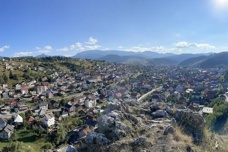
Photo: Petaje · CC BY-SA 4.0
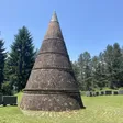
Photo: Petaje · CC BY-SA 4.0
Rožaje is the mountain town of Montenegro's far east, at about 1,100 m in the upper valley of the Ibar, close to the point where Montenegro, Serbia and Kosovo meet. The 2023 census counted 4,434 people in the settlement itself and 11,215 with the adjoining settlements of Bandžovo Brdo and Ibarac; the municipality has 23,184 and the youngest average age in the country, 35.8 years. Visitors come for Hajla (2,403 m), the spring of the Ibar, two old mosques and the Ganića kula museum, and in winter for the small ski area on Turjak. The peaks around the town are Hajla, Žljeb 2,322 m, Štedim 2,272 m and Smiljavica 1,953 m. There is no railway: the nearest station is Bijelo Polje, 65.2 km away, and Podgorica is 124.2 km by road, about 2 h 23 min.


Hajla, 2,403 m, is about 15 km from the centre and has no protected status. Two bases serve it: the Bandžov picnic area at about 1,400 m, with the Jelenčica hut, the Dermano restaurant and eco-katuns, where the easy routes start, and the Grope mountain hut at about 1,900 m below the summit, with room for about 60 people. Rujišta lake lies at about 1,500 m. The Štedim plateau, between 1,700 and 2,000 m, is used in winter for ski touring and snowshoeing. The hiking season runs from June to the end of October; trail rules are on the hiking page, and the emergency number 112 covers mountain rescue. The climate is continental with mountain features: about 900 mm of precipitation a year, most of it in May and least in August, and long snowy winters.

The Hajla ski centre stands on Turjak, 8 km from Rožaje on the Berane side of town, and not on Hajla itself: a baby lift and an anchor lift carrying 840 skiers an hour, a run of 1,019 m, parking for 200 cars, equipment rental and repairs, a ski and snowboard school and the Košuta restaurant 150 m from the piste. It is a small local area that opens when there is snow. The two surface lifts of the former Turjak hotel, on private land nearby, have been out of service since 2005. The state is building a larger centre, Hajla-Štedim, on the Štedim side: the 7.2 km road from town to Štedim has been rebuilt and the pylons and bottom station of a six-seat chairlift stand, with the base station and water supply still to come. All centres in the country are compared on the skiing page; the nearest working resorts with chairlifts are Kolašin 1450 and Kolašin 1600, 66.7 km away.
Settlement here goes back to the 7th century, and the archaeological sites around the town show older Illyrian and Roman traces, among them an Illyrian settlement on Brezovačko brdo. The name Rožaje is first recorded in 1585. The town grew as a trading centre with livestock fairs. The Sultan Murat II mosque (1450) and the Kučanska mosque (1830) are its oldest dated buildings, and Ganića kula one of its oldest structures.
Road distances below are free-flow routing on OpenStreetMap data, without traffic or snow.
| To | Distance | Time |
|---|---|---|
| Berane | 30.7 km | about 45 min |
| Bijelo Polje | 65.2 km | about 1 h 19 min |
| Kolašin | 66.7 km | about 1 h 25 min |
| Plav | 71.5 km | about 1 h 38 min |
| Podgorica | 124.2 km | about 2 h 23 min |
| Pljevlja | 133.1 km | about 3 h |
| Podgorica Airport | 134.2 km | about 2 h 36 min |
| Žabljak | 152.4 km | about 3 h 08 min |
| Bar | 178.7 km | about 3 h 23 min |
| Budva | 186.9 km | about 3 h 39 min |
| Kotor | 197.3 km | about 3 h 50 min |
| Tivat Airport | 208.2 km | about 4 h 03 min |
June to October is the season for Hajla and the Štedim plateau on foot; the ski area on Turjak and the touring routes on Štedim open when there is snow, in winters that are long here. The town's events are the memorial winter climb of Hajla "Safet Mavrić Ćako" and the Zlatna pahulja children's song festival in winter, the Dan Hajle mountain marathon, the Days of Mushrooms and Medicinal Herbs and Rožaje Cultural Summer; dates are announced each year. The mosques and Ganića kula can be seen in any month.
Yes, a small area on Turjak, 8 km from town: two surface lifts and a 1,019 m run, open when there is snow. The larger Hajla-Štedim centre is under construction; the nearest resorts with chairlifts are at Kolašin, 66.7 km away.
About 15 km to the summit area. The easy routes start at Bandžov (about 1,400 m) and the Grope hut at about 1,900 m sleeps about 60.
By road through Berane: 124.2 km, about 2 h 23 min. Podgorica Airport is 134.2 km away, about 2 h 36 min. There is no railway; the nearest station is Bijelo Polje, 65.2 km away.
Rent a car for day trips and compare pick-up points in one search.
Postcode: postacg.me
Elevation: turistickaorganizacijarozaje.me
Municipality area: monstat.org
Municipality population (2023 census): monstat.org
Tourist information: turistickaorganizacijarozaje.me
Nearest hospital: data.gov.me
Emergency medical service · Public
Health centre · Public
29. novembra bb, Rožaje
hitna.me: Zavod za hitnu medicinsku pomoć: Organizaciona struktura (list of units) · Zavod za hitnu medicinsku pomoć: Kontakt (124 for all municipalities) · Zavod za hitnu medicinsku pomoć: Djelatnost zavoda (service 00-24, every day)
data.gov.me: Ministry of Health open data: Spisak svih zdravstvenih institucija u CG (xlsx, updated 2025-05-12)
gov.me: Government of Montenegro: Primary health care centres in Montenegro
fzocg.me: Health Insurance Fund: contracts with institutions in the health network
Town hall
Maršala Tita bb, 84310 Rožaje
MONSTAT, 2023 census, population by municipality (Release 133/2024) · MONSTAT, 2023 census, population by settlement · MONSTAT, Statistical Yearbook 2025, mountain peaks over 1,800 m · Tourist Organisation Rožaje, about Rožaje · Tourist Organisation Rožaje, what to visit · Tourist Organisation Rožaje, active holidays · Tourist Organisation Rožaje, events · Municipality of Rožaje · National Tourism Organisation, mountain towns · National Tourism Organisation, skiing · National Tourism Organisation, hiking and trekking · National Tourism Organisation, Prokletije National Park · Government of Montenegro, Informacija o skijalištima u Crnoj Gori (2014) · Share Montenegro, 11 Mar 2019, Ski centar Hajla season report · Ministry of Tourism, answer to MP question on ski centres (2026) · Biznis.rs, 22 Sep 2025, Hajla-Štedim investment · SeeNews, Strucon chairlift contract for Hajla-Štedim · Obradović, S. (2021), Water quality of the Ibar (Serbian Journal of Geosciences) · Wikipedia, Rožaje (coordinates)
Google Analytics counts visits without cookies. With your consent it also sets cookies that show us how the site is used. Nothing is used for advertising. Privacy