Kotor
Walled town on the Bay of Kotor
Coastal Region · Historic
Weather
Full forecastSea temperature
Last 14 nights20 °CBay of Kotor entrance
Night of 02.11.2026Copernicus Marine
Sources
Generated using E.U. Copernicus Marine Service Information, DOI 10.48670/moi-00172
About Kotor
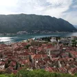
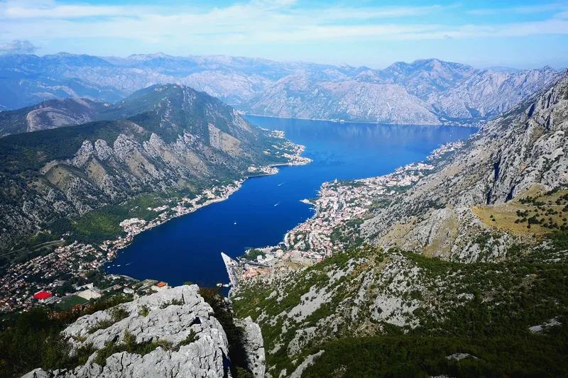
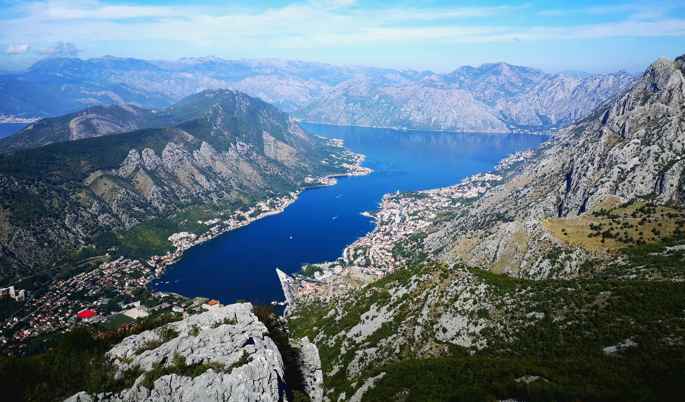
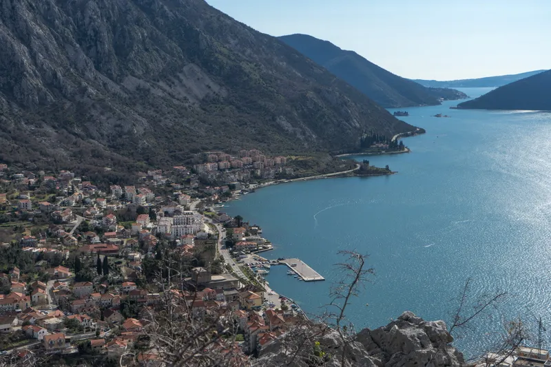
Kotor is a walled medieval town at the inner end of the Bay of Kotor, wedged into a triangle between the sea, the Škurda river and St John's hill, with the Lovćen massif rising behind it. The Natural and Culturo-Historical Region of Kotor has been a UNESCO World Heritage site since 1979, and in 2017 the fortifications that climb to St John's Fortress (locally San Đovani) joined the serial listing of Venetian Works of Defence. The municipality had 22,746 residents at the 2023 census; urban Kotor (the Old Town with Dobrota, Škaljari and Muo) counts 12,659, and the Old Town itself only 562. Tivat Airport is 8.5 km away by road, about 11 minutes.
Tours and activities in Kotor
Sponsored Kotor: #1 Rated Blue Cave, Secret Tunnels & Lady of the RocksRating 4.8 (3,201)from €49.99
 Kotor: Top Rated Blue Cave, Submarine Tunnels & Lady of the RocksRating 4.7 (193)from €38.08
 Private Shore Excursion from Kotor PortRating 5 (23)from €224
 Kotor: Perast & Our Lady of the Rocks Island - Every 2 HoursRating 4.8 (714)from €35
Tours, ratings and prices: Viator.
All tours in KotorWhat to see and do
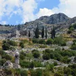
- Climb the walls. The fortifications run about 4.5 km in all, and roughly 1,400 steps lead up to the fortress, about 300 m above the sea (the hill itself is given as 260 m). The ticket is €15; residents of Montenegro walk up free.
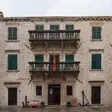
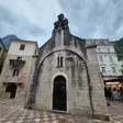
- The Old Town. St Tryphon's Cathedral dates from 1166. The Church of St Luke (1195) kept a Catholic and an Orthodox altar side by side from the mid-17th century until 1810. St Mary (Blessed Ozana) was restored in 1221, St Paul dates from 1266, and St Clare holds the Franciscan library. The Square of Arms has the 17th-century baroque clock tower and the Prince's Palace; Pima Palace stands a few steps further in.
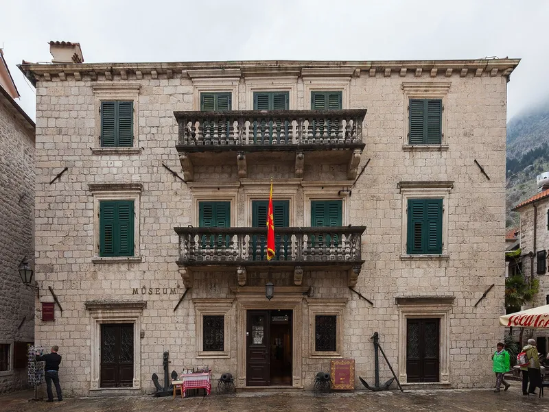
- The Maritime Museum of Montenegro. It fills the early-18th-century Grgurina Palace and grew out of the Boka Navy collection, open to the public since 1900. Adults pay €6, students and children €2. The museum has no parking of its own.
- The Kotor-Lovćen cable car. The gondola opened on 13 July 2023 and runs from Dub, near the Vrmac tunnel, up to Kuk (1,348 m) inside Lovćen National Park. The ride takes about 11 minutes.
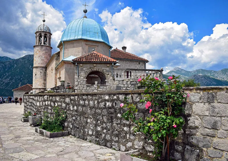
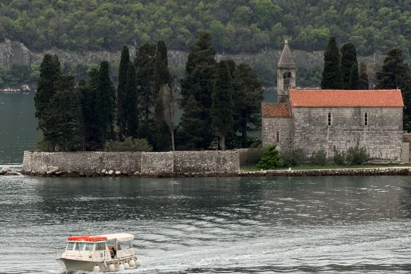
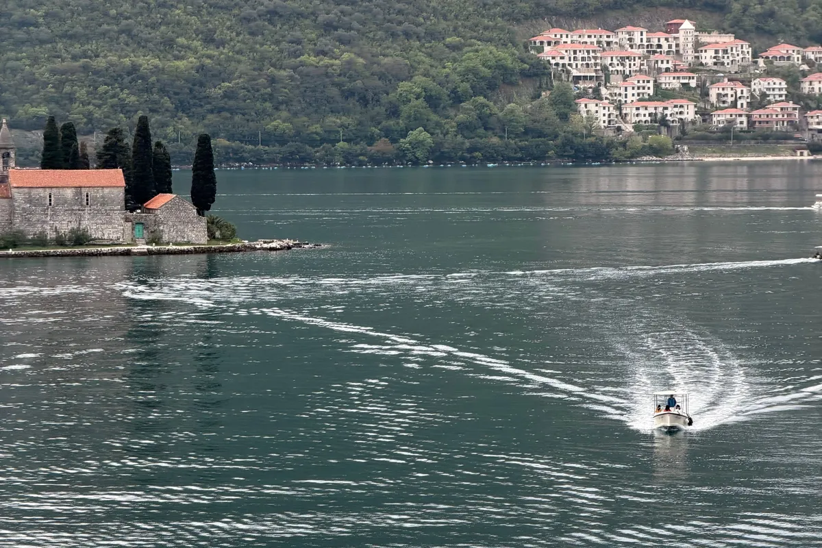
- Perast and the islets. Our Lady of the Rocks is an artificial islet built up around a crag by sinking stones and old boats; every 22 July since 1452 the Fašinada boat procession adds more. Beside it lies the natural islet of Sveti Đorđe, with a 12th-century church and the old Perast graveyard. Perast is 14 km from Kotor, about 22 minutes by car.
- Boat tours of the bay. The usual circuit calls at the Blue Cave, Mamula island, the wartime submarine tunnels, Our Lady of the Rocks and Perast. The bay is a submerged river canyon, not a fjord, however often it is called one.
SponsoredBay of Kotor boat tourson Viator
Old town and walls
Three gates lead into the walled Old Town: the Sea Gate (restored 1555), the River Gate (1540) and the Gurdić Gate (rebuilt in the late 17th century). Cars stay outside; everything within the walls is on foot. From the back of the town the walls climb in zigzags to St John's Fortress. Entry to the climb costs €15, with residents of Montenegro exempt; the fee rose from €8 in October 2023.

Kotor cruise port
Cruise ships tie up directly in front of the Old Town. The Port of Kotor is open around the clock, and berth 1, at the international border crossing by the Sea Gate, is 168 m long with a 120 m extension for cruise ships, in 8.6 to 12.8 m of water. Berth 2, in the mouth of the Škurda, is 76 m long and takes small ships, megayachts and ferries drawing up to 4 m. Ships too large for the quay anchor in the bay, at anchorage 1 off Kamenarovići or anchorage 2 off Orahovac, and bring passengers ashore by tender.
Traffic has returned to pre-2020 levels: 464 calls and 613,747 passengers in 2019, 434 calls and 418,174 passengers in 2022, and 497 ships with about 600,000 passengers in 2025. The port publishes the daily schedule of arrivals, so a glance at it tells you which days the Old Town will be busiest.
Beaches around Kotor
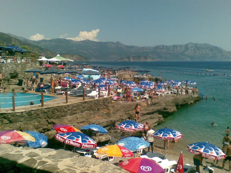
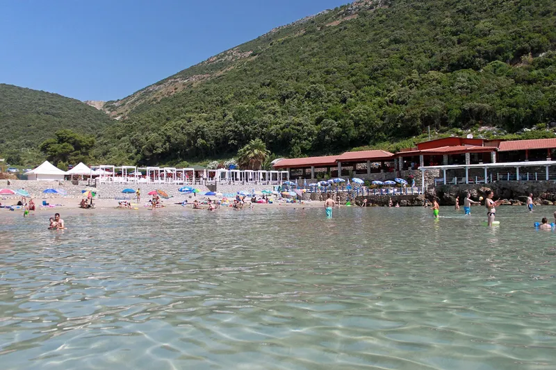
The town's own shore is harbour and promenade, and the municipality has little sand. The beaches with pages here lie on the Grbalj coast beyond the Vrmac tunnel: Bigova, a small sheltered cove with jetties and a pebble beach, and, towards Budva, Trsteno (fine sand, sandy seabed) and Ploče at Platamuni cape (about 400 m of concrete and pebble, about 9 km from Budva). The nearest large beach is Jaz on the Budva side: 1,200 m of pebble with sand in the water, a campsite behind it and four Blue Flag bathing areas in 2026.
History in brief
The town is linked to ancient Acruvium, mentioned by Pliny, and Illyrian rule here dates from the 3rd century BC. Roman and then Byzantine rule lasted to 1185, followed by the Nemanjić state (1185-1371), Hungary-Croatia, Bosnia under King Tvrtko (1384-1391) and an independent city-republic (1391-1420). Venice held Kotor from 1420 to 1797, the period that shaped the walls, gates and palaces seen today; Austria, Russia (1806-07) and France (1807-13) then took turns, and Austria ruled again from 1814 to 1918. The earthquake of 15 April 1979 damaged the walls and many monuments. UNESCO inscribed the region that same year and at the same time placed it on the List of World Heritage in Danger; it came off that list in 2003 after restoration. The Boka Navy (Bokeljska mornarica), a brotherhood of seafarers whose tradition is traced to 809, joined UNESCO's Representative List of intangible heritage in 2021.
Getting there and around
Tivat Airport is the natural gateway; Dubrovnik is the alternative for the Boka (under 40 km from Herceg Novi). Driving times below are road times without traffic.
| From Kotor to | Distance | Driving time |
|---|---|---|
| Tivat Airport | 8.5 km | about 11 min |
| Tivat | 11 km | about 16 min |
| Perast | 14 km | about 22 min |
| Budva | 23 km | about 29 min |
| Herceg Novi | 30 km | about 47 min, via the Lepetane-Kamenari car ferry (crossing and waiting not included) |
| Cetinje | 54 km | about 1 h 10 min |
| Podgorica | 74 km | about 1 h 30 min over Njeguši and Cetinje |
| Podgorica Airport | 77 km | about 1 h 37 min |
The shortest road to Cetinje and Podgorica is the old Austro-Hungarian road over Njeguši and Krstac, the Kotor serpentine, whose hairpins give the classic views over the bay. It is not suited to large campers. Inside Kotor, cars stay outside the walls: the Old Town is pedestrian.
When to visit
The sea bathing season runs from May to October, and the coastal hiking season, including the walls climb, from mid-April to the end of October. The calendar is built around a few fixed dates:
- Kotor Winter Carnival, February (6-15 February in 2026).
- Fašinada in Perast, 22 July.
- KotorArt, the international summer festival founded in 2002.
- Bokeška noć (Boka Night), a procession of decorated boats in front of the Old Town on the penultimate Saturday of August.
- Kotor Winter Fest over New Year.

Nearby
- Tivat, the airport town with the Porto Montenegro marina; the airport is about 4 km from Tivat and 8 km from Kotor.
- Budva, the beach resort, 23.1 km and about 29 minutes from Kotor.
- Herceg Novi, at the entrance to the bay below Orjen.
- Lovćen National Park above the town: 6,220 ha, entry €3 a day; its Kuk viewpoint (1,348 m) looks straight down on the bay. The Lovćen massif rises to Štirovnik, 1,749 m.
- Orjen in the Herceg Novi hinterland: 1,895 m in the official survey (the nature park gives 1,894 m for Veliki kabao), the highest point of the coastal Dinarides.
- Cetinje, the Old Royal Capital, over the serpentine road.

Questions
How many steps to Kotor fortress, and how long does it take?
About 1,400 steps and about an hour up at a steady pace; the top is roughly 260-300 m above the sea, depending on whether you count the hill or the fortress. Counts of 1,200 to 1,350 steps are also quoted, so treat the number as approximate.
Is the walls walk free?
No. The ticket is €15, raised from €8 in October 2023; residents of Montenegro are exempt.
Where do cruise ships dock in Kotor?
At the main berth in front of the Old Town (168 m plus a 120 m extension) or at anchor in the bay off Kamenarovići or Orahovac, with tenders to the quay by the Sea Gate.
How many cruise ships visit Kotor?
497 ships with about 600,000 passengers in 2025, against 464 calls and 613,747 passengers in 2019.
Kotor or Budva?
They do different jobs. Kotor is the walled UNESCO town with the fortress climb, the Maritime Museum and boat trips in the bay; Budva has the beaches (Mogren, Slovenska plaža, Bečići) and the festivals. Tivat Airport is about 8 km from Kotor and about 20 km from Budva, so both fit one trip.
Beaches in detail
Places to visit
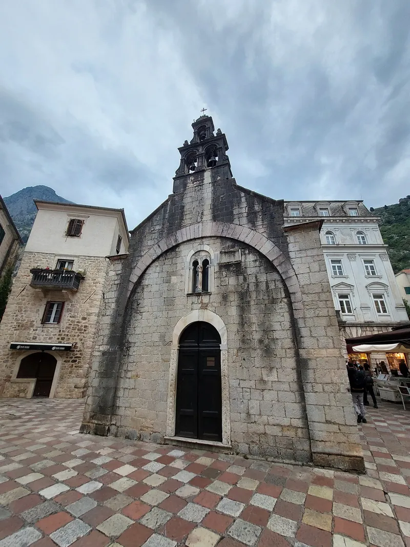
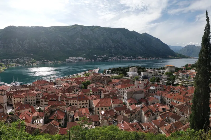
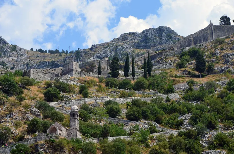
Towns and villages in the municipality
Local cuisine
Ćatovića Mlini
Restaurant
Morinj
Mon-Sun 12:00-21:00
Stari Mlini
Restaurant
Known for: fish and octopus under the sač
Dobrota, Ljuta bb
Gradska pijaca ispod zidina
Market
Ispod zidina Starog grada
- DagnjeBay of Kotor mussels, wild and farmed
- BrodetFish stew with polenta; in Boka, of one small oily fish
- Peraška tortaAlmond cake with a lattice top; Perast adds pine nuts
- Risan MacaruliLast held 10 Jun 2025
- 2 places in Kotor
- Coastal Region7 dishes
Sources
catovica-mlini.com: Ćatovića Mlini (own site)
openstreetmap.org: OpenStreetMap node 2631675247 "Ćatovića Mlini" (ODbL) · OpenStreetMap node 2479810386 "Stari Mlini" (ODbL)
starimlini.com: Stari Mlini (own site)
kotor.me: Opština Kotor, Odluka o radnom vremenu (Sl. list CG, opštinski propisi 058/25), čl. 8
Town facts
- Postcode
- 85330
- Municipality area
- 336 km²
- Municipality population (2023 census)
- 22,746
Sources
Postcode: postacg.me
Municipality area: monstat.org
Municipality population (2023 census): monstat.org
Bus, parking, services
Bus station
- Autobuska stanica Kotor
- Put Prvoborca bb, Kotor
- +382 32 325 809
- +382 32 325 126 (management)
- autobuskastanicakotor.me
Sources
Bus station: autobuskastanicakotor.me
Health
Emergency medical service, Kotor
Open 24 hoursEmergency medical service · Public
Kliničko-bolnički centar Kotor
Hospital · Public
Škaljari bb, Kotor
Specijalna bolnica „Vaso Ćuković“ Risan
Hospital · Public
Risan bb, Risan
JZU Dom zdravlja Kotor
Health centre · Public
Dobrota bb, Kotor
data.gov.me
Sources
hitna.me: Zavod za hitnu medicinsku pomoć: Organizaciona struktura (list of units) · Zavod za hitnu medicinsku pomoć: Kontakt (124 for all municipalities) · Zavod za hitnu medicinsku pomoć: Djelatnost zavoda (service 00-24, every day)
data.gov.me: Ministry of Health open data: Spisak svih zdravstvenih institucija u CG (xlsx, updated 2025-05-12) · Ministry of Health open data: Opšte bolnice i kliničko-bolnički centri (updated 2025-05-12) · Ministry of Health open data: Specijalne bolnice u Crnoj Gori (updated 2025-05-12)
fzocg.me: Health Insurance Fund: contracts with institutions in the health network
gov.me: Government of Montenegro: Primary health care centres in Montenegro
Town hall and tourist information
Opština Kotor
Town hall
Stari grad 317, 85330 Kotor
Turistički info centar Kotor
Tourist information centre
Vrata od mora (Sea Gate), Kotor
- Tourist information1 tourist information office
- Post offices in Kotor12 post offices
- Fuel stations in Kotor5 fuel stations
- Vets in Kotor4 vet clinics
- Campsites7 campsites
data.gov.me
Sources
kotor.me: Opština Kotor: Kontakt
data.gov.me: data.gov.me: Lista opština Crne Gore (Ministry of Public Administration, CC BY, updated 2025-05-30) · data.gov.me: Turističke organizacije (Ministry of Tourism, CC BY, updated 2025-09-30)
kotor.travel: TO Kotor: site footer "Tourist info center" and imprint (kotor.travel)
On these trips
- Day trips from Kotor: 7 trips with drive times7 day trips · from Kotor
- 3 days in Montenegro: Kotor, Lovćen, BudvaDay 1 · Kotor: old town, the walls and the bay
- Day trips from Budva: Kotor, Cetinje, SkadarTrip 1 · Kotor, the fortress walk and Perast
- 7 days in Montenegro: coast to Durmitor loopDay 1 · Kotor: old town, the walls and the bay
- 10 days in Montenegro: the full loop by carDay 1 · Kotor: old town, the walls and the bay
Sources
MONSTAT, 2023 census, population by municipality (Release 133/2024) · MONSTAT, 2023 census, population by settlement · MONSTAT, Statistical Yearbook 2025, mountain peaks over 1,800 m · Municipality of Kotor, Meet Kotor · National Tourism Organisation, fortresses · National Tourism Organisation, Bay of Kotor · National Tourism Organisation, cultural heritage UNESCO · National Tourism Organisation, hiking and trekking (coastal season) · National Tourism Organisation, panoramic roads · National Tourism Organisation, party beaches (Ploče) · Kotor Tourist Organisation: walls, islands, Fašinada, boat tours · Boka News, 18 Oct 2023, Kotor walls fee raised to €15, residents free · UNESCO WHC decision 27 COM 7A.27 (2003) · UNESCO WHC, state of conservation, Kotor (2003) · Government of Montenegro, Kotor fortress inscribed (2017) · UNESCO ICH, Boka Navy Kotor (2021) · Municipality of Kotor, events programme 2025 · National Tourism Organisation, Kotor-Lovćen cable car · National Tourism Organisation, Winter Kotor Carnival · National Tourism Organisation, Kotor Winter Fest · KotorArt festival · Maritime Museum of Montenegro, contact and general information (tickets) · Maritime Museum of Montenegro, home (history) · Serbian Orthodox Church Municipality of Kotor, Church of St Luke · National Parks of Montenegro, Management Plan NP Lovćen 2026-2030 (gondola, area) · National Parks of Montenegro, Lovćen active holidays (Kuk viewpoint) · National Parks of Montenegro, Lovćen price list · National Tourism Organisation, Lovćen National Park · Parks Dinarides, Nature Park Orjen · Morsko dobro, The Beaches of Montenegro (brochure) · Tourist Organisation Budva, Jaz · Blue Flag Montenegro, flagged bathing areas by season · Tourist Organisation Budva, how to get there (airport distances) · Tourist Organisation Herceg Novi, about the city (airports) · Tourist Organisation Podgorica, how to get there · Wikipedia, Kotor (coordinates) · Port of Kotor, technical characteristics (berths, anchorages) · Port of Kotor, cruise statistics 2019-2022 · Boka News, 5 Feb 2026, Port of Kotor 2025 season and 2026 outlook · Port of Kotor, cruise ship arrivals · OSRM routing (car, OpenStreetMap data, ODbL; times without traffic) · NTO: Kotor Cable Car (upper station Kuk, 1,348 m)