Mojkovac
Railway town on the Tara between Biogradska gora and Durmitor
Northern Region · 2,471 people (settlement)
Raining now · 6 °CPhoto: Vux33 · CC BY-SA 4.0
About Mojkovac
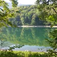
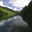
Mojkovac is a small town at 853 m in the valley of the Tara, between the national parks of Biogradska gora and Durmitor in northern Montenegro, with 2,471 residents in the town and 6,728 in the municipality (2023 census). People come for the lake in Biogradska gora, 12.4 km away, for fly fishing and rafting on the Tara in the town itself, and for the start of the Tara canyon downstream. The town has a station on the Bar-Belgrade railway; Podgorica is 79 km by road, about an hour and a half, and Kolašin 23 km. Half a day covers the riverside and the lake; a base here puts both parks within reach.
Key facts
| Elevation | 853 m (town) |
| Population, 2023 | 2,471 in the town; 6,728 in the municipality (15 settlements); 8,622 in the municipality in 2011 |
| Municipality area | 359 km² |
| Postcode | 84205 |
| Railway | Mojkovac station; halts at Štitarička Rijeka and Žari |
| Municipal day | 7 January (Battle of Mojkovac) |
| Neighbouring municipalities | Kolašin, Šavnik, Žabljak, Bijelo Polje, Berane |
Getting there
By train. Mojkovac is a station on the Bar-Belgrade line, the easiest way in without a car. The station lies about 2 km from the centre, a walk of about 24 minutes, or 2.5 km by road. A ticket from Podgorica costs €4.20 in second class and €6.30 in first; for train times call ŽPCG Booking on +382 20 441 197.
By bus. Regular lines link the town with the rest of Montenegro; timetables are on busticket4.me, and the bus station answers on +382 50 680 195. The buses guide covers the network.
By car. The main road from Podgorica runs up the Morača and through Kolašin; from the coast, Tivat Airport is 164 km and about 3 h 10. The times below are without traffic. In winter check the road conditions first: the town counts about 120 snow days a year.
| From | Distance | Driving time |
|---|---|---|
| Kolašin | 22.7 km | about 34 min |
| Bijelo Polje | 23.5 km | about 41 min |
| Berane | 47.3 km | about 1 h 08 |
| Andrijevica | 62.6 km | about 1 h 26 |
| Žabljak | 70.0 km | about 1 h 43 |
| Pljevlja | 79.1 km | about 2 h 06 |
| Podgorica | 79.2 km | about 1 h 28 |
| Podgorica Airport | 90.1 km | about 1 h 44 |
| Nikšić | 130.5 km | about 2 h 30 |
| Budva | 142.9 km | about 2 h 47 |
| Tivat Airport | 164.2 km | about 3 h 11 |
What to see in town
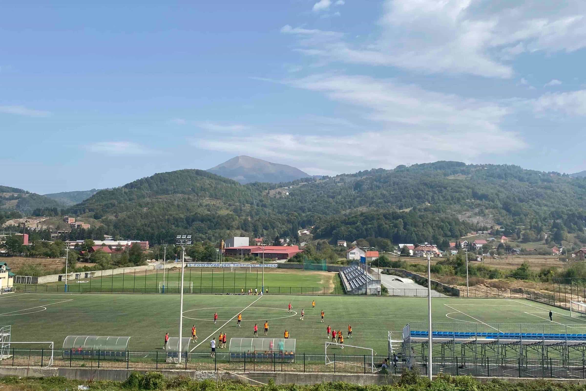
The Tara runs through the centre under two bridges: the Old bridge (Stari most) at the town entrance and the Green bridge (Zeleni most) upstream. The tourist information centre and the souvenir shop Suza Evrope stand on 21. maja street between them. The site of today's centre was once called Požar. By the river at the town entrance, the former tailings site of the Brskovo mine is now a 19 ha sports and recreation zone, reached from the centre by a footbridge: a 1.5 km path for running, cycling and walking, an outdoor gym, a children's playground and a tennis court. It is also where the summer events are held.
Three monuments mark the town's wars: to the fallen of the Battle of Mojkovac, by the bridge on the Tara; to serdar Janko Vukotić, who commanded the Montenegrin army in that battle; and to the fighters of the People's Liberation War, on the town square. Seven people from the area were named People's Heroes after the Second World War, and memorials to them stand in and around the town.

The village churches of the municipality are the Church of the Annunciation in Polja, St Archangel Michael in Štitarica and St Prokopije in Lepenac.

Biogradska gora and Bjelasica
The car park at Biogradsko jezero in Biogradska gora National Park is 12.4 km from the centre, about 26 minutes by car. The park, declared in 1952, covers 5,650 ha of Bjelasica with a 1,600 ha primeval forest reserve around the lake; 370 ha lie in Mojkovac municipality. The walking season runs from May to the end of October. On the Mojkovac side of Bjelasica the highest point is Razvršje (2,033 m).
The state ski centre Žarski is being built on Bjelasica above the right bank of the Tara, 15.3 km from town, with no opening date. Until it opens, the nearest lifts are at Kolašin 1600 and Cmiljača near Bijelo Polje; all of them are on the ski resorts page.

Down the Tara towards Durmitor
About 15 km from town on the road to the Đurđevića Tara bridge, the Ravnjak spring and Tmajevac, where the Ravnjak meets the Tara, mark the entry to Durmitor National Park (about 3,000 ha of it lie in Mojkovac municipality) and the start of the canyon. The roadside viewpoint Galev krš, with a memorial to the mountaineer Džambas, is the place to see it. Between Bistrica and Dobrilovina, at about 950 m, the Crna Poda reserve protects black pines about 400 years old and up to 45 m tall; below it, at Đavolje lazi, the river narrows to 2-3 m.
Dobrilovina, 27.8 km from town (about 44 minutes), has the Monastery of St George. From the village a gravel road, for a 4x4 or on foot, climbs Sinjajevina to Zabojsko jezero at 1,477 m: 265 by 165 m, about 19 m deep, frozen for about three months a year and under strict protection inside the park. The Đurđevića Tara bridge and its zip line are 47.5 km from town (about 1 h 13), Žabljak 70 km and Black Lake 72.1 km.
Two more places are close to town. In the north-west of the municipality the Prošćenske planine reach 1,856 m at Ljeljeni vrh above the start of the canyon, with a mountain hut built by the local club. About 10 km from town, at the foot of Mučnica, more than 200 wooden steps climb to the Mrki krš viewpoint over the forest and the town; the caves beside it, with three chambers, are told of as the treasury of the Nemanjić kings.
Fishing, rafting and paragliding
The Mojkovac fly-fishing zone follows the main road for 8 km, from the edge of Biogradska gora down to the town, with grayling, trout and huchen. In town, anglers fish below the Old bridge and on the stretch between the two bridges. Between Kolašin and Mojkovac the Tara is catch and release all year; permits and zone rules are on the fly-fishing page, the wider picture on fishing in Montenegro.

Local agencies run rafts and kayaks on the Mojkovac stretch, from the Rakočević camp down to the town. July and August, when the water is low, are the best and safest months; the season opens on 1 May with a rafting and kayak regatta that finishes by the Old bridge. The canyon trips that start further downstream are on the Tara rafting page. Paragliding is possible all year from take-offs chosen for the wind, the Magic East (Top Trail 3) cycling route passes through the town, and the tourist organisation lists hiking, horse riding, jeep and quad tours and katun visits without fixed routes.
History in brief
The town's story begins at Brskovo, in the reign of King Uroš I Nemanjić (1242-1276). The mine there is first mentioned in 1253; Saxon miners worked it, silver coins were minted, and Brskovo grew into a mining and trading town with a caravan station on the road between Kotor and Novo Brdo and a Dubrovnik consulate, whose consul general for Serbia sat here in 1311-1312. It declined from the mid-14th century, with plague and the new mines at Janjevo and Novo Brdo. In today's village of Brskovo remain a fortress on the Gradina hill with a round tower 12 m across, preserved to a height of 2 m, a settlement and square at Doganjice with a church and fresco fragments, slag from ore processing and more than 150 medieval mine shafts. By tradition the town's name comes from Uroš I's words “moj kovani novac” (“my minted coin”); the other explanation derives it from the personal name Mojko.
Ottoman rule began in 1398. After the wars of 1876-1878 the left bank of the Tara was freed and the river became the border fixed at Berlin; the whole area joined Montenegro in the First Balkan War in 1912. On 6 and 7 January 1916 the Montenegrin army under serdar Janko Vukotić stopped the Austro-Hungarian advance down the Tara valley towards Podgorica in the Battle of Mojkovac, with the heaviest fighting at Bojna Njiva, Razvršje and Uloševina; 7 January is the municipal day. The present municipality was formed in 1955 from Polja (Kolašin district) and Mojkovac (Bijelo Polje district). In the 1970s and 1980s the town had more than 5,000 jobs in industry; the Brskovo lead and zinc mine, the Vukman Kruščić timber plant and the MISS textile factory have all closed, and the municipality now names agriculture and tourism as its priorities.
Events through the year
- 7 January: the municipal day, marking the Battle of Mojkovac.
- 1 May: rafting and kayak regatta on the Tara, finishing by the Old bridge.
- June: Mojkovački otkos, a hand-mowing contest with old crafts, in the sports zone.
- End of July: Mojkovačka čorbijada, a soup-cooking contest, in the same zone.
- August: Mojkovac fest, music on the town square.
- Last week of September: Mojkovačka filmska jesen, a film festival founded in 1976 and among the oldest in the region, with acting awards for films from Bosnia and Herzegovina, Serbia, Croatia and Montenegro.
- Christmas and New Year: a Christmas bazaar on the town square.
Without fixed dates: the folklore festival “Zlatni ćemer”, the Sinjajevina skyrun from Štitarica over Jablanov vrh (22-34 km, 1,600 m of climb), the Days of honey and healthy food, and a paragliding show.
Practical information
- Tourist information: tourist organisation, Trg Ljubomira Bakoča bb, +382 50 472 428; information centre and souvenir shop Suza Evrope, 21. maja bb, +382 67 022 014.
- Health: health centre (Dom zdravlja), Trg Dragana Jovanovića 1, +382 50 472 246; emergency 124; two pharmacies. The nearest general hospital is in Bijelo Polje, 23.5 km away (hospitals).
- Money and post: ATMs of CKB, Erste, Lovćen, NLB and Prva banka; post office 84205; a Jugopetrol station.
- Where to stay: Hotel & Resort Gacka, Hotel Dulović, Hotel Serdar and Hotel Ravnjak by the Ravnjak spring; motels and apartments (Kozak, Motel Krstac, Apartmani Babić); the campsites Šćepanović, Rabrenović in Donja Polja and Eko Oaza Suza Evrope in Dobrilovina; rooms in rural households.
- Local food: Kolašinski lisnati sir, a protected layered cheese, is made in 17 local communities of Kolašin and Mojkovac, and honey tastings are offered in town (local cuisine).
When to visit
July averages 19.1 °C and January -6.3 °C; the year brings up to about 2,200 mm of rain and snow, with July and August the driest months. There are about 120 snow days, and the snow cover reaches 150 cm in town and more on the mountains. Rafting is best in July and August, walking in Biogradska gora from May to October, and the film festival fills the last week of September.
Nearby
- Kolašin, 23 km: the ski lifts and the Kolašin in 3 days plan.
- Bijelo Polje, 24 km, with the nearest hospital and the Cmiljača ski resort.
- Trešnjevik pass, 49.3 km, on the old road between Kolašin and Andrijevica.
- Žabljak, 70 km, for Durmitor and the Žabljak in 3 days plan.
- Planning: Mojkovac is reachable by train on the day trips from Podgorica, and the national parks and rafting pages cover both sides of the town.
Questions
How far is Mojkovac from Podgorica?
79.2 km by road, about 1 h 30 by car. By train a second-class ticket from Podgorica costs €4.20.
Does the train stop in Mojkovac?
Yes. Mojkovac is a station on the Bar-Belgrade line, about 2 km from the centre; Štitarička Rijeka and Žari in the municipality are halts.
How far is Biogradska gora from Mojkovac?
12.4 km to the lake car park in Biogradska gora, about 26 minutes by car.
How far is the Đurđevića Tara bridge?
47.5 km down the Tara road, about 1 h 13 by car; Žabljak is 70 km.
How high is Mojkovac and how many people live there?
The town lies at 853 m. The 2023 census counted 2,471 people in the town and 6,728 in the municipality, down from 8,622 in the municipality in 2011.
What was the Battle of Mojkovac?
On 6 and 7 January 1916 the Montenegrin army under serdar Janko Vukotić stopped the Austro-Hungarian advance down the Tara valley towards Podgorica. 7 January is the municipal day.
Where does the name come from?
By tradition from King Uroš I's words “moj kovani novac” (“my minted coin”), after the silver coins minted at Brskovo; another explanation derives it from the personal name Mojko.
Can you fish in the Tara at Mojkovac?
Yes. The fly-fishing zone runs 8 km from the edge of Biogradska gora to the town, catch and release all year; in town, the best stretches are below the Old bridge and between the two bridges.
Town facts
- Postcode
- 84205
- Elevation
- 853 m
- Municipality area
- 359 km²
- Municipality population (2023 census)
- 6,728
Sources
Postcode: postacg.me
Elevation: mojkovac.travel
Municipality area: monstat.org
Municipality population (2023 census): monstat.org
Bus, parking, services
Train station
Nearest hospital
- Opšta bolnica Bijelo Polje
- Medanovići bb, Bijelo Polje
- +382 50 684 142
- 41 min by car (23.2 km)
Sources
Train station: zicg.me
Nearest hospital: data.gov.me
Health
Emergency medical service, Mojkovac
Open 24 hoursEmergency medical service · Public
JZU Dom zdravlja Mojkovac
Health centre · Public
Trg Dragana Jovanovića 1, Mojkovac
Sources
hitna.me: Zavod za hitnu medicinsku pomoć: Organizaciona struktura (list of units) · Zavod za hitnu medicinsku pomoć: Kontakt (124 for all municipalities) · Zavod za hitnu medicinsku pomoć: Djelatnost zavoda (service 00-24, every day)
data.gov.me: Ministry of Health open data: Spisak svih zdravstvenih institucija u CG (xlsx, updated 2025-05-12)
gov.me: Government of Montenegro: Primary health care centres in Montenegro
fzocg.me: Health Insurance Fund: contracts with institutions in the health network
Town hall and tourist information
Opština Mojkovac
Town hall
Trg Ljubomira Bakoča, 84 205 Mojkovac
+382 50 472 135 · +382 50 684 445 · +382 50 470 272
Mon-Fri 07:00-15:00
Turističko-informativni centar Mojkovac (suvenirnica „Suza Evrope“)
Tourist information centre
… maja bb, 84205 Mojkovac
Turistička organizacija Mojkovac
Tourist board office
Trg Ljubomira Bakoča bb, 84205 Mojkovac
- Tourist information2 tourist information offices
- Post offices2 post offices
- Gas stations1 fuel station
- Vets2 vet clinics
- Campsites3 campsites
- EV chargers: 1
Sources
mojkovac.me: Opština Mojkovac: Kontakt (site header and footer)
data.gov.me: data.gov.me: Lista opština Crne Gore (Ministry of Public Administration, CC BY, updated 2025-05-30) · data.gov.me: Turističke organizacije (Ministry of Tourism, CC BY, updated 2025-09-30)
mojkovac.travel: TO Mojkovac: Contact us
Sources
Tourist Organisation Mojkovac, About the town (O gradu), read 2026-11-01 · Tourist Organisation Mojkovac, Natural attractions, read 2026-11-01 · Tourist Organisation Mojkovac, Cultural and historical heritage, read 2026-11-01 · Tourist Organisation Mojkovac, Stories and legends (Mrki krš), read 2026-11-01 · Tourist Organisation Mojkovac, Events (Manifestacije), read 2026-11-01 · Tourist Organisation Mojkovac, Active tourism (fly fishing, rafting, sports zone), read 2026-11-01 · Tourist Organisation Mojkovac, Protected areas, read 2026-11-01 · Tourist Organisation Mojkovac, Accommodation and food, read 2026-11-01 · Tourist Organisation Mojkovac, Contact, read 2026-11-01 · Municipality of Mojkovac, About the town, read 2026-11-01 · Government of Montenegro, consent to 7 January as the Day of Mojkovac municipality (document page), read 2026-11-01 · Government of Montenegro, Battle of Mojkovac centenary commemoration, 8 Jan 2016 · Novosti, Government consent: Day of Mojkovac municipality on 7 January (press) · MONSTAT, 2023 census, population by municipality (Release, part I), read 2026-11-01 · MONSTAT, 2023 census, population by settlement and sex (xlsx), read 2026-11-01 · MONSTAT, Statistical Yearbook 2025, table 1-2 (area of municipalities), read 2026-11-01 · JPNPCG, Management Plan NP Biogradska gora 2026-2030 (PDF), read 2026-10-14 · National Tourism Organisation, Fly fishing (Kolašin-Mojkovac catch and release), read 2026-10-14 · ŽICG, Network statement 2026 (stations and halts), read 2026-10-14 · ŽPCG, Red vožnje (timetable search with fares), Podgorica-Mojkovac · Pošta Crne Gore, post office 84205 Mojkovac, read 2026-10-15 · Government of Montenegro, Primary health care centres in Montenegro · Zavod za hitnu medicinsku pomoć, contact (124) · Health Insurance Fund, contracts with institutions in the health network (general hospitals) · Ministry of Agriculture, Kolašinski lisnati sir the seventh protected product, 7 May 2019 · OpenStreetMap node 4366592891, Mojkovac centre, ODbL, read 2026-11-01 · Routes computed with OSRM on OpenStreetMap data (ODbL), car and foot, queried 2026-11-01