Zeta
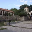
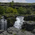
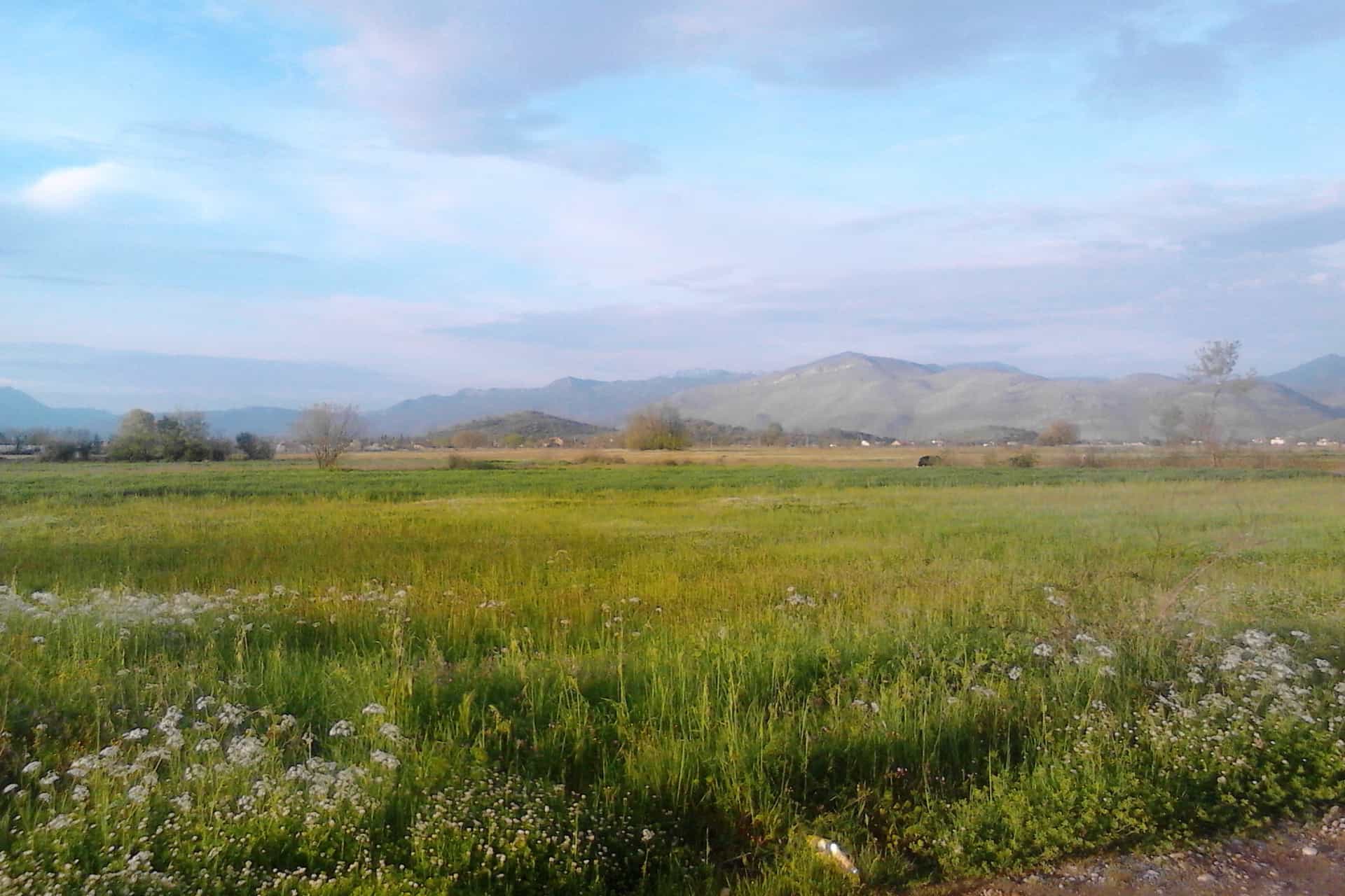
Golubovci, the Zeta plain and the Skadar Lake shore
Central Region · 16,071 people (municipality)
Photo: Zexxon15 · CC BY-SA 4.0
About Zeta
Zeta is the municipality around Golubovci on the lower Zeta plain between Podgorica and Skadar Lake, the flat country most visitors cross on the way from Podgorica Airport to the coast. Golubovci is its largest settlement and its postal town (81304); the municipal seat is Anovi, 2.6 km away. The airport and five stops on the Bar railway lie here, and the Vranjina side of Skadar Lake, with the national park's main visitor centre, is 11 km from the municipal building. Separate from Podgorica since 2022, Zeta had 16,071 residents in 2023. This is not the Zeta river, which joins the Morača at Podgorica.

Getting there and around
By air. Podgorica Airport (TGD) stands on Aerodromski put in Golubovci, 6.6 km from the municipal building. BTC Zeta, MS Tours and Zejdin buses run from the terminal to the bus station in Podgorica, Zejdin also to Ulcinj; Zeta Taxi and Vuk BG Taxi serve the airport, and the airport guide has the parking and fares.
By train. Golubovci station and the Aerodrom, Zeta, Morača and Vranjina stops lie on the Bar line, served by local trains between Podgorica and Bar; the Zeta and Vranjina stops are in or beside the national park. Check the ŽPCG timetable for which trains stop where, and the train guide for fares. No scheduled Podgorica-Golubovci bus is published by an official source; the buses guide explains the intercity network.

By car. The Adriatic highway and the Podgorica-Bar road cross the municipality. Distances run from the municipal building in Anovi, by road without traffic.
| From | Distance | Driving time |
|---|---|---|
| Golubovci (settlement centre) | 2.6 km | about 5 min |
| Podgorica Airport | 6.6 km | about 13 min |
| Plavnica | 6.6 km | about 10 min |
| Vranjina (national park visitor centre) | 11.1 km | about 12 min |
| Tuzi | 12.7 km | about 20 min |
| Podgorica | 14.7 km | about 21 min |
| Virpazar | 16.1 km | about 17 min |
| Božaj border crossing | 23.2 km | about 38 min |
| Danilovgrad | 32.5 km | about 44 min |
| Cetinje | 40.4 km | about 51 min |
| Bar | 42.3 km | about 46 min |
| Budva | 57.4 km | about 1 h 13 |
| Nikšić | 62.8 km | about 1 h 18 |
| Ulcinj | 66.0 km | about 1 h 24 |
| Kolašin | 70.7 km | about 1 h 14 |
Skadar Lake at Vranjina and Plavnica
Vranjina, an island village of 129 people joined to the mainland by a bridge, is the base of Skadar Lake National Park: its administration building holds the main visitor centre with a souvenir shop and an outdoor exhibition, and sells park tickets. Electric bikes, kayaks and boats can be rented there, and licensed boats leave the piers of Vranjina and Plavnica on lake cruises, as they do at Virpazar and Rijeka Crnojevića; the Vranjina shore by the village, under the road and railway embankment, serves only small boats. Fees are on the park page and the operators on the boat tours page. Vranjina is one of the park's five viewpoints, listed with the others on the Skadar Lake viewpoints page, and an educational trail, Šuma na vodi (forest on the water), is being laid out nearby.
The Vranjina monastery has been protected cultural property since 1949 and the old village since 1979; the visitor centre is 11.1 km, about 12 minutes from the municipal building. Plavnica, 6.6 km away in the Berislavci area, has a walled pier 56 m long with a silted 1 km approach channel, and private rooms and restaurants have grown up around it.
Across the water, in Cetinje municipality, lie the islet fortress of Lesendro by Vranjina (protected 1949), the fortress of Žabljak Crnojevića (1948) and Kom monastery (1949); boat tours call at Žabljak Crnojevića.

Fortresses and old churches
Balšin grad on Ponarska gora above Ponari has been protected since 4 August 1950. Tradition links it to the Balšić dynasty; the hill was used from prehistory through Illyrian-Hellenistic and Roman times, the small trapezoid fort with round towers is medieval and Ottoman, and the site has not been excavated. It looks over Skadar Lake, Žabljak Crnojevića and Vranjina to Lovćen, Rumija and Prokletije. Also protected since 1950 are Oblun fortress and the Holy Trinity church in Vukovci, St George's church in Srpska and four archaeological sites at Mataguži (Trepezulje, Kremenjača, Mliništa and Viganj); the Mljace site at Mataguži followed in 1960 and the Velje ledine necropolis in Gostilj in 1956. No visiting hours, signage or access rules are published for any of them.

Practical information
- Municipality: Glavna gradska ulica 89, Anovi, 81304 Golubovci, +382 20 873 290. The tourist organisation (zeta.travel) publishes no office or phone.
- Post: 81304 Golubovci, Anovi 89/2, 07:00-20:00; a counter in the Voli market in Mahala, 08:00-21:00.
- Health: the Golubovci unit of the Dom zdravlja Glavnog grada (call centre 19816), an ambulance unit for Zeta (124) and three pharmacies; the hospitals are in Podgorica (hospitals).
- Money and power: a CKB branch and ATMs in Mahala and at the airport; no EV charger is recorded; for power cuts, the CEDIS dispatcher on 020 622 773 (see power, water and air).
- Where to stay: the campsites Auto Camp Vranjina, River Camp Morača and Autocamp Campus (Goričani), and private rooms by the lake at Vranjina and Plavnica.
History in brief
The lake basin and Lower Zeta became part of Roman provinces from 9 AD, within the territory of Doclea, founded early in the 1st century. Plavnica is recorded about 1222 and Gostilj in 1233; in 1445 Mataguži headed the list of katuns of Upper Zeta whose representatives formed the Zeta assembly, and in the early 17th century the Venetian official Mariano Bolizza counted 70 houses and 200 soldiers in Gostilj. The area joined Montenegro after the Congress of Berlin, with the border settled in 1883; from 1903 to 1910 Golubovci was the seat of the Zeta captaincy, and after the First Balkan War the village municipalities of Golubovci, Mahala, Bijelo Polje and Berislavci were formed. The railway to Bar (1959), the Adriatic highway (1963), the airport, the Radio Montenegro transmitter and the 13. jul farm followed, and 1950-1980 was the period of greatest growth. Under the 2011 law Golubovci was an urban municipality within the Capital City; in 2022 the area became the Municipality of Zeta, with 22 settlements on 152 km², an area still provisional until the boundary with Podgorica is settled.
When to visit
The plain has a Mediterranean-influenced climate: the mean daily temperature stays above 0 °C on more than 320 days a year and above 15 °C on about 180, and in July and August temperatures can pass 40 °C; the year brings about 115 rainy days. On the lake, boats and kayaks run in spring and summer; most bird species are present from April to June and the largest flocks in winter. An autumn day of Zeta cakes, priganice and patišpanj, with stalls of home produce, crafts, flowers and honey, has been held on Trg Anovi in Golubovci by the municipality and its culture centre. Vranjina and Plavnica are on the day trips from Podgorica.
Questions
Is Podgorica Airport in Golubovci?
Yes: its address is Aerodromski put, Golubovci, in the municipality of Zeta, 6.6 km from the municipal building.
What is the postcode of Golubovci?
81304.
Is Golubovci the same as Zeta?
Golubovci, with 2,521 residents in 2023, is the largest settlement and the postal town of the Municipality of Zeta; the seat of the municipality is Anovi, and Mahala (2,410), Mojanovići and Mataguži are the other large villages.
How far is Golubovci from Podgorica?
About 15 km: 14.7 km by road from Podgorica to the municipal building in Anovi, about 21 minutes.
Is there a train to Golubovci?
Yes: Golubovci has a station on the Bar line, and local trains also stop at the Aerodrom halt by the airport and at Zeta, Morača and Vranjina.
How do I get to Skadar Lake from Golubovci?
The Vranjina visitor centre is 11.1 km from the municipal building, about 12 minutes by car, and Plavnica 6.6 km; local trains also stop at Vranjina.
When did Zeta become a municipality?
In August 2022, under an amendment to the Law on Territorial Organisation; before that the area was the urban municipality of Golubovci within the Capital City.
Town facts
- Postcode
- 81304
- Municipality area
- 152 km²
- Municipality population (2023 census)
- 16,071
Sources
Postcode: postacg.me
Municipality area: monstat.org
Municipality population (2023 census): monstat.org
Bus, parking, services
Train station
Nearest hospital
- Klinički centar Crne Gore (KCCG)
- Ljubljanska bb, 81000 Podgorica
- +382 20 412 412
- 24 min by car (14.2 km)
Sources
Train station: zicg.me
Nearest hospital: data.gov.me
Health
Emergency medical service, Zeta
Open 24 hoursEmergency medical service · Public
Dom zdravlja Glavnog grada, objekat Golubovci
Health centre · Public
Golubovci, Zeta
Sources
hitna.me: Zavod za hitnu medicinsku pomoć: Organizaciona struktura (list of units) · Zavod za hitnu medicinsku pomoć: Kontakt (124 for all municipalities) · Zavod za hitnu medicinsku pomoć: Djelatnost zavoda (service 00-24, every day)
dzpg.me: Dom zdravlja Glavnog grada: Telefonski brojevi po objektima
Town hall and tourist information
Opština Zeta
Town hall
Glavna gradska ulica 89, Anovi, 81304 Golubovci
Turistička organizacija Zeta
Tourist board office
Sources
Municipality of Zeta, home page (address, contact) · Municipality of Zeta, About Zeta (settlements, seat in Anovi, relief, climate, history) · State Election Commission, Assembly decision on the Zeta municipal election commission (Sl. list CG 104/22), citing the 2022 amendment to the Law on Territorial Organisation (Sl. list CG 92/22) · Law on Territorial Organisation of Montenegro, consolidated text to Sl. list CG 12/2014 (gov.me, 2015), Art. 5 and 6 · Law on Territorial Organisation of Montenegro, consolidated text to Sl. list CG 86/2018 (gov.me, 2019), Art. 5 · MONSTAT, Census 2023, population by settlement (xlsx) · MONSTAT, 2023 census, population by municipality (Release 133/2024) · MONSTAT, Statistical Yearbook 2025, table 1-2 (area of municipalities, Zeta provisional), read 2026-11-01 · National Parks of Montenegro, Management Plan NP Skadarsko jezero 2026-2030 · National Tourism Organisation, Skadar Lake National Park (boat and kayak rental at Vranjina) · Tourist Organisation Zeta, Vranjina (In porta sem) · Tourist Organisation Zeta, Balšin grad · Tourist Organisation Zeta, Dan zetskih kolača i priganica (Trg Anovi, Golubovci) · Airports of Montenegro, Podgorica Airport parking and transportation · ŽICG, Network statement 2026 (stations and halts) · ŽPCG, stops · ŽPCG, timetable · Pošta Crne Gore, post office 81304 Golubovci · Pošta Crne Gore, Golubovci counter in the Voli market, Mahala · Dom zdravlja Glavnog grada, telephone numbers by facility · Institute for Emergency Medical Assistance, organisational structure (Zeta unit) · Montefarm, pharmacies · Health Insurance Fund of Montenegro, list of pharmacies (June 2026) · CKB, branches and ATMs · Erste Bank, ATM locator · NLB, ATM at Podgorica Airport · CEDIS, contact (dispatch centres) · KACG, Auto Camp Vranjina · KACG, River Camp Morača · KACG, Autocamp Campus · OpenStreetMap Nominatim, Golubovci (settlement relation 12512735), ODbL · OpenStreetMap Nominatim, Plavnica (Berislavci, Zeta), ODbL · eMontenegro routes API (OSRM on OpenStreetMap data), road distances from the municipal building in Anovi, queried 2026-11-01