Ibar
A long river with a short Montenegrin start: the Ibar rises from six springs below Hajla near Rožaje and leaves the country after 33.5 km on its way to Kosovo, Serbia and the West Morava.
33.5 km · North-east Montenegro · Mountain river
Photo: Mazbln · CC BY-SA 3.0
- In Montenegro
- 33.5 km
- Basin
- 8,059 km²
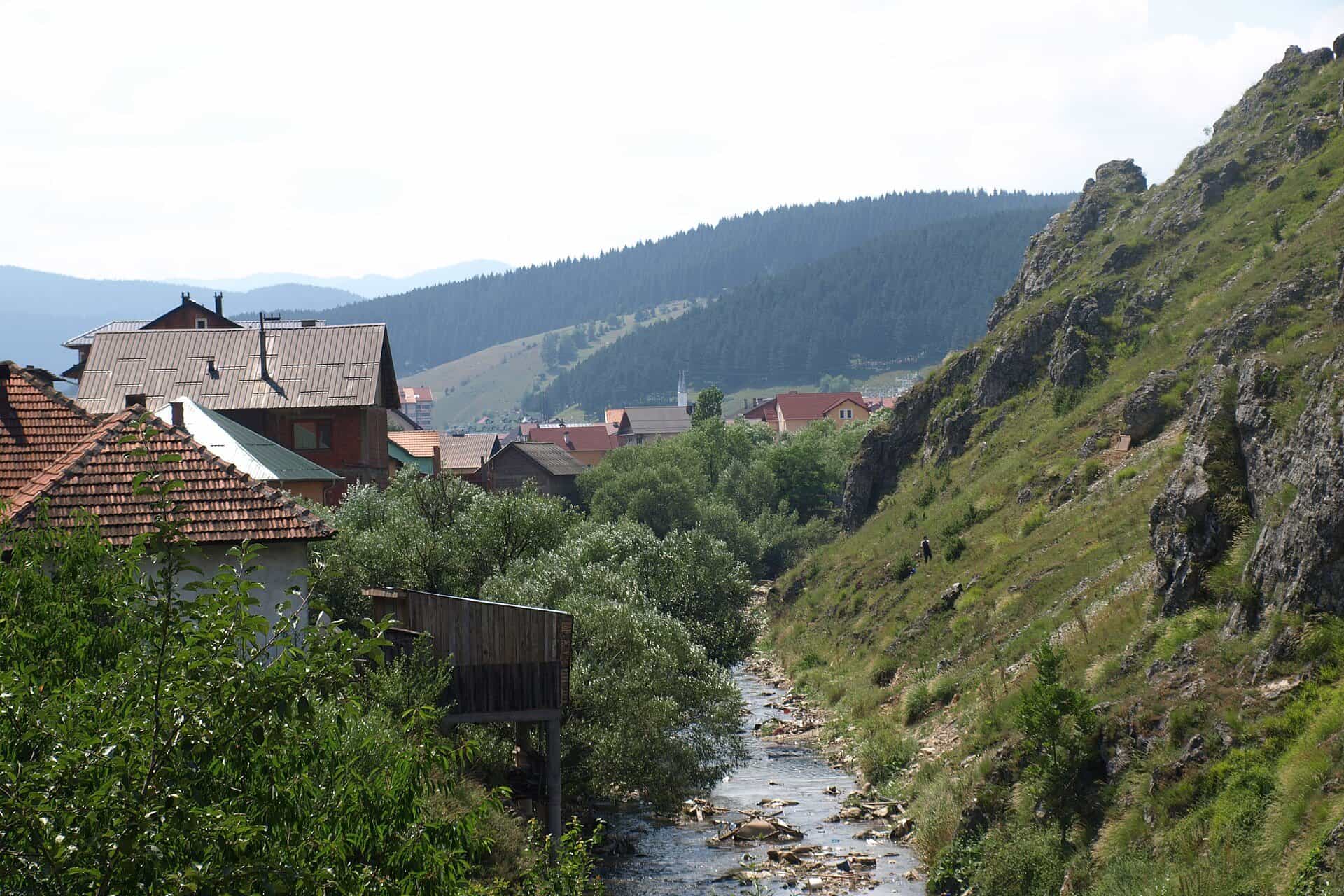
The Ibar is a 276 km river that spends only its first 33.5 km in Montenegro. It rises from six springs below Mount Hajla, at 1,360 m, about 10 km from the centre of Rožaje, flows through the town and leaves the country for Kosovo and Serbia, where it joins the West Morava near Kraljevo; the water ends in the Black Sea. In Montenegro it is a mountain trout river with a town at about 1,100 m on its banks and the Hajla massif above it.
Course
The Ibar's catchment is 8,059 km², of which 413 km², about 5 %, lie in Montenegro, where the river takes in 23 tributaries before the border. The Kosovo section is 104 km long with a catchment of 3,966 km². Over its whole length the Ibar is the largest and most important tributary of the West Morava.

Rožaje and Vrelo Ibra
Rožaje is the town of the upper Ibar, at about 1,100 m, near the point where Montenegro, Serbia and Kosovo meet, ringed by Hajla (2,403 m), Žljeb (2,322 m), Štedim (2,272 m) and Smiljavica (1,953 m). Vrelo Ibra, the spring, is about 10 km from the centre. The town's landmarks are the Sultan Murat II mosque of 1450, the largest in Rožaje, the mostly wooden Kučanska mosque of 1830 and the Ganića kula, one of the oldest buildings, now the Homeland Museum.

Hajla
Hajla, 2,403 m, rises about 15 km from the centre of Rožaje. Below the summit are the Grope mountain hut at about 1,900 m, with room for about 60 people, and Bandžov at about 1,400 m, with a hut, a restaurant and eco-katuns, where the easy routes start; the Štedim plateau at 1,700-2,000 m is used for ski touring and snowshoeing in winter. Mountain hiking here runs from June to the end of October.
Fishing
Under the national order of 2026 (Sl. list CG 75/2026, in force 11 June 2026) all trout in Rožaje waters are closed from 1 November to 15 March and grayling from 1 March to 1 June, and fishing on the Ibar from its source to the Dimiškin bridge is banned until 1 April 2029; daily permits come from the local club. Zones on other rivers are on the fly-fishing page.
Getting there
- Rožaje: 124.2 km from Podgorica, about 2 h 23 min by car over the Smokovac-Mateševo motorway, Andrijevica and Berane; 30.7 km, about 45 minutes, from Berane over the Lokve pass.
- Vrelo Ibra: about 10 km from the centre of Rožaje.
- Hajla: about 15 km from the centre; Bandžov is the base for the easy routes.
Driving times are free-flow, without traffic or snow. The neighbouring river to the west is the Lim.
Questions
How much of the Ibar is in Montenegro?
33.5 km of 276 km, and 413 km² of the 8,059 km² catchment.
Where does it rise?
From six springs below Hajla, at 1,360 m, about 10 km from Rožaje.
Can you fish the Ibar near Rožaje?
Not between the source and the Dimiškin bridge until 1 April 2029; elsewhere outside the closed seasons, with a daily permit from the local club.
How far is Rožaje from Podgorica?
124.2 km, about 2 h 23 min by car.
Route
- 1
Springs below Hajla
Six springs at 1,360 m.
- 2
Rožaje
The town of the upper Ibar.
Things to do
Vrelo Ibra
The spring of the Ibar, six springs below Hajla at 1,360 m, about 10 km from Rožaje.
Hajla
2,403 m summit about 15 km from Rožaje, with the Grope hut at about 1,900 m and the Bandžov base.
Sources
Water Administration of Montenegro, Registar voda od značaja za Crnu Goru, 2nd ed. (July 2024) · Obradović, S. (2021), Water Quality of the Middle and Lower Course of the Ibar River, Serbian Journal of Geosciences 7 · Ministarstvo poljoprivrede, šumarstva i vodoprivrede, Naredba o ribolovnim zabranima, lovostaju i minimalnim veličinama riba (Sl. list CG 75/2026), Art. 2-3 · Tourist Organisation of Rožaje, About Rožaje · Tourist Organisation of Rožaje, What to visit (Vrelo Ibra, Hajla, Grope, Bandžov, Štedim) · National Tourism Organisation of Montenegro, Charming mountain towns (Rožaje) · National Tourism Organisation of Montenegro, Hiking and trekking (season) · MONSTAT, Statistical Yearbook 2025, table 1-8 Mountains (Hajla) · Routes computed with OSRM on OpenStreetMap data (ODbL); free-flow driving times · Wikipedia, Ibar (river) (secondary, pointer only)