Lim
The longest river that touches Montenegro: 220 km from Lake Plav to the Drina, 94 km of them through Andrijevica, Berane and Bijelo Polje, with huchen, grayling and trout zones in each.
94 km · North-east Montenegro · Mountain and valley river
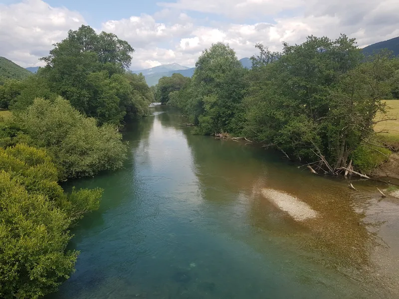
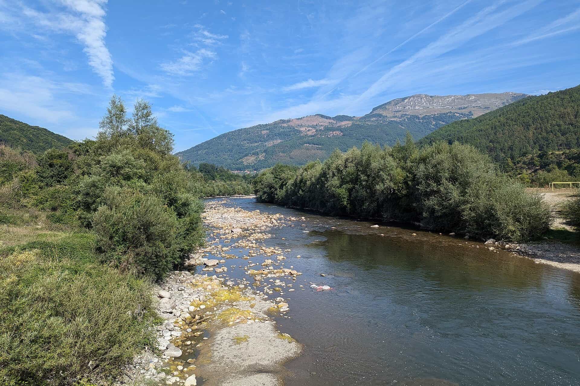
Photo: Андрей Романенко · CC BY-SA 4.0
- In Montenegro
- 94 km
- Basin
- 5,784 km²
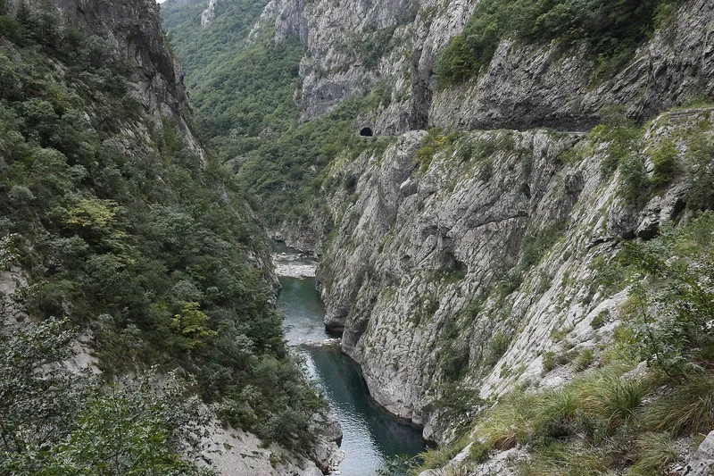
The Lim is the longest river that flows through Montenegro: 220 km from Lake Plav to the Drina, 94 km of them inside the country (MONSTAT: 123 km). It is the river of the north-east: Andrijevica, Berane and Bijelo Polje stand on it, and its water goes to the Drina and the Black Sea. For visitors it is above all a fishing river, with fly-fishing zones in all four municipalities it crosses and trout tributaries fished all year, along a valley road that links Plav with the Bar-Belgrade railway at Bijelo Polje.
Course
The river starts as the Vrmoša near the Albanian border, enters Lake Plav and takes the name Lim where it leaves the lake. The lake is a through-flow lake: the Ljuča, formed below Gusinje where the Grnčar from Albania meets the Vruja, brings in almost all of its water over 12.76 km, and the Lim carries it out. Lake Plav itself is 1.99 km², lies at 906 m and is 9.1 m deep at most. The river is at 925 m where its course begins and at 296 m where it leaves Montenegro.

From the lake the Lim flows past Andrijevica, Berane and Bijelo Polje. Its catchment is 5,784 km² in all, 2,557 km² of them in Montenegro. Beyond the border it passes Prijepolje, Priboj and Rudo and reaches the Drina near Međeđa in Bosnia and Herzegovina; the lowest stretch lies under the Višegrad reservoir.
Tributaries
Three left-bank tributaries have pages of their own, and all three are trout water:
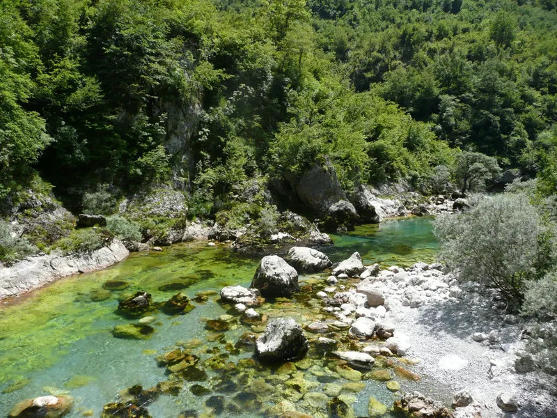
- Zlorečica joins before Andrijevica. Very cold, clear water with brown trout, grayling and rainbow trout, fished catch-and-release; with the Lim and the Ljuča it has hosted a European fly-fishing championship.
- Bistrica joins between Andrijevica and Berane. It is fished all year, catch-and-release, for wild brown trout; the canyon section is the hardest water.
- Ljuboviđa joins between Berane and Bijelo Polje. The Bar-Belgrade road and railway follow its valley, and its fly-fishing zone runs 500 m either side of the Vuković ethno village.
Towns on the Lim
Plav stands on the lake where the river begins. Andrijevica, in the upper valley, has the Knjaževac memorial park. Berane is the main town of the upper valley; its Monument to Freedom stands on Jasikovac hill east of the centre, across the Lim. Bijelo Polje is the last town before the Serbian border and the last station on the Bar-Belgrade railway before Serbia.

Fishing
Four fly-fishing zones lie on the Lim and its headwaters:
| Zone | Water | Species | Notes |
|---|---|---|---|
| Plav | Ljuča, Lake Plav, Lim source (4 km) | Grayling, brown trout, huchen, lake trout, pike, chub, nase | Lake closed 1 October-1 April, Ljuča 1 October-1 May (2026 order) |
| Andrijevica | Lim and tributaries | Brown trout, grayling, rainbow trout | Best September-October; catch-and-release |
| Berane | 3 km near the town | Grayling, brown trout, chub, huchen | Catch-and-release |
| Bijelo Polje | Gubavač to Gošino bridge | Grayling, trout, huchen, cyprinids |
Daily permits come from the sport-fishing club of each zone; fly zones allow a single barbless hook, and most are catch-and-release. Closed seasons in the national order of 2026 (Sl. list CG 75/2026, in force 11 June 2026) for Plav, Gusinje, Andrijevica, Berane and Bijelo Polje: all trout from 1 November to 15 March, grayling from 1 March to 1 June, nase from 15 April to 1 June, carp and other cyprinids from 1 May to 15 June. Huchen and pike are under a closed season in all waters until 1 April 2029: any caught must be returned alive. Lake Plav is closed from 1 October to 1 April and the Ljuča from 1 October to 1 May except two stretches. Until 1 April 2029 fishing is banned on all Lim tributaries in Bijelo Polje except the Bistrica and the Ljuboviđa, and in Berane on the Kaludarska, the Talumska, the Luška makva, the Brnjica, the Dapsićka and parts of the Bistrica and the Lješnica. Zones on other rivers are on the fly-fishing page.
Getting there
- Plav: 131.1 km from Podgorica, about 2 h 28 min by car; the lake and the start of the Lim; the Plav fishing zone.
- Andrijevica: the upper valley, between Plav and Berane.
- Berane: 93.8 km from Podgorica, about 1 h 40 min; the middle of the valley, with the 3 km fishing zone by the town.
- Bijelo Polje: 107.5 km from Podgorica, about 2 h 10 min, or by train on the Bar-Belgrade line; the zone runs from Gubavač to Gošino bridge.
Driving times are free-flow, without traffic or snow.
Questions
How long is the Lim in Montenegro?
94 km of its 220 km in the Water Register; MONSTAT's yearbook gives 123 km.
Where does the Lim start?
At the outflow of Lake Plav; above the lake the stream is called the Vrmoša, and the lake's water comes in through the Ljuča.
Is Lake Plav the highest lake in the Balkans?
No. It lies at 906 m; Black Lake on Durmitor, at 1,418 m, is higher.
Which fish can you catch?
Grayling, brown trout and huchen in every zone, plus lake trout, pike, chub and nase around Plav and cyprinids near Bijelo Polje. Huchen and pike must be released until 1 April 2029 (2026 order).
Can you fish the Lim in winter?
Trout are closed in these waters from 1 November to 15 March and Lake Plav from 1 October to 1 April; the Bistrica at Berane is fished all year, catch-and-release.
Route
- 1
Lake Plav
1.99 km² at 906 m; the river is called Lim from the lake outflow.
- 2
Berane
Town in the middle of the valley; 3 km fishing zone near the town.
- 3
Bijelo Polje
Last town before the border; fishing zone from Gubavač to Gošino bridge.
Activities
- FishingClosed seasons per the 2026 order: all trout 1 November-15 March, grayling 1 March-1 June; Lake Plav closed 1 October-1 April; huchen and pike released until 1 April 2029 · permit required
Things to do
Fly fishing
Four zones: Plav, Andrijevica, Berane and Bijelo Polje; daily permits from the local clubs.
Lake Plav
The lake at the head of the river, 906 m above sea level.
The Bistrica
Tributary at Berane fished all year, catch-and-release, for wild brown trout.
Fish species
- Grayling
- Brown trout
- Huchen (Danube salmon)
- Rainbow trout
- Lake trout (blatnjača)
- Pike
- Chub
- Nase
Bridges
- Gošino bridge (Bijelo Polje)
On these trips
Sources
Water Administration of Montenegro, Registar voda od značaja za Crnu Goru, 2nd ed. (July 2024), entries Lim, Ljuča and Grnčar · MONSTAT, Statistical Yearbook 2025, tables 1-6 Natural lakes and 1-9 Major rivers · National Tourism Organisation of Montenegro, Fly fishing · Ministarstvo poljoprivrede, šumarstva i vodoprivrede, Naredba o ribolovnim zabranima, lovostaju i minimalnim veličinama riba (Sl. list CG 75/2026), Art. 2-3 · Municipality of Plav, About Plav (the lake's inflow and outflow) · Water management plans for the Danube and Adriatic basin areas, 2021 (data.gov.me, CC BY): Zlorečica, Bistrica and Ljuboviđa water bodies · Željeznički prevoz Crne Gore, stations (Bijelo Polje) · Spomenik Database, Berane (Monument to Freedom on Jasikovac) and Andrijevica (Knjaževac memorial park) (secondary) · Routes computed with OSRM on OpenStreetMap data (ODbL); free-flow driving times · Wikipedia, Lim (river) (secondary: the Vrmoša, the towns and the mouth)