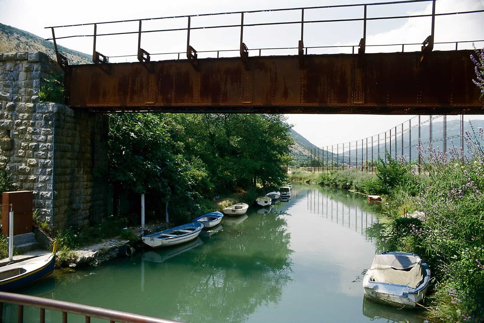
Sutorina
The westernmost river of Montenegro: 9 km from the Croatian border at Prijevor through Igalo to the sea at Provodina, in a natural bed above the settlement of Sutorina and a concrete channel below it.
9.03 km · Coast, Herceg Novi · Short coastal river; concrete channel in its lower course
Photo: Falk2 · CC BY-SA 4.0
- In Montenegro
- 9.03 km
- Basin
- 50 km²
The Sutorina is the short river of the westernmost corner of Montenegro: 9.03 km from the Croatian border at Prijevor to the Adriatic at Provodina, through Igalo, entirely in Herceg Novi municipality. It is one of the 13 rivers of importance for Montenegro in the Water Register, and the only one of them on the coast west of the Bojana. Down to the settlement of Sutorina it runs in a natural bed; from there a concrete channel carries it to the sea.
Course
The river rises at Prijevor on the Croatian border at 256 m and reaches sea level after 9.03 km, a mean gradient of 28.2 m/km; for 0.98 km near the source the river itself is the state border. The catchment is estimated at about 50 km². Down to the settlement of Sutorina the bed is natural; from there the river runs in a concrete channel to the sea at Provodina. The 2021 water management plan follows the same split with two water bodies: Sutorina_1, natural, 3.88 km, and Sutorina_2, heavily modified because of the concreted bed, 3.15 km.

Status
In the Water Register of July 2024, 13 rivers stand as rivers of importance for Montenegro: the Sutorina with the Bojana, Morača, Zeta, Cijevna, Nudolska, Piva, Tara, Ćehotina, Lim, Ibar, Grnčar and Komarnica. The register records each river's source, mouth, length, gradient and catchment; for the Sutorina it also records the concrete channel of the lower course.
Igalo and the valley
The lower river runs through Igalo, the spa settlement about 3 km from Herceg Novi, which with 5,977 residents at the 2023 census has more people than the Herceg Novi settlement itself (4,393). Igalo is a centre of physiotherapy and mud treatment for rheumatic and neurological conditions; at Blatna plaža, the mud beach, sea mud from the shallows is used free of charge. Njivice, 4 km from Herceg Novi at the entrance to the Bay of Kotor, has several beaches with shallow water for children and rocky beaches towards Igalo. Herceg Novi's road crossing into Croatia, Debeli Brijeg, is about 9 km and 16 minutes from the town centre; the police list has one more road crossing to Croatia, Kobila, and the border crossings page has the details of both.
Getting there
Herceg Novi is 107 km from Podgorica, about 2 h 20 min; Tivat Airport is 23.5 km and about 39 minutes away with the Kamenari-Lepetane ferry, and Dubrovnik Airport under 40 km across the border, through Debeli Brijeg. Driving times are free-flow, without traffic or the ferry queue. Igalo is about 3 km from the town centre along the shore.

Questions
Is the Sutorina the border with Croatia?
For 0.98 km of its 9.03 km, at its upper end near Prijevor, where it rises.
Why is the lower river in a channel?
The register and the 2021 water plan record a concrete channel from the settlement of Sutorina to the sea at Provodina and class that stretch as heavily modified; the natural bed is upstream of the settlement.
Which beaches are near the mouth?
Blatna plaža, the mud beach at Igalo, and the Njivice beaches 4 km from Herceg Novi, with rocky shore between them towards Igalo.
Sources
Water Administration of Montenegro, Registar voda od značaja za Crnu Goru, 2nd ed. (July 2024), entry Sutorina · Water management plans for the Danube and Adriatic basin areas, 2021 (data.gov.me, CC BY) · MONSTAT, 2023 census, population by settlement (Herceg Novi, Igalo) · National Tourism Organisation, healing beaches (Igalo mud) · National Tourism Organisation, family beaches (Njivice) · Morsko dobro, The Beaches of Montenegro (brochure), p. 18 · Tourist Organisation Herceg Novi, about the city (airports) · Uprava policije, Border crossing points (gov.me, 11.05.2021, archived) · OSRM routing (car, OpenStreetMap data, ODbL; times without traffic): Herceg Novi, Debeli Brijeg, Tivat Airport, Podgorica