Grebaje Valley
Glacial valley at about 1,100 m above Gusinje, the most visited part of Prokletije National Park and its main hiking and climbing base: two huts, marked trails to Karanfil, Očnjak and Karaula and the 10.2 km Volušnica-Popadija loop, park entry €3 a day.
Gusinje, Prokletije National Park · Loop Grebaje-Volušnica-Popadija about 5 h 30
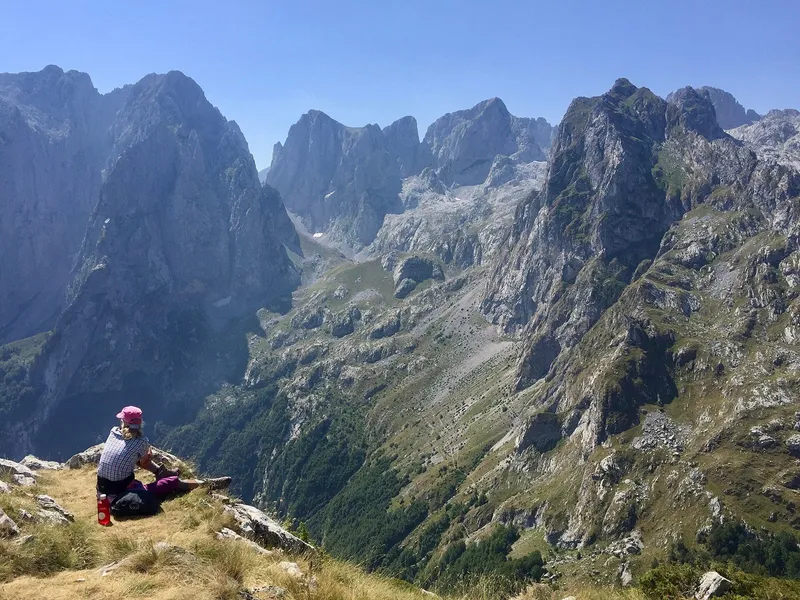
Photo: Marko Randjic · CC BY-SA 4.0
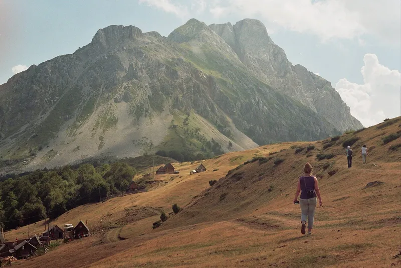
The Grebaje valley is a glacial valley at about 1,100 m above Gusinje and the main starting point for hiking and climbing in the Montenegrin Prokletije. It is the most visited part of Prokletije National Park; its checkpoint is open all year and entry is €3 per person per day. A road from Gusinje through the village of Dolja reaches it, asphalt for about 6.9 km and then about 1.5 km of gravel. Two mountain huts stand in the valley, and marked trails lead to the Karanfili, Očnjak, Karaula and the Volušnica-Popadija loop.
Key facts
| Elevation | valley about 1,100 m; Branko Kotlajić hut 1,175 m |
| Length | about 2 km along the Volušnica stream |
| Status | inside Prokletije National Park; Important Plant Area |
| Checkpoint | Grebaje, open all year, the busiest in the park |
| Entry | €3 per person per day |
| From Gusinje | about 6.9 km of asphalt through Dolja, then about 1.5 km of gravel |
| Huts | Branko Kotlajić (45 beds) and Karanfil |
| Main loop | Grebaje-Volušnica-Popadija-Grebaje, 10.2 km, about 5 h 30, medium |
| Busiest | May-October, peak in August |
The valley
Two glacial valleys, Ropojana-Vruje and Grebaje-Dolja, divide the Gusinje side of Prokletije into three groups: Trojan, Popadija, Volušnica and Talijanka; the Karanfili, Mali Potkajs and Vezirova brada; and Bjelič with Bor. Grebaje continues the Dolja valley and is enclosed by steep rock walls; the ground is stony and short of water, and snowfields linger at low altitude. The floor is a plateau of four larger meadows crossed by the Volušnica stream, which dries up in summer. The valley begins at the Krug meadow, also called Stari katun.

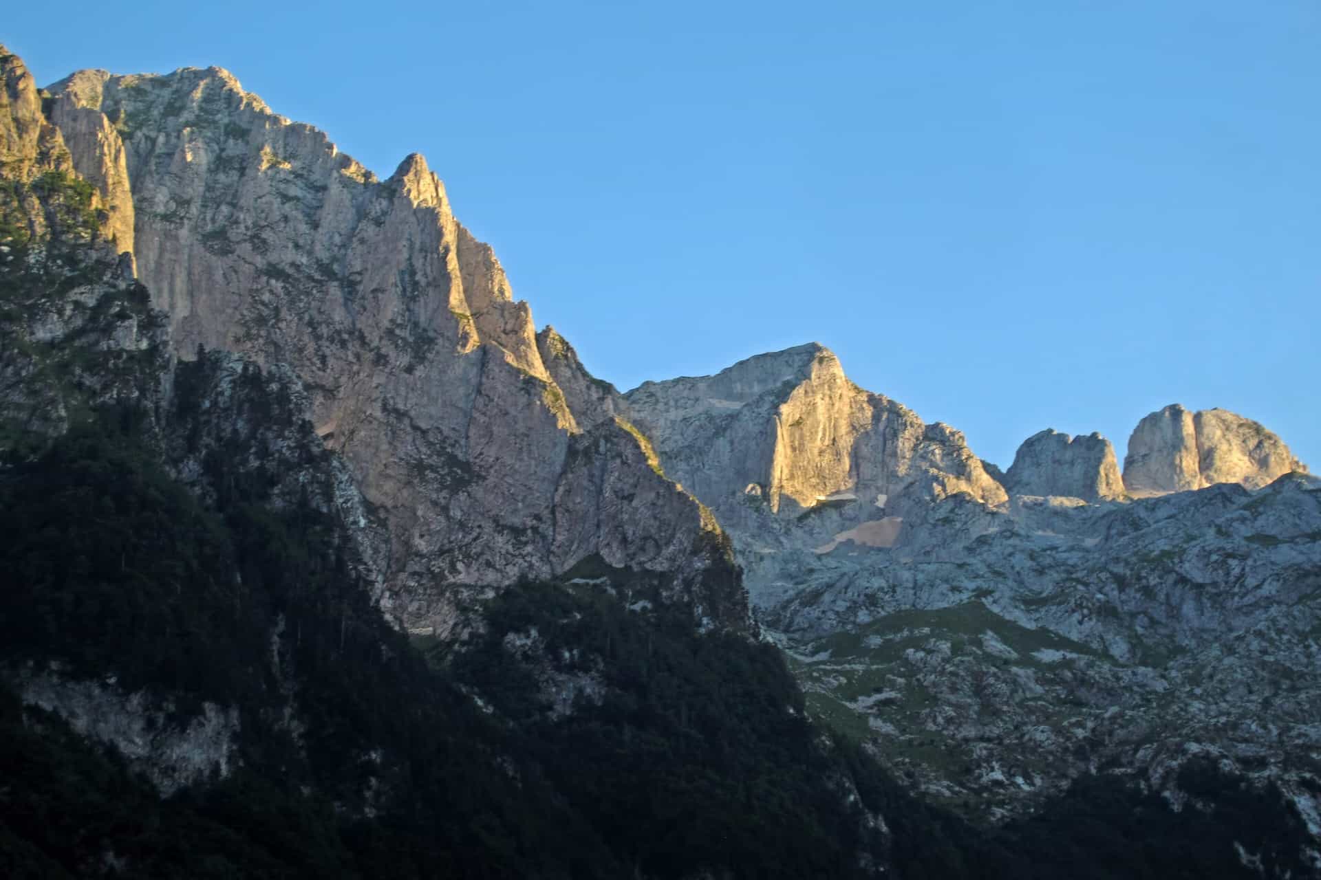
The Karanfili rise straight above the valley. Their cliffs and summits reach about 2,460-2,490 m and carry climbing routes from easy to extremely difficult, which is what made Grebaje the centre of mountaineering and alpinism in the Montenegrin Prokletije. Mountaineering camps and climbing courses have been held here since 1980.
The valley holds a small lake (jezerce) and two rock-art sites: an Iron Age hunting scene from the 8th century BC in a rock shelter on Vezirova brada, and the carved slab on Volušnica known as the Great Mother of Prokletije (Velika majka sa Prokletija, or Magna Mater). Neither has been excavated or placed under protection. More than 30 plant species endemic to the south-western Prokletije grow in the area, and the wildlife includes chamois, brown bear, wild boar, roe deer and fox.
Trails from the valley
The one loop with published figures runs from Grebaje via Volušnica and Popadija back to Grebaje: 10.2 km, graded medium, about 5 h 30. It starts at the Karanfil hut and goes via point 1402 and the junction for Karaula (1,570 m), the Volušnica katun, the Magna Mater carving and a waterfall to Popadija (2,056 m), then Talijanka (2,057 m) and Volušnica, also called Maja e Can (1,879 m), before dropping back to the hut. The same ridge is walked as a themed hike from Popadija over Talijanka to Volušnica.

Other summits reached from the valley on marked trails:
- Karanfil (about 2,460-2,490 m): 4.5-5 hours, for well-trained hikers and climbers. From the top the view reaches Maja Jezercë (2,695 m) on the Albanian side, the highest peak of the Prokletije.
- Očnjak (2,185 m): 2.5-3 hours, for trained hikers only. Belgrade alpinists first climbed it in 1957; a walking route was found in 1962.
- Karaula (1,915 m): about 2 hours, with views of Plav Lake, the Grebaje and Ropojana valleys and Gusinje.
- Kotlovi (about 1,600 m): a snowy hollow below Koplje, a rock wall more than 300 m high.

The park's marked trails from the valley also include Karanfili Veliki vrh, Karanfili Sjeverni vrh, Sjeverni vrh with Karanfil Ljuljaševića, Vezirova brada (Rogopeč, Grebaje, Karanfil Ljuljaševića) and Volušnica via Popadija to Trojan. All 13 marked trails in the park are rated as more demanding. The park also has two themed trails, Magna Mater and Od Glečera do Grebaje (from the glacier to Grebaje), and the mountain-bike route from Gusinje to dolina Grebaje and back is one of the park's five. The valley floor itself is easy walking; the climbs out of it are not.
Huts, water and where to stay
Two mountain huts stand in the valley. Branko Kotlajić, owned by the Belgrade club PK Radnički, is at 1,175 m with 45 beds, water, heating, toilets and a kitchen. Karanfil, run by the Gusinje club PD Karanfili, stands at the start of the valley and is where the loop begins. Other accommodation is private guesthouses and eco-katuns, seasonal and mostly in the valley itself. Opening dates of the huts are not published.
Suljova česma, a spring in a small conifer wood along the gravel road a little below the Karanfil hut, is the last drinking water in the valley. Fill up there before any of the climbs.
Fees
| Item | Price |
|---|---|
| Park entry | €3 per person per day |
| Parking, car | €1 per hour |
| Parking, off-road vehicle | €2 per hour |
| Parking, bus | €5 per hour |
| Tent pitch at a designated campsite | €3 per day |
| Park guide | €40 for 4 h, €80 for 8 h |
Getting there
From the centre of Gusinje drive about 1.2 km to a junction and turn right. The road passes a Catholic church and runs through the village of Dolja; a tapped spring is on the right after about 4.1 km. The asphalt ends after about 6.9 km, and a good gravel road continues about 1.5 km to the head of the valley. The Grebaje checkpoint is open all year. The park has no mobile base stations, so phone coverage in the valley is poor.
When to go
Visits run from May to October and peak in August. Summer is the best time for Prokletije, but snow is possible even then.
Safety
Every marked trail in the park is rated as more demanding, snow is possible even in summer, and there is no reliable phone signal. Above the tree line lives the nose-horned viper (poskok). Tell the hut where you are going. The emergency number is 112.
Nearby
The Prokletije National Park page has the whole trail list and the other checkpoints; the Peaks of the Balkans trail passes through the park on the Montenegrin side. Plav Lake lies below Plav, the next town. Other walks are on the hiking page.
Questions
Grebaje, Grebaja or Grbaja?
Grebaje (Dolina Grebaje) is the established name on maps, in guides and in mountaineering literature. Grebaja is also used locally, and Grbaja appears on some trail pages and maps. All three mean the same valley.
How much does it cost?
€3 per person per day for the park, plus €1 per hour for a car in the park car park.
What is the main hike?
The Grebaje-Volušnica-Popadija loop: 10.2 km, about 5 h 30, graded medium, over Popadija (2,056 m), Talijanka (2,057 m) and Volušnica (1,879 m).
Highlights
- Valley at about 1,100 m in Prokletije National Park, the park's most visited part
- Loop Grebaje-Volušnica-Popadija: 10.2 km, about 5 h 30, medium
- Marked trails to Karanfil, Očnjak and Karaula; two mountain huts
- Park entry €3 per person per day; checkpoint open all year
On these trips
Sources
JPNPCG: Management Plan NP Prokletije 2026-2030 (PDF) · JPNPCG: Prokletije, active holidays · JPNPCG: Prokletije price list · TO Gusinje: Doline · TO Gusinje: Prirodni fenomeni · TO Gusinje: Prirodni i antropogeni resursi · TO Gusinje: Planinarski pohod Popadija-Talijanka-Volušnica (themed route) · PSCG (Mountaineering Association of Montenegro): mountain huts · NTO: Hiking and trekking · Deljanin Eco Village: Dolina Grebaje (road from Gusinje, peaks, history) · Via Dinarica: Dolina Grebaje, Nacionalni park Prokletije · Gusinje-Plav: Grebaje · OpenStreetMap way 241545866 "Planinarski dom Branko Kotlajić" in the Grebaje valley, ODbL