Skip to content
eMontenegro

Three days in Plav and Gusinje, for June to October. Day 1 stays low: Plav Lake and the start of the Lim below the town, then Gusinje and Ali Pasha's Springs. Day 2 is the Grebaje valley above Gusinje and the park's Volušnica-Popadija loop, a full mountain day. Day 3 is Babino polje and the walk to Hridsko jezero. Plav is the base for all three nights.

Guided tours for this trip

Sponsored

Tours, ratings and prices: Viator.

See all tours

Summer plan

June-October · 97 km · 2 h 45 min driving

Show the route map

Summer plan · Day 1

Plav, Plav Lake, Gusinje and Ali Pasha's Springs

32 km · 55 min drivingMonths: June-October

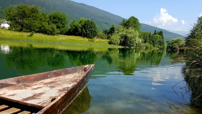
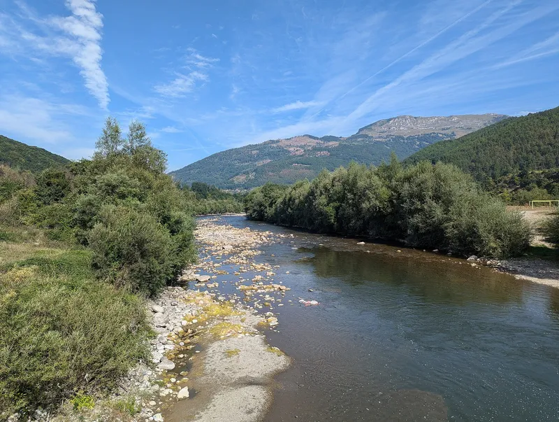
Start in town: the National Tourism Organisation dates Redžepagić tower and the Old Mosque in Ribare to the 15th century, and the two stand about 200 m apart. Plav Lake, below the town, is the largest glacial lake in Montenegro: 1.99 km² at 906 m and 9.1 m deep at most. The Ljuča feeds it and the Lim leaves it, at the start of a 220 km course to the Drina. The lake, the Ljuča and the first 4 km of the Lim form the same organisation's Plav fly-fishing zone, with grayling, brown trout, huchen, lake trout, pike, chub and nase, fished with a daily permit from the local club; fishing on the lake is closed from 1 October to 1 April and on the Ljuča from 1 October to 1 May except two stretches, and huchen and pike must be released until 1 April 2029 (fishing order of 2026).

Then south-west to Gusinje, a municipality again since February 2014 after a consultative referendum (it had been abolished in 1953), with 1,877 residents in the settlement in 2023. The National Tourism Organisation points to the Vizier's mosque (17th century) and to the Orthodox church of St George and the Catholic church of St Anthony standing on one street; the town's summer festival, Gusinjsko ljeto, ran from 13 July to 5 August in 2025. Ali Pasha's Springs (Ali-pašini izvori) are in Gusinje municipality, not Plav: karst springs at 925 m at the foot of Vezirova brada, which the Gusinje tourist board calls the largest permanent karst spring in Montenegro. The board puts them a kilometre from Gusinje and the national organisation 1.5 km from the Vizier's mosque; by road it is 2.2 km. The water is very cold and flows strongest in spring; it runs into the Vruja, which meets the Grnčar to form the Ljuča and so reaches Plav Lake. Local belief holds that the water keeps you young and that marriages made here last; the tourism organisation adds that vows are often taken at the springs, once 30 weddings in a single day, and that thousands gather here at the end of August. It also names other springs nearby, Savino oko, Bajrovića vrelo and Dragija, and the 15 m Skakavica waterfall at the entrance to the Grlja canyon.

  1. Car: Plav to Plav Lake · 1.4 km · 4 min

  2. 1

    Plav Lake

    Glacial Lake · 906 m · Plav

  3. Car: Plav Lake to Lim · 2.7 km · 6 min

  4. 2

    Lim

    94 km · North-east Montenegro

  5. Car: Lim to Gusinje · 10.4 km · 15 min

  6. 3

    Gusinje

  7. Car: Gusinje to Ali Pasha's Springs · 2.2 km · 4 min

  8. 4

    Ali Pasha's Springs

  9. Car: Ali Pasha's Springs to Plav · 15.3 km · 25 min
Summer plan · Day 2

The Grebaje valley: the Volušnica-Popadija loop

39 km · 1 h 5 min drivingMonths: June-October

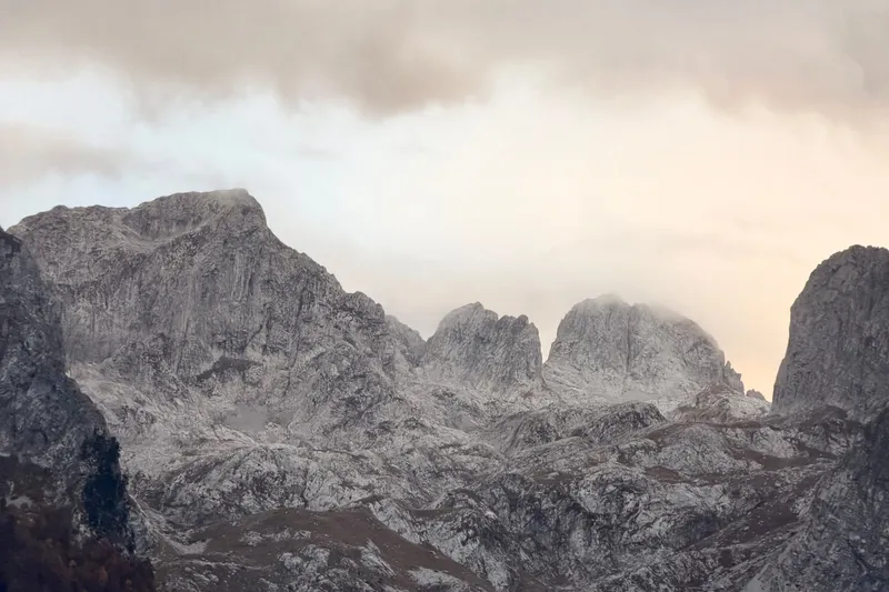
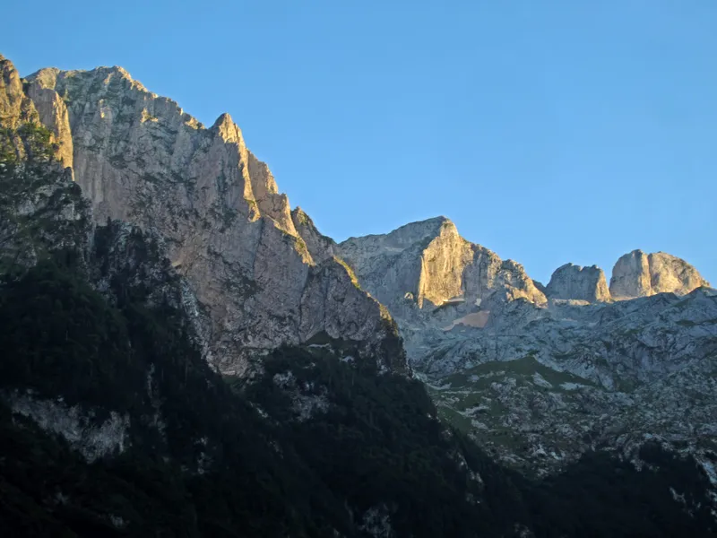
Back through Gusinje and the village of Dolja to the Grebaje valley, a glacial valley at about 1,100 m, the most visited part of Prokletije National Park and the main starting point for mountaineering and climbing, with the Karanfili rising straight above it. From Gusinje the road is asphalt for about 6.9 km, then about 1.5 km of gravel. The valley's checkpoint is open all year, and entry is EUR 3 per person per day. The recommended loop, from Grebaje via Volušnica and Popadija back to Grebaje, is 10.2 km, graded medium, about 5 h 30. It starts at the Karanfil hut and climbs via point 1402 and the junction for Karaula (1,570 m) to the Volušnica katun, past the carved slab known as the Great Mother of Prokletije (Magna Mater) and a waterfall, to Popadija (2,056 m); it then follows Talijanka (2,057 m) and Volušnica, also called Maja e Can (1,879 m), before dropping back to the hut. Fill your bottles at Suljova česma, a little below the Karanfil hut: it is the last drinking water in the valley. Start early: there is no mobile signal in the park and snow is possible even in summer. The valley floor itself is easy walking if you want a shorter day.

  1. Car: Plav to Grebaje Valley · 19.6 km · 35 min

  2. 5

    Grebaje Valley

    Gusinje, Prokletije National Park · Loop Grebaje-Volušnica-Popadija about 5 h 30

  3. 6

    Prokletije National Park

    Plav / Gusinje

  4. Car: Grebaje Valley to Plav · 19.5 km · 35 min

Things to do here: Hiking

Tours for this day

Sponsored

Tours, ratings and prices: Viator.

Summer plan · Day 3

Babino polje and the walk to Hridsko jezero

26 km · 45 min drivingMonths: June-October

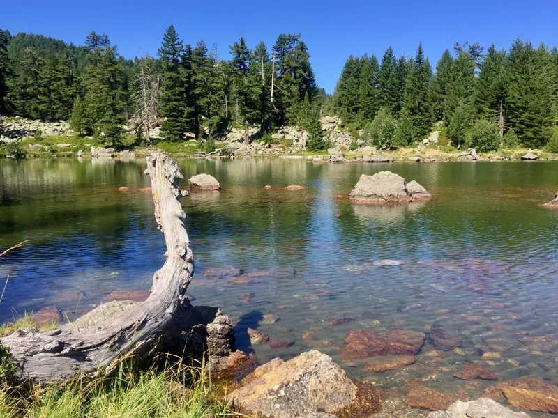
From Plav to Babino polje, the hamlet with the Hrid mountain hut, for Hridsko jezero, a glacial lake at 1,970 m near the Albanian border and one of the park's most visited sites. The park lists the trail as 3.1 km, graded easy, about 1 h, a linear trail reached from the direction of Plav; the National Tourism Organisation lists the stretch from Babino polje to the lake among its easy walks. Ask at the Hrid hut in Babino polje about the start of the trail and the road beyond. This is a second park day, so a second EUR 3 ticket; the park opened a seasonal ticket checkpoint at Hridska krivina in 2025. The lake lies inside the Hridsko jezero special nature reserve: its surface varies between 33,000 and 36,000 m², it is about 5 m deep and its outflow is intermittent. The national organisation calls it the Lake of Happiness: wishes made on the shore are said to come true, and jewellery can be seen on the bottom. For a longer day, the park names a separate circuit, from Babino polje via Bajrovića katun, Hridsko jezero, karaula Bjelaja, Tromeđa and Ćafa Bogićes back to Babino polje, without a length; go with a licensed guide, as the tourism organisation recommends.

With a fourth day: Visitor, 2,210 m in the official survey table, is the mountain directly above Plav, outside the national park, with the glacial Visitorsko jezero. The National Tourism Organisation names it among the mountains hiked from June to the end of October.

  1. Car: Plav to Babino polje · 12.8 km · 25 min

  2. 7

    Babino polje

  3. 8

    Hridsko jezero

    Glacial Lake · 1,970 m · Prokletije National Park, Plav

  4. Car: Babino polje to Plav · 12.9 km · 25 min

Overview

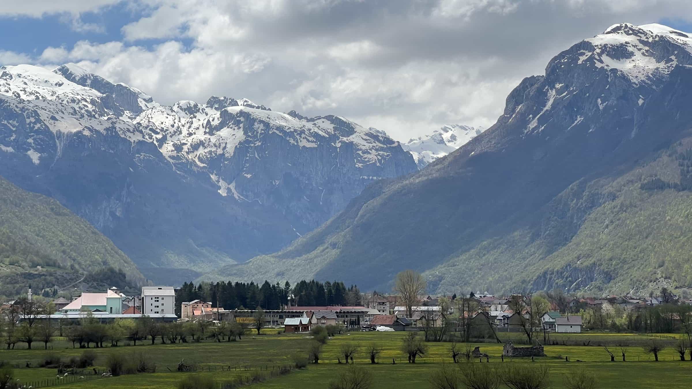
Plav is a small town at about 945 m on the shore of Plav Lake, in the far south-east of Montenegro on the borders with Albania and Kosovo, with 4,121 residents in the settlement at the 2023 census. The National Tourism Organisation calls it the town where most Prokletije tours begin; its hiking season runs from June to the end of October, and it warns that snow is possible even in summer. Prokletije National Park, declared in 2009 and now lying in the municipalities of Plav and Gusinje, covers the mountains above the Plav-Gusinje basin, which is about 25 km long and 5 km wide. Gusinje, the basin's other town, is 13.5 km south-west by the R-9. The park's records count visits from May to October, with August the busiest month; this plan starts in June, with the hiking season.

Kolašin is 73 km away by road, about 1 h 30, and has its own page, 3 days in Kolašin, which suggests Plav Lake as a fourth day. The third mountain base has one too: 3 days in Žabljak.

Clear mountain lake ringed by pines and boulders, with a weathered dead tree in front
Hridsko jezeroPhoto: Bruno Rijsman, CC BY 2.0

In winter: why there is no plan

The plan ends with October. For winter, the National Tourism Organisation lists skiing and snowshoeing for Plav and names one snowshoe trail near the town, Osmica, but no ski centre. The park's Grebaje checkpoint is listed as open all year, but no published source says whether the roads to the Grebaje valley and Babino polje are cleared of snow, so neither walk is planned for winter. Winter tyres or other prescribed winter equipment are compulsory in winter conditions from 15 November to 1 April, and the road conditions page carries the daily AMSCG report.

Fees: the park day ticket, guides

Prokletije National Park charges EUR 3 per person per day, free under 15; the day ticket includes the visitor centre and the educational paths. Days 2 and 3 are both park days, so count two tickets per person. Where the park charges for parking, a car pays EUR 1 an hour and an off-road vehicle EUR 2. A park guide costs EUR 40 for 4 hours or EUR 80 for 8. Camping in the park is EUR 3 a day for a tent pitch and EUR 20 for a serviced space.

The jagged limestone peaks of Karanfili seen from a grassy summit
Karanfili from TalijankaPhoto: Hladnikm, CC BY-SA 4.0

Safety: no signal in the park, snow in summer, 112

The park has no mobile base stations, so do not count on a signal on days 2 and 3. The park management plan rates all 13 of its marked mountain trails as more demanding, snow is possible even in summer, and the National Tourism Organisation recommends a licensed guide. Tell the hut where you are going. The emergency number is 112.

Where to sleep

Plav, three nights: every day starts and ends here, and Gusinje is 13.5 km away. Private guesthouses and seasonal eco-katuns are mainly in the Grebaje valley. There are three mountain huts: Hrid at Babino polje, where day 3 starts, and Branko Kotlajić and Karanfil in the Grebaje valley, where the day 2 loop starts at the Karanfil hut. Branko Kotlajić stands at 1,175 m and has 45 beds. Camping in the national park is allowed only at designated paid pitches.

Getting to Plav

From Podgorica it is 131 km by road, about 2 h 30: the Smokovac-Mateševo motorway (toll EUR 3.50 per car for the full section), then through Kolašin and Andrijevica, and from Andrijevica on the M-9 to Murino and Plav; the municipality gives 180 km. Podgorica Airport is 141 km, about 2 h 45. The R-9 continues from Murino to Gusinje. The municipality gives 73 km to the railway junction at Bijelo Polje. Albania and Kosovo lie across the mountains; the crossings are on the border crossings page.

Sources

Distances and drive times: computed by road; they ignore stops, road works and snow. Park trails, fees, checkpoints and huts: the JPNPCG trail page, price lists and the Prokletije Management Plan 2026-2030. Gusinje and Ali Pasha's Springs: Tourist Organisation Gusinje. Seasons, sights, the springs' gathering, fishing and winter activities: National Tourism Organisation. Population: MONSTAT, 2023 census. Plav's roads and distances: Municipality of Plav. Tolls: Monteput. Camping rule: Law on National Parks, Art. 16. Winter tyres: Law on Road Traffic Safety, consolidated text current to 31 March 2021.

Common questions

What is there to do in Plav and Gusinje?

Plav Lake, the largest glacial lake in Montenegro, and the start of the Lim below it; Gusinje with its mosque and churches and Ali Pasha's Springs; the Grebaje valley and the park's 10.2 km Volušnica-Popadija loop; and the 3.1 km walk to Hridsko jezero. The plan on this page puts them in three days, June to October.

How far is Hridsko jezero from Plav, and how long is the walk?

Babino polje, where the Hrid hut stands, is 12.8 km from Plav by car, about 23 minutes. The park lists a 3.1 km trail to the lake, graded easy, about 1 h, linear, but does not say where it starts; ask at the hut.

How long is the Grebaje loop?

10.2 km, graded medium, about 5 h 30, by the park's figures. It starts at the Karanfil hut in the Grebaje valley and goes over Popadija (2,056 m), Talijanka (2,057 m) and Volušnica (1,879 m).

Do I pay to enter Prokletije National Park?

Yes: EUR 3 per person per day, free under 15, including the visitor centre and the educational paths. This plan has two park days, so two tickets. A park guide costs EUR 40 for 4 hours or EUR 80 for 8.

Where are Ali Pasha's Springs?

In Gusinje municipality, at 925 m at the foot of Vezirova brada: about a kilometre from Gusinje by the tourist board, 1.5 km from the Vizier's mosque by the National Tourism Organisation, 2.2 km by road. From Plav it is 15.4 km by road.

Can I visit Plav in winter?

There is no winter plan. The National Tourism Organisation lists skiing and snowshoeing for Plav and names the Osmica snowshoe trail, but no ski centre near the town; ask locally whether the roads to the Grebaje valley and Babino polje are cleared of snow. Winter tyres or other prescribed winter equipment are compulsory in winter conditions from 15 November to 1 April.

How do I get to Plav from Podgorica?

By road: 131 km, about 2 h 30, on the motorway to Mateševo (toll EUR 3.50 per car), then through Kolašin, Andrijevica and Murino. The municipality gives 180 km.

Plan the drive

Cities
Plav