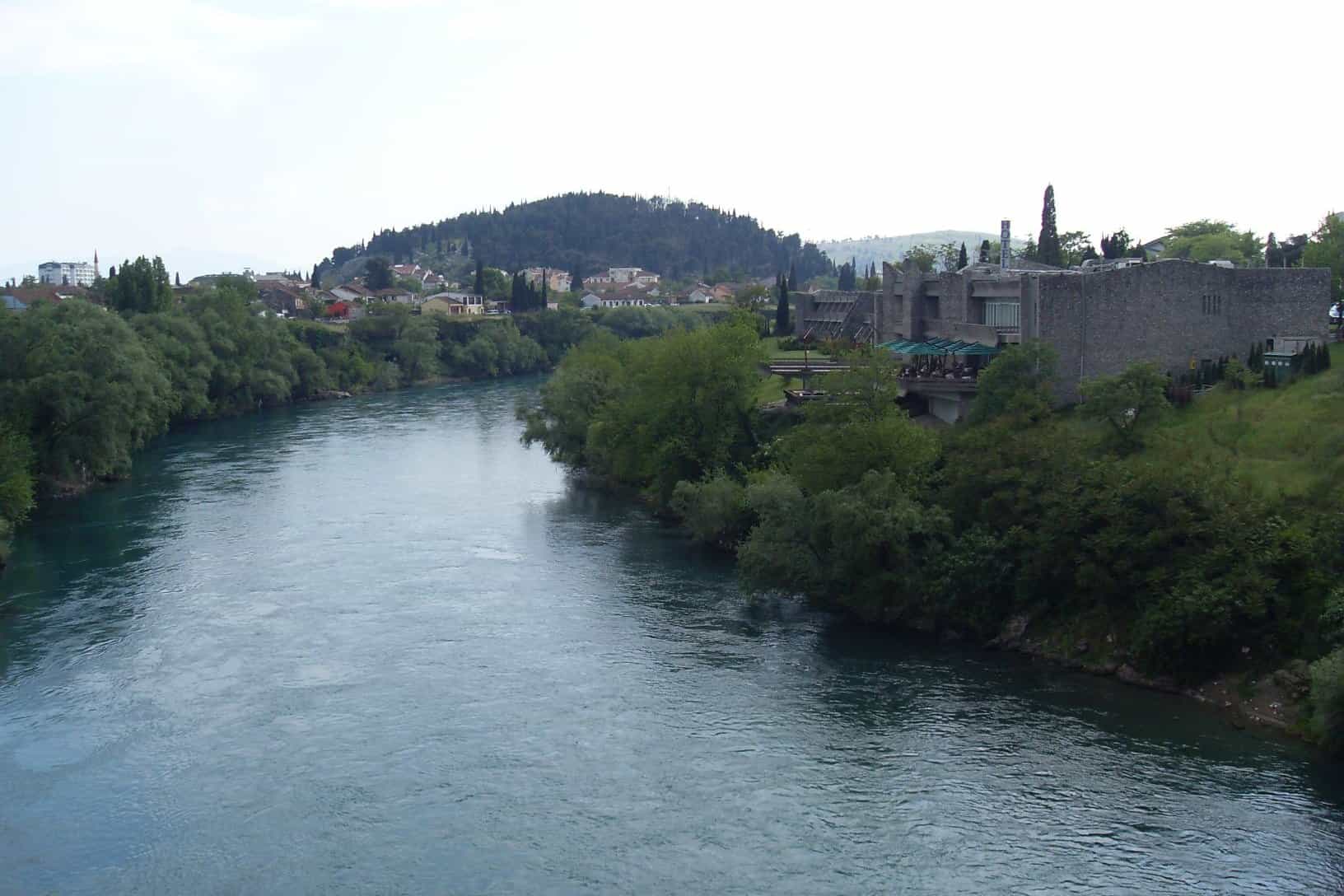
Ljubović Hill
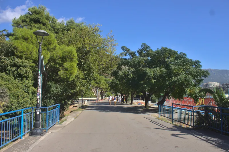
Pine-covered limestone hill of about 101 m on the edge of Podgorica's centre, with walking and cycling paths on a road closed to motor vehicles
Podgorica · Wood
Photo: Wusel007 · CC BY-SA 3.0
Ljubović Hill (Brdo Ljubović) is a pine-covered limestone hill of about 101 m on the southern edge of central Podgorica, between Zabjelo and Stara Varoš. The road over it is closed to motor vehicles, so its walking and cycling paths are free of traffic. The middle of the park-forest is 1.9 km on foot from the city centre, about 23 minutes.
Where is Ljubović Hill?
Ljubović Hill rises at the edge of the city centre and stretches from north-west to south-east. The Zabjelo neighbourhood surrounds it on the west, south and east, and the old quarter of Stara Varoš lies to the north. It is also called Park šuma Ljubović, the Ljubović park-forest.
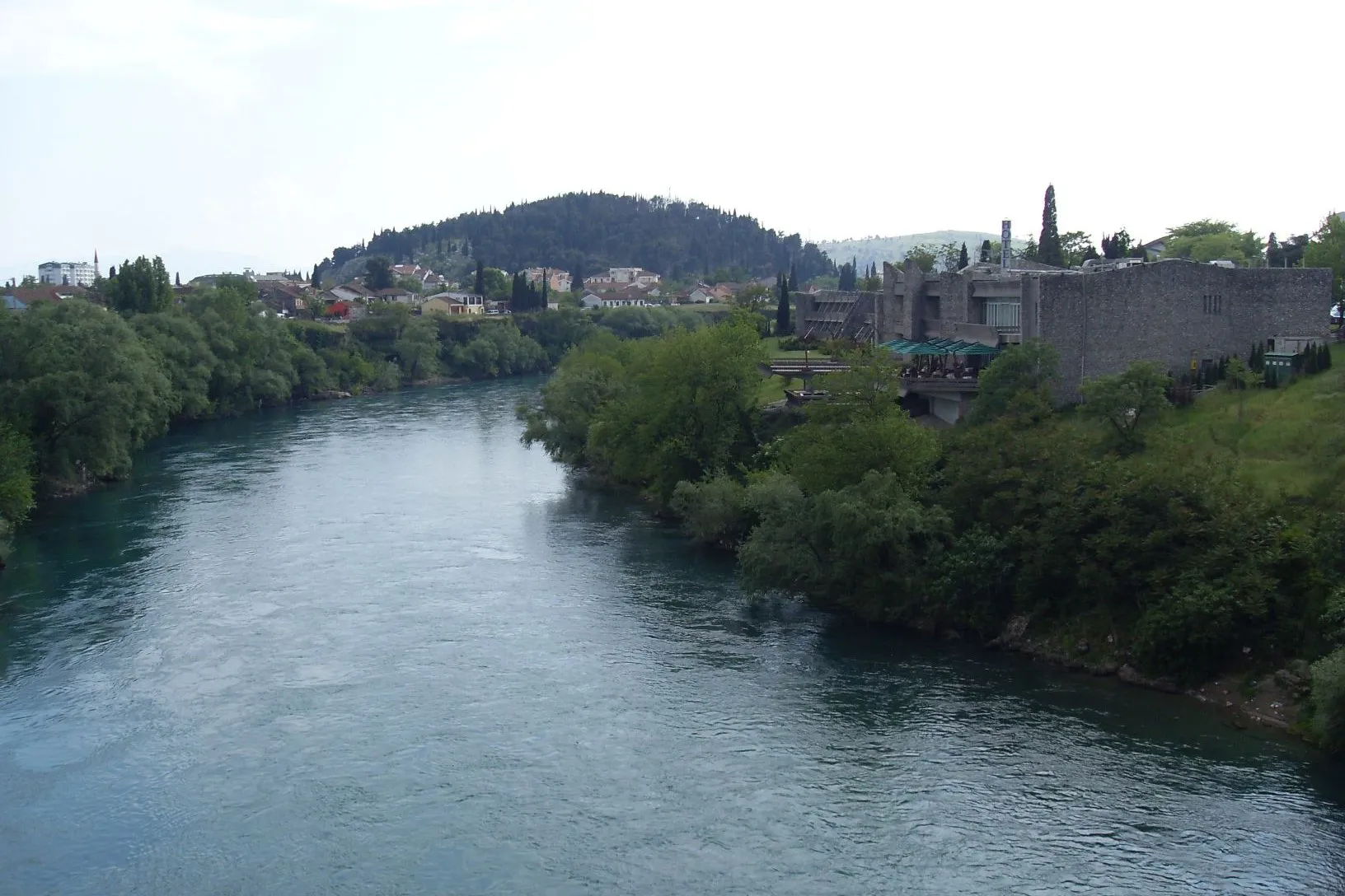
Paths on the hill
The hill is a limestone crest covered in pine, with wild grasses and medicinal herbs between the trees. Blocks of bare limestone show on its eastern and northern slopes, and there is a small cave on the north side. Like Gorica, the hill was reforested in the 20th century. Walking and cycling paths cross it, and a modern road links the main points used for walking, sport and recreation; motor vehicles are not allowed on it. Along the way there are benches and tended green areas, an outdoor gym, a basketball court and table tennis tables.
- 101 m height above sea level
- 1.9 km on foot from the centre
- 23 min walk from the centre
How do you get to Ljubović Hill?
Ljubović Hill is reached on foot from the centre of Podgorica: 1.9 km to the middle of the park-forest, about 23 minutes. The hill can be walked in any season.
Good to know: The road over Ljubović Hill is closed to motor vehicles, so plan to arrive on foot or by bike. Where the paths start and where the nearest parking is are best checked with the Podgorica tourist office before you go.
Nearby
- Clock tower (Sahat kula) in Stara Varoš, 1.1 km on foot, about 14 minutes.
- Old bridge on the Ribnica at Sastavci, where the Ribnica meets the Morača, 1.5 km on foot, about 18 minutes.
- Dajbabska gora, a viewpoint hill to the south-west, 3.7 km by road, about 13 minutes.
- Dajbabe Monastery, 6.3 km by road, about 15 minutes.
- Gorica hill, the city's other park-forest hill, and the parks of Podgorica in the centre.
Questions
How high is Ljubović Hill in Podgorica?
Ljubović Hill is about 101 m above sea level, a limestone crest covered in pine on the southern edge of Podgorica's centre.
Can you drive up Ljubović Hill?
No, the road over Ljubović Hill is closed to motor vehicles; walkers and cyclists use the hill's paths.
How far is Ljubović Hill from the centre of Podgorica?
Ljubović Hill is 1.9 km on foot from the centre of Podgorica, about 23 minutes' walk to the middle of the park-forest.
Closest places



More parks and promenades
Nearest by road first

Sources
Podgorica Tourist Organisation, Brdo Ljubović (about 101 m, limestone, pine, wild grasses and medicinal herbs; Zabjelo on the west, south and east, Stara Varoš to the north; walking and cycling paths; road closed to motor vehicles; park furniture and green areas; attractive all year) · Podgorica Tourist Organisation, Ljubović Hill (English page: 101 m; stretches from north-west to south-east; limestone blocks visible on the eastern and northern sides; small cave on the northern side; reforested in the 20th century along with Gorica; walking and cycling trails, furniture, green areas; road not accessible to motor vehicles; attractive all year) · OpenStreetMap way 28139637 "Park šuma Ljubović", ODbL · OSRM routing (OpenStreetMap data, ODbL) · OpenStreetMap node/13227674346 (leisure=fitness_station inside way/28139637), ODbL, read 2026-11-14 · OpenStreetMap way/207343032 (leisure=pitch sport=basketball inside way/28139637), ODbL, read 2026-11-14 · OpenStreetMap node/13227674344, node/13227674359 (leisure=pitch sport=table_tennis inside way/28139637), ODbL, read 2026-11-14 · OpenStreetMap node/13227674343, node/13227674345, node/13227674347, node/13227674348, node/13227674349 (amenity=bench inside way/28139637), ODbL, read 2026-11-14