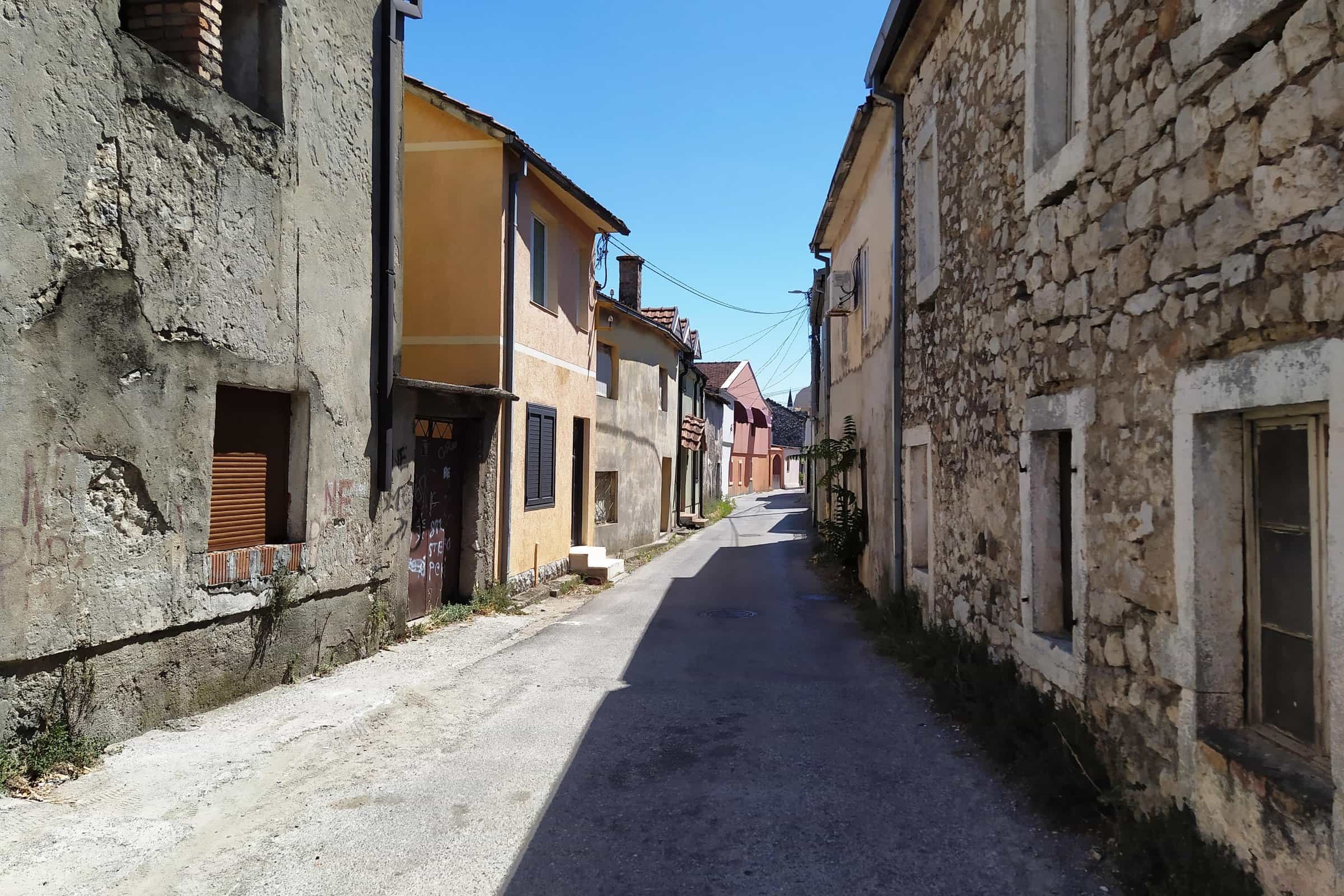
Stara Varoš, Podgorica's old town
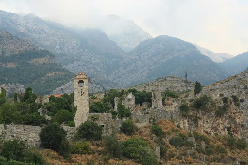
The Ottoman-era quarter on the Ribnica, core of Podgorica from 1474 to 1879, with the Clock Tower, two working mosques and the Čubranović house of 1630
Ottoman-era old town · Left bank of the Ribnica above its mouth in the Morača
Photo: Radosław Botev · CC BY 3.0 PL
Stara Varoš is the old town of Podgorica: the Ottoman-era quarter on the left bank of the Ribnica, just above its mouth in the Morača. It was the core of the town under Ottoman rule, from 1474 to 1879, and is still a lived-in quarter, with the Clock Tower, two working mosques, the türbe of Hadži Mehmed-paša Osmanagić, the Čubranović house of 1630 and the Risto Stijović Gallery along its cobbled lanes. It is an open quarter with no hours and no ticket, 815 m on foot from the city centre, about 10 minutes.
- What Podgorica's Ottoman quarter: cobbled lanes, two mosques, the Clock Tower, old houses
- Period Core of the town under Ottoman rule 1474-1879; oldest surviving house 1630
- Mosques Starodoganjska (late 15th century) and Osmanagić (late 18th century)
- Visiting Open quarter, no ticket; the mosques are working places of worship
- Where Left bank of the Ribnica, 815 m (10 minutes) on foot from the centre
The quarter
The Ottomans took the area in 1457, and in 1474-1478 Sultan Mehmed II built a fortress and a mosque where the Ribnica meets the Morača. In 1485 the land register of Shkodra counted Podgorica as a town of 40 Christian households, about 200 people. The quarter that grew here was the whole of Podgorica for four centuries, and it keeps the oriental character of the old town: the street pattern, the building forms, the customs and the way of life. The Treaty of Berlin gave Podgorica to Montenegro in 1878, and the town changed hands in January 1879; the first municipal government then sat in the Čubranović house.
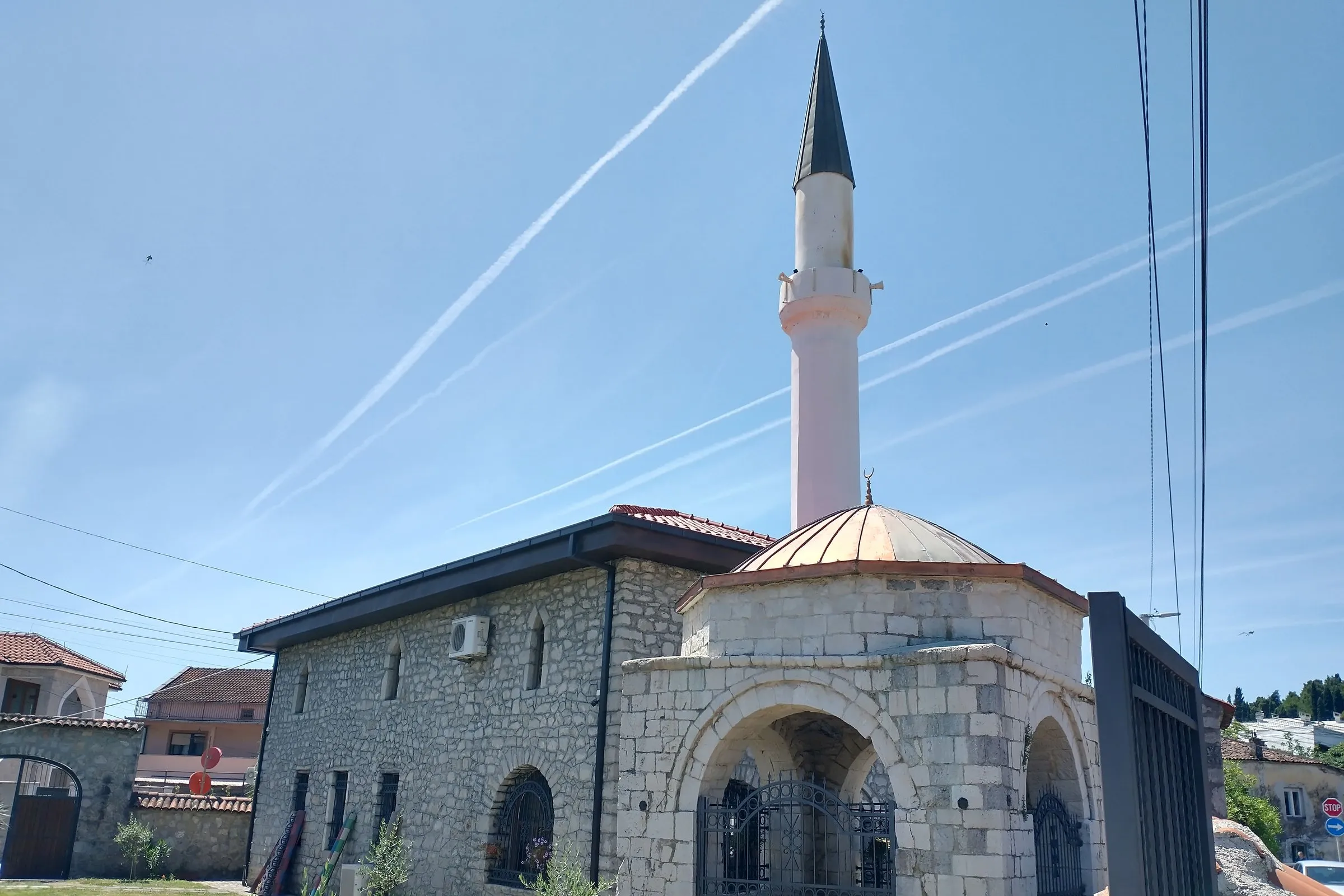
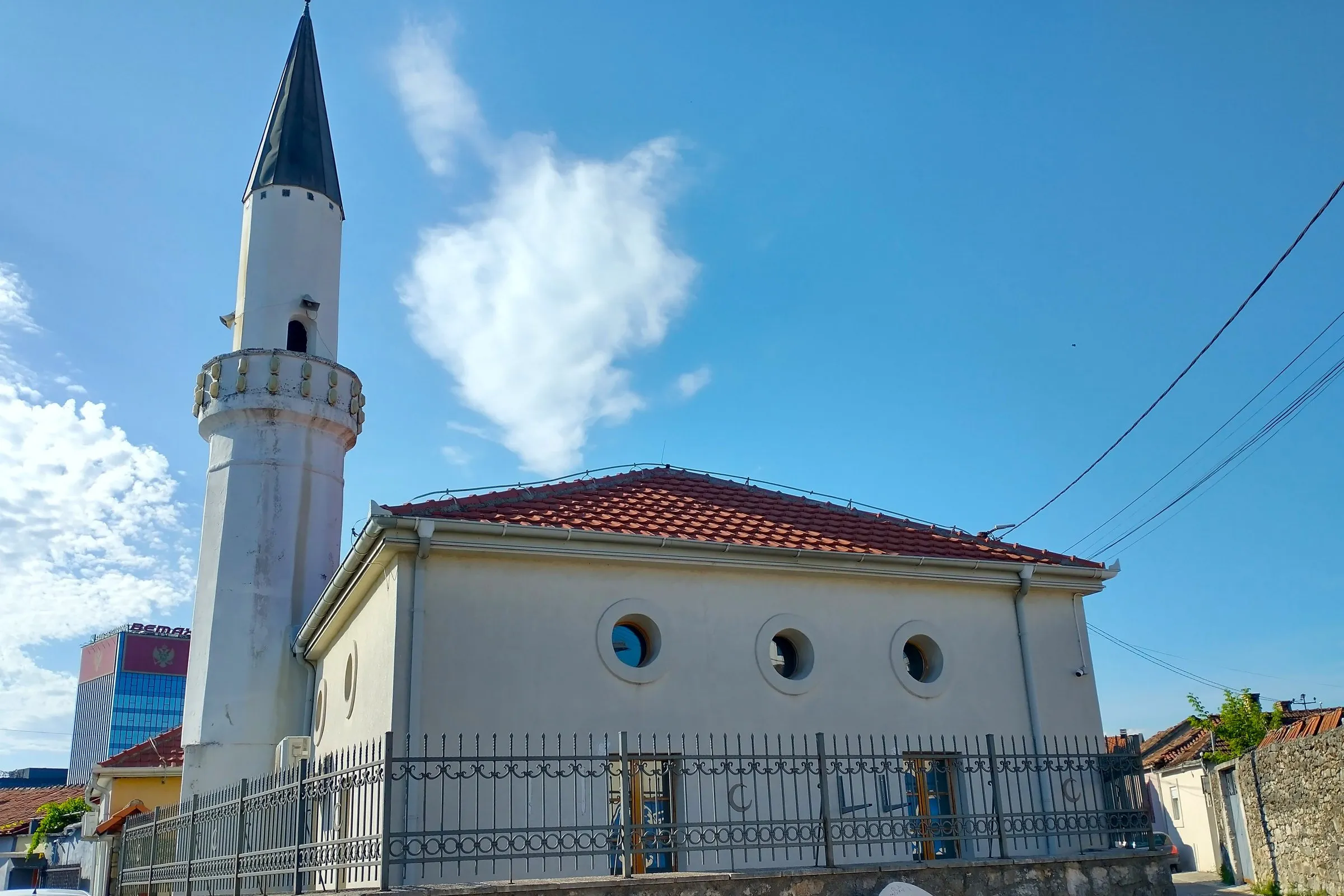
After 1945 a new town, Nova Varoš, grew to the north, and administrative and cultural life moved there. The quarter had already lost much in the Second World War: the Allied bombing of 1943 destroyed the Grand Vizier's bridge and four historic mosques and badly damaged two more. What survives today is a number of old houses, the ruins of the mosque of Mehmed II, two mosques, the Clock Tower and the hexagonal türbe of Hadži Mehmed-paša Osmanagić.
What to see
The quarter is for walking: the cobbled kaldrma gives the feel of the period, the cafés and restaurants serve traditional food, and shops sell souvenirs with Podgorica and Stara Varoš motifs.
The Clock Tower (Sahat kula) on Bećir-beg Osmanagić Square is the symbol of the quarter, built in the 18th century by Hadži Mehmed-paša Osmanagić. Its own page has the details.
The Čubranović house, near the Clock Tower, is dated 1630 and is probably the oldest surviving house of the old Varoš; it is a protected monument. After the liberation in January 1879 it housed the first local government, led first by vojvoda Ilija Plamenac and then by vojvoda Marko Miljanov. It is a house to see from the outside.
The Risto Stijović Gallery in Braće Zlatičanin street is the memorial gallery of the sculptor, built where his birth house stood, 110 m (about 2 minutes) from the Clock Tower. Below the quarter, at the mouth of the Ribnica, stands the old Ribnica bridge, 561 m (7 minutes) on foot.
Osmanagić Mosque
The Osmanagić Mosque (Osmanagića džamija), in the Petra Prlje street area, was built at the end of the 18th century by Hadži Mehmed-paša Osmanagić, the man who also built the Clock Tower. He is buried in the hexagonal türbe in the mosque courtyard. The mosque was badly damaged by bombing in the Second World War and stood in ruins until 1997, when it was thoroughly renovated; the works ran into 1998. It is a working mosque, 274 m (3 minutes) on foot from the Clock Tower.
Starodoganjska Mosque
The Starodoganjska Mosque (Skender Čauševa džamija), at Gojka Radonjića 42, is the older of the two: built at the end of the 15th century and credited in Turkish records to Skender Čauš, who also founded a tekke nearby. Apart from the mosque inside the fortress, it was the only mosque in the town until 1582. When the endowments that kept it ran dry, the town's merchants looked after it, which gave it the name Starodoganjska. It took only light damage in the 1943 bombing and was restored in 1979. It stands 259 m (3 minutes) from the Clock Tower.
Visiting
Stara Varoš is an open city quarter: walk in at any time, there is no ticket. Both mosques are working places of worship. Their visiting hours and rules for visitors are not published, so check locally before going in and dress as you would in any place of worship.
Getting there
From the centre of Podgorica the Clock Tower, the heart of the quarter, is 815 m on foot (about 10 minutes) or 1.5 km by car (about 3 minutes). On foot from the Clock Tower it is 724 m (9 minutes) to the City Museum and the Modern Gallery at Marka Miljanova 4, and 1.3 km (16 minutes) to the Church of St George under Gorica.
Nearby
- Clock Tower, the centre of the quarter.
- Risto Stijović Gallery, 110 m, about 2 minutes on foot.
- Old Ribnica bridge, 561 m, 7 minutes.
- City Museum and Modern Gallery, 724 m, 9 minutes.
- Church of St George under Gorica, 1.3 km, 16 minutes.
- Other old towns of Montenegro.
Questions
What is Stara Varoš in Podgorica?
Stara Varoš is the Ottoman-era old town of Podgorica on the left bank of the Ribnica, with the Clock Tower, the Osmanagić and Starodoganjska mosques, the Čubranović house of 1630 and the Risto Stijović Gallery.
How old are the mosques in Stara Varoš?
The Starodoganjska Mosque in Stara Varoš dates from the end of the 15th century and the Osmanagić Mosque from the end of the 18th century; both are working mosques.
Is Stara Varoš free to visit?
Stara Varoš is an open city quarter with no ticket and no hours; the mosques are working places of worship without published visiting hours, so check locally.
History
1474-1485
Fortress and first mosque
After the Ottoman conquest of the area in 1457, Sultan Mehmed II builds a fortress and a mosque where the Ribnica meets the Morača; in 1485 the Shkodra register counts 40 Christian households.
Late 15th century
Starodoganjska Mosque
The Starodoganjska (Skender Čauš) Mosque is built; apart from the fortress mosque it is the town's only mosque until 1582.
1630
Čubranović house
The Čubranović house, probably the oldest surviving house of the old Varoš, is built.
18th century
Clock Tower and Osmanagić Mosque
Hadži Mehmed-paša Osmanagić builds the Clock Tower and, at the end of the century, the Osmanagić Mosque with his türbe in its courtyard.
1878-1879
End of Ottoman rule
The Treaty of Berlin (1878) gives Podgorica to Montenegro; in January 1879 the first municipal government sits in the Čubranović house.
1943-1998
Bombing and restoration
Allied bombing destroys the Grand Vizier's bridge and four historic mosques and badly damages two more; the Osmanagić Mosque stays in ruins until its renovation in 1997-1998, the Starodoganjska is restored in 1979.


More old towns
Nearest by road first


Sources
Tourist Organisation Podgorica, Stara Varoš i Sahat kula (Ottoman core 1474-1879, oriental character, kaldrma, food and souvenirs, Clock Tower 18th century) · Tourist Organisation Podgorica, Osmanagić Mosque (late 18th century, builder of the Clock Tower, türbe in the courtyard, ruins until the 1997 renovation) · Tourist Organisation Podgorica, Skender Čauševa (Starodoganjska) Mosque (late 15th century, only mosque outside the fortress until 1582, merchants and the name, light damage in 1943) · Tourist Organisation Podgorica, Kuća Čubranovića (1630, oldest surviving house, protected, seat of the first local government in January 1879 under Ilija Plamenac and Marko Miljanov) · JU Muzeji i galerije Podgorice, Galerija Risto Stijović (memorial gallery on the site of the birth house, Braće Zlatičanin street) · Machiel Kiel, Podgorica, TDV İslâm Ansiklopedisi (conquest 1457, fortress and mosque 1474-1478, 1485 register, Treaty of Berlin 1878, 1943 bombing, Nova Varoš after 1945, what survives, türbe, Osmanagić Mosque restored 1997-1998, Starodoganjska restored 1979) · Portal Analitika, 9 May 2017, Nepokretna baština Crne Gore: Podgorica (register summary: Stara Varoš, Čubranović house 1630, Starodoganjska second half of the 15th century, the 16th-century date for the Osmanagić Mosque) · OpenStreetMap ways 224779824 (Clock Tower), 207343026 (Osmanagić Mosque), 211671844 (Starodoganjska Mosque), ODbL · OSRM routing (OpenStreetMap data, ODbL)