Kolašin 1600 piste map
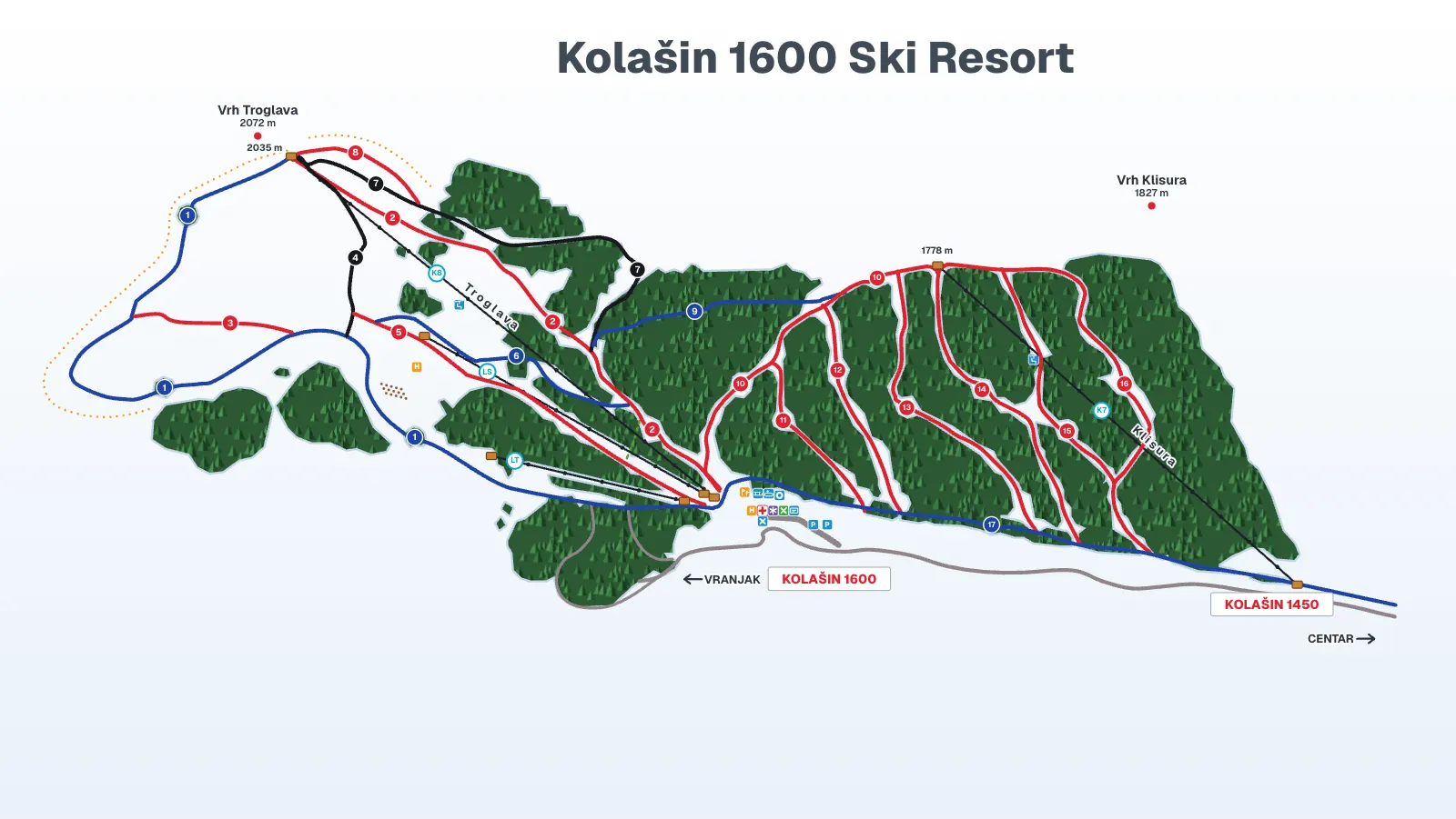
An interactive piste map of Kolašin 1600 on Bjelasica, 12 km above Kolašin: the K8 Troglava chairlift to 2,035 m, the K7 link and 17 runs by number and level, redrawn after the operator's map, which numbers the runs but gives them no names. It does not show what is open today; for that, see snow today and the Kolašin tourist information centre.
Snow forecast
Snow and skiing today| Day | Base 1,600 m | Top 2,035 m |
|---|---|---|
| Today 22.11. | 3 / 4 °C19.2 mm · rain | 1 / 2 °C13 mm · sleet |
| Mon 23.11. | -8 / 4 °C23.9 mm · rain | -11 / 2 °C23.6 mm · sleet |
Sources
Model forecast, not a measurement; no snowfall in cm and no snow depth on the pistes.
Weather in Kolašin
How to read the map
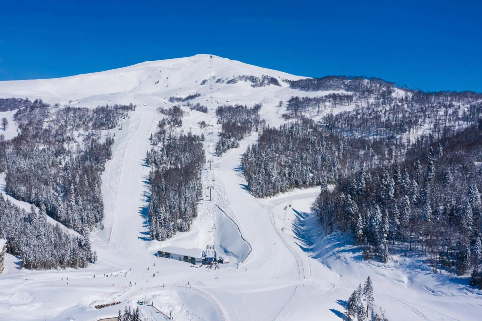
The base of Kolašin 1600 is at about 1,600 m, in the middle of the map below the lifts, with the ski pass office, rental, first aid, mountain rescue, the Troglava restaurant, tubing, the sledding track, the training area and two car parks; a signpost points to Vranjak, and another at the right edge is marked Centar. K8 Troglava, a six-seat chairlift, climbs left from the base to 2,035 m, just below the Troglava peak (2,072 m). Below it run two surface lifts added for 2024/25: the T-bar (LS), 800 m long, and the platter lift (LT), 400 m. On the right K7 Klisura, also a six-seat, rises from beside the Kolašin 1450 base to 1,778 m under the Klisura peak (1,827 m); the 1450 lifts and runs are on the Kolašin 1450 piste map.
The operator's map numbers the runs 1 to 17 and gives them no names, so the map and the table use the numbers. Colours follow the usual scale: blue for easy (1, 6, 9 and 17), red for intermediate (2, 3, 5, 8 and 10 to 16) and black for the steepest (4 and 7). Run 9 is the ski road, drawn as a green dashed line, and the orange dotted line is the ski area boundary. Lift symbols sit on blue tiles, the heliports on orange, mountain rescue on purple and first aid as a red cross on white.
Tap or click a run or lift to see its number and level in the panel. The filter above the map shows only lifts or only one colour, the Legend button lists every symbol, and the full-screen button enlarges the map, where the wheel or two fingers zoom and Esc closes it.
Lifts on the map
| Lift | Top |
|---|---|
| TroglavaChairlift, 6 seats | 2,035 m |
| KlisuraChairlift, 6 seats | 1,778 m |
| T-barSurface liftLength 800 m | |
| Platter liftSurface liftLength 400 m |
Runs on the map
The operator’s map gives these runs numbers, not names.
Getting to the top and back down
Beginners start at the base, where the magic carpet that serves the beginner area and the training area sit among the base symbols; the base station has ski and snowboard rental and a ski school. From the top of K8 Troglava (2,035 m) the blue run 1 is the long easy way down, sweeping around the left of the map back to the base, while run 6 is the blue across the middle of the K8 side. The other runs from the K8 top are red 2 and 8 and black 4 and 7; 3 and 5 branch off lower down.
The ski road (9) links the K8 side to the top of K7 Klisura (1,778 m), from where the reds 10 to 16 descend; 10 ends at the Kolašin 1600 base and the others reach the blue run 17, which runs from the Kolašin 1600 base past the bottom of K7 to Kolašin 1450. K7 opened in February 2022 and serves 9 km of pistes between the two resorts; together they have about 45 km. Each resort sells its own pass, so ask the Kolašin tourist information centre whether K7 is running before you plan a day across both.
Common questions
How many runs does Kolašin 1600 have?
The operator's map of Kolašin 1600 draws 17 runs by number, 4 blue, 11 red and 2 black; the 8 marked pistes on the K8 side alone, 2 blue, 4 red and 2 black, add up to 10.5 km, and the whole area is about 21 km.
Which lift goes to the top of Kolašin 1600?
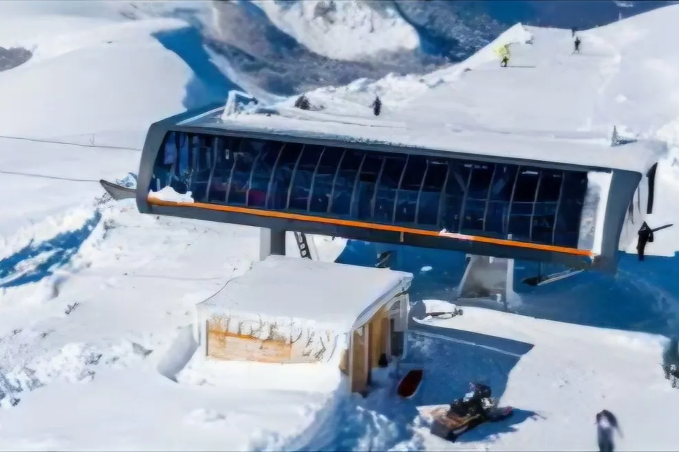
K8 Troglava, a six-seat Doppelmayr chairlift with heated seats, takes you from the Kolašin 1600 base to 2,035 m, just below the Troglava peak (2,072 m).
Are Kolašin 1600 and Kolašin 1450 connected?
Yes, the K7 Klisura chairlift (opened in February 2022, top station 1,778 m) links Kolašin 1600 with Kolašin 1450 and the 9 km of pistes between them, but each resort sells its own pass, so ask the Kolašin tourist information centre whether K7 is running.
Which runs at Kolašin 1600 are blue?
Four runs at Kolašin 1600 are blue: run 1, the long descent from the K8 top around the left of the map, run 6 across the K8 side, run 9, the ski road to the top of K7, and run 17 from the base past the bottom of K7 to Kolašin 1450.
Does the map show which lifts are open?
No, the Kolašin 1600 map is a drawing of the layout; which lifts and runs are open is answered by the Kolašin tourist information centre, and the snow today page shows the snow at the base and the top.
Where is the official Kolašin 1600 piste map?
The official Kolašin 1600 piste map is published by the operator, Skijališta Crne Gore, on skijalista.me; the interactive map on this page is redrawn after it, with the same run numbers and the lifts named.
Related
Sources
- Skijališta Crne Gore, Kolašin 1600
- Skijališta Crne Gore, piste map
- Skijališta Crne Gore, homepage
- National Tourism Organisation of Montenegro, Skiing
- Government of Montenegro, K7 commissioning (14 Feb 2022)
- Ministry of Tourism, answer to an MP question on state ski areas (2026)
- Skijališta Crne Gore: Kolašin 1600 (operator page, Wayback copy of 15 Jul 2026)
- Skijališta Crne Gore: piste map MAPA-KL1600.jpg (Wayback copy of 15 Jul 2026)
