Ćurevac
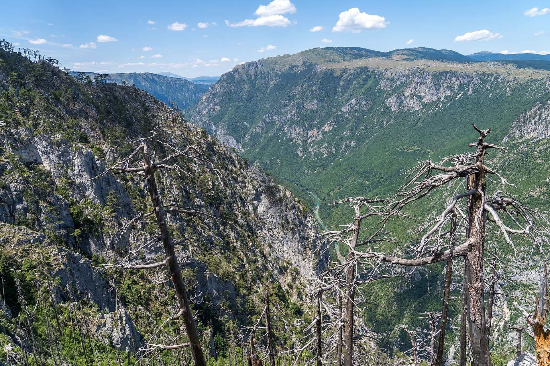
The Durmitor viewpoint above the Tara canyon, 1,625 m, reached on foot from Žabljak.
1,625 m
Photo: Alexkom000 · CC BY 4.0
Ćurevac, 1,625 m, is the viewpoint over the Tara canyon that every official source names: Durmitor National Park lists it, the national tourism organisation names it for trekking tours, and the Žabljak tourist office publishes the trail. The marked loop from Žabljak is 17.74 km with 340 m of climb, graded medium.

What you see
The trail looks straight down into the canyon and onto the village of Tepca on the slope below. The viewpoint's height is 1,625 m.

How to get there
- On foot: the Žabljak tourist office's loop, 17.74 km, +340 m, between 1,411 and 1,642 m, graded medium. The NTO says Ćurevac tours need good fitness and recommends going in a group.
- By car: on the Durmitor Ring, 4 km from the centre of Žabljak, a road turns right to the Ćurevac viewpoint; the Žabljak tourist office recommends this short detour at the start of the Ring. Parking at the end of the road is not described.
- GPS: 43.20155, 19.09298, an OpenStreetMap viewpoint node named "Ćurevac"; no official point exists, so the marker is approximate.
- Park fee: €5 per person per day for Durmitor National Park.
The Durmitor Ring is a 76 km loop from Žabljak, signposted both ways with brown "Panoramic Roads" signs numbered 2. The audio guide runs anticlockwise; campers are advised to drive clockwise, and one section is not suited to large campers.
Emergency number 112 covers mountain rescue. The hiking season on the massif runs June to the end of October.
Elevation
The park gives 1,625 m; the tourist office's trail profile tops out at 1,642 m. Both figures are published here.

Other viewpoints over the canyon
Nature Park Piva, on the Plužine side, lists two viewpoints with GPS over the lower canyon:
| Viewpoint | GPS | View | Access |
|---|---|---|---|
| Sokolina, Crkvičko Polje | 43.31713, 18.93735 | Durmitor, Maglić, Volujak, Zelengora; up the canyon from Brštanovica to Štuoc | - |
| Maričina greda, 1,106 m | 43.33453, 18.92542 | The canyon from Brštanovica to Grab | On trail 192c, 1.1 km from Bukova ravan |
Further along the Ring, the road passes the Tara canyon lookout below the Štuoc pass (1,952 m) and reaches Nedajno over the Sušica canyon and the Sedlo pass. From Žabljak, the same massif has the Savin kuk viewpoint over the lakes. Rafting runs the river below.
On these trips
- Žabljak in 3 days: Durmitor, summer and winterSummer · Day 3 · The Tara canyon: Ćurevac, the Đurđevića Tara bridge, the zip line
- 7 days in Montenegro: coast to Durmitor loopDay 6 · Durmitor: Black Lake, the Durmitor Ring and Ćurevac
- 10 days in Montenegro: the full loop by carDay 9 · Durmitor: Black Lake, the Durmitor Ring and Ćurevac
Sources
National Parks of Montenegro: Durmitor, active holidays · TO Žabljak: Ćurevac trail · NTO: Hiking & Trekking · Nature Park Piva: Sokolina viewpoint · Nature Park Piva: Maričina greda viewpoint · National Parks of Montenegro: Durmitor price list · Lonely Planet: Tara Canyon (secondary, road access only) · TO Žabljak: Panoramski putevi (Ministry panoramic-road guide: Durmitor Ring, Kruna Crne Gore) · OpenStreetMap node 4811345194, tourism=viewpoint 'Ćurevac' (ODbL)