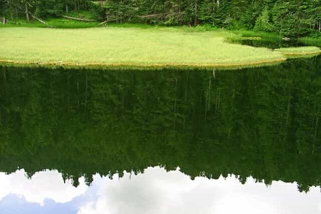
Visitorsko jezero
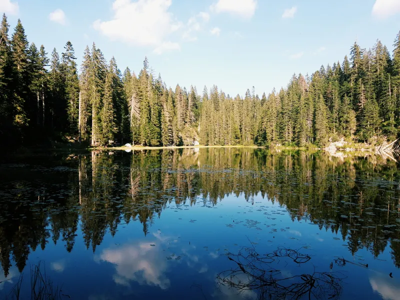
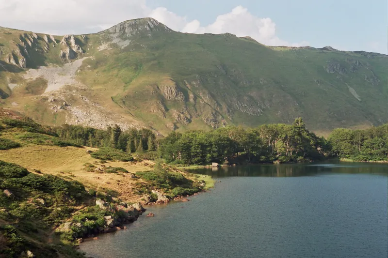
Glacial lake at 1,735 m on the north-east side of Visitor above Plav: 91 x 72 m, up to 4.1 m deep, a grassy island over almost a third of the surface, 16-18 °C in July and August.
Glacial Lake · 1,735 m · Visitor, Plav
Photo: Martin Brož · CC BY 3.0
- Elevation
- 1,735 m
- Max depth
- 4.1 m
Visitorsko jezero is a small glacial lake at 1,735 m on the north-east side of Visitor, the mountain above Plav. It is one of the "mountain eyes" of the Prokletije region: 91 x 72 m, up to 4.1 m deep, ringed by conifer forest, with a grassy island that covers almost a third of its surface. The water reaches 16-18 °C in July and August, warm enough for a swim after the walk. The usual way in is from Murino: a forest road up the Murina valley, then about an hour on foot. Fishing is banned.
Key facts
| Elevation | 1,735 m |
| Size | about 91 x 72 m |
| Surface | 0.005 km² (about 4,200 m²) |
| Depth | 4.1 m at the deepest point; mean 2.3 m |
| Volume | about 9,850 m³ |
| Shoreline | about 270-290 m, moving with the water level |
| Island | grassy, almost a third of the surface |
| Water | 16-18 °C in July and August; frozen in winter |
| Summit | about 2 km from the highest peak of Visitor (2,210 m) |
| Fishing | banned on the lake until 1 April 2027 (national fishing order) |
Getting there
The lake lies in the Murino area of Plav municipality, about 5 km north-west of the town, below the summit of Visitor. Three ways lead to it:
- From Murino: a forest road climbs the Murina valley; from its end the lake is about an hour on foot.
- From Plav through Pepiće: a newer forest road up the Pepićka river valley reaches close to the lake. Cyclists ride it as route PL05: it leaves the Plav roundabout on the Andrijevica road and is mostly poor macadam and dirt. The climb starts after the turn at Pepiće (km 8.2); the ruin of Nizamska kula stands at about km 11, an open shelter at about km 14.5 and the Mramorje katun at km 18.2, then a steep path reaches the lake at about km 18.9. Return the same way. Just before the lake a path forks left to the summit. By road from the centre of Plav it is 19.4 km.
- On foot from Plav or Gusinje: the footpaths and horse trails from Plav and Gusinje are longer and fairly strenuous.
Which vehicles can use the forest roads, and where to leave a car, is not published; ask at the tourist office in Plav before you drive up. Plav itself is 131 km and about 2 h 30 by car from Podgorica.
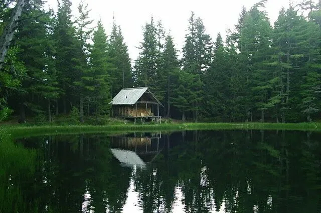
The lake
Visitorsko jezero fills the lowest and smallest cirque on the north-east side of Visitor, about 2 km from the highest peak. The cirque opens towards the Murina river and is closed on the south-west by steep slopes. The lake measures about 91 x 72 m, with a shoreline of about 270-290 m that moves with the water level; the mean depth is 2.3 m, the deepest point 4.1 m, and the basin holds about 9,850 m³ of water. Snow, rain, springs and one small stream that dries in summer feed it. The surface freezes in winter; in July and August the water warms to 16-18 °C. Conifer forest surrounds the shore. All attempts to stock the lake with fish have failed, and the national fishing order bans fishing on Visitorsko jezero until 1 April 2027.
The island
A grassy island covers almost a third of the surface. Local tradition calls it a floating island, a shoal near the middle, which shepherds once used to keep their livestock safe from predators. The story told in Plav goes further: villagers who kept losing stock to wolves felled trees, built a raft big enough to carry the animals and pushed it out onto the water at night, so the herds were out of reach. That is a legend, not a record of how the island formed.
Forest and fungi
The munika pine (Pinus heldreichii) grows in Montenegro only in the Prokletije region, and Visitor is one of its sites. On the road from Mramor towards Ravna livada stands a single munika estimated at more than 650 years old, with a girth of 6.72 m, known as the giant tree (Džinovsko drvo). The lake and its surroundings are the most important fungi area surveyed for Prokletije National Park, with 13 internationally significant species.
Tatarijsko jezero and the summit
A second lake, Tatarijsko jezero on Bješkeća, lies at 1,935 m about two hours on foot from the Mramorje katun: 60 x 48 m, 2.36 m deep at most, clear, and a popular summer swim. The path to the summit of Visitor forks left just before Visitorsko jezero. The Plav tourist organisation leads a guided hike each summer that takes in the giant tree, the highest peak of Visitor and a loop around the lake, ending with a swim: 5 km each way with 361 m of climb, graded easy.
When to go
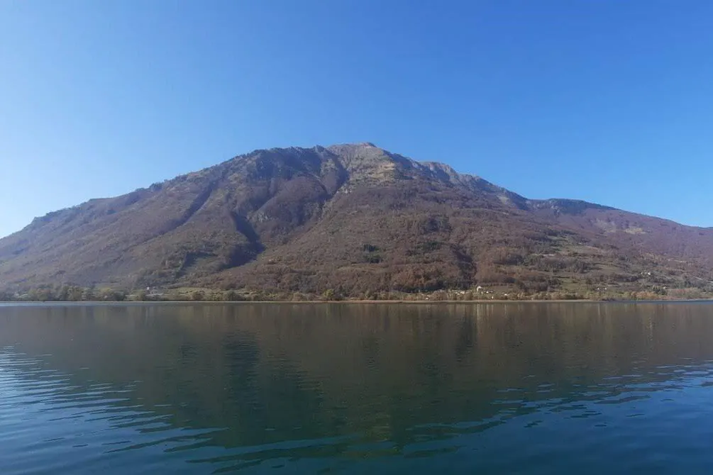
The hiking season on Visitor runs from June to the end of October. For a swim, July and August are the months when the water reaches 16-18 °C. The lake freezes in winter and the stream that feeds it dries in summer, so the shoreline you find depends on the season.
Safety
A mountain lake at 1,735 m: the water is 16-18 °C at its warmest and up to 4.1 m deep, and the forest roads are poor macadam and dirt. The emergency number is 112, which covers mountain rescue.
Nearby
The Visitor page covers the summit, the paragliding take-off at 1,589 m (see paragliding) and the fishing rules. Plav sits on Plav Lake at the foot of the mountain; across the valley, Hridsko jezero (1,970 m) lies inside Prokletije National Park. Gusinje is the next town south, Andrijevica the next north. A three-day plan for the area is in the Plav in 3 days itinerary; other lakes are on the lakes hub.
Questions
How do you get to Visitorsko jezero?
From Murino a forest road leads up the Murina valley, then the lake is about an hour on foot; or take the forest road from Plav through Pepiće to the Mramorje katun (19.4 km from the centre, mostly macadam and dirt) and the steep path from there. Ask in Plav which vehicles the roads take.
Can you swim in Visitorsko jezero?
Yes, Visitorsko jezero is swimmable in July and August, when the water reaches 16-18 °C; the guided hike from Plav ends with a swim in it.
Can you fish in Visitorsko jezero?
No, fishing on Visitorsko jezero is banned until 1 April 2027 under the national fishing order; attempts to stock the lake with fish have all failed.
How big and how deep is the lake?
Visitorsko jezero is about 91 x 72 m, 4.1 m deep at the deepest point and 2.3 m on average, with about 9,850 m³ of water.
Is the island floating?
A grassy island covers almost a third of Visitorsko jezero; the floating island and the shepherds' raft belong to local tradition, not to any measurement.
Activities
- Hiking
- Swimming
Things to do
The walk to the lake
Forest road up the Murina valley from Murino, then about an hour on foot; or 19.4 km of mostly macadam from Plav through Pepiće to the Mramorje katun and a steep path.
A summer swim
Water of 16-18 °C in July and August; the guided hike from Plav ends with a swim.
Guided hike from Plav
Each summer the Plav tourist organisation leads a hike to the giant munika tree, the summit of Visitor and around the lake: 5 km each way, 361 m of climb, graded easy.
Tatarijsko jezero
A second lake at 1,935 m, about two hours on foot from the Mramorje katun: 60 x 48 m, clear, popular for a summer swim.


More lakes
Nearest by road first


Sources
Water Administration, Register of waters of importance for Montenegro (Registar voda od značaja za Crnu Goru), July 2024, entry Visitorsko jezero, p. 68 · Tourist Organisation Plav, Visitorsko jezero (Visitor 2,211 m) · Tourist Organisation Plav, Visitorsko jezero · Tourist Organisation Plav, Džinovsko drvo (giant tree) · Tourist Organisation Plav, Tatarijsko jezero · Tourist Organisation Plav, guided hike Visitor 2026 (route and figures) · Tourist Organisation Plav, guided hike Visitor and Visitorsko jezero 2025 · Accursed Mountains, route PL05 Visitor Lake (bike route, GPX) · JPNPCG, Management Plan NP Prokletije 2026-2030 (PDF) · MONSTAT, Statistical Yearbook 2025, peaks table · National Tourism Organisation, Hiking and trekking · National Tourism Organisation, Paragliding · Ministarstvo poljoprivrede, šumarstva i vodoprivrede, Naredba o ribolovnim zabranima, lovostaju i minimalnim veličinama riba (Sl. list CG 75/2026) · EKIP, 112 emergency number press release, Feb 2023 · OpenStreetMap relation 3944523 Visitorsko jezero, ODbL · OpenStreetMap node 3578691217 Bandera (Krivi smet), Visitor summit, ODbL · OpenStreetMap way 524409101 Žižina koliba, Katun Mramorje, ODbL · Routes computed with OSRM on OpenStreetMap data (ODbL)