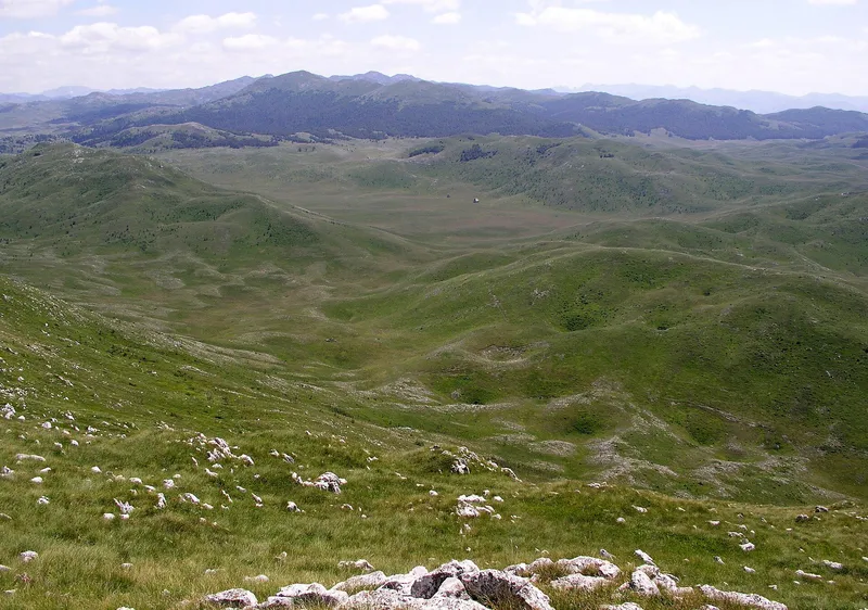
The Prošćenske planine, the Prošćenje mountains, are a karst upland at about 1,600 m north of the Tara valley, in the north-west of Mojkovac municipality, where the terrain opens an easy way across towards Pljevlja and Bijelo Polje. The highest point is Ljeljeni vrh, 1,856 m, above the start of the Tara canyon, and the ground is a sequence of dolines, dry valleys and spruce forest rather than a single ridge. A mountain hut of the same name, built by the Mojkovac club, stands at 1,423 m with 30 beds. Plan a walk here with the hut and the club.
Key facts
| Highest peak | Ljeljeni vrh, 1,856 m, above the start of the Tara canyon |
| Upland height | about 1,600 m |
| Municipality | Mojkovac, north-west |
| Hut | Prošćenske planine, 1,423 m, 30 beds, water, WC, kitchen |
| Largest valley | Burenski Do, 3.5 km by 1.5 km |
| Protection | peaks in the protective zone of Durmitor National Park |
| Emergency | 112, which covers mountain rescue |
Peaks
- Ljeljeni vrh, 1,856 m, the highest, where the Tara canyon begins
- Zabrćka glava, 1,752 m
- Ledenice, 1,689 m
- Baltića šiljak, 1,673 m
- Goveđa glava, 1,656 m
- Buren, 1,631 m, a limestone ridge east of Burenski Do
- Sveviđe, 1,556 m
Apart from Ljeljeni vrh, none of them reaches 1,800 m, so the mountains stay well below Sinjajevina and Bjelasica on either side of the Tara.
Valleys and dolines
The relief is karst, and the names on the map are valleys rather than summits. South of Ljeljeni vrh, Veliki Do ends in a steep limestone edge that drops into the Tara canyon. West of the peak the slope eases down to Stupsko polje, a broad plateau. North of it lies Crvena Lokva, a limestone valley running from south-east to north-west and pitted with sinkholes: a stream once flowed here when the Tara ran at a much higher level, then sank underground; a saddle at 1,440 m bounds its lower end, 760 m above the canyon. North-east of Ljeljeni vrh, Petrovića Omar is a valley and ridge under dense spruce and fir, with two smaller valleys, Jokića Krlje and Meki Do, beyond it. Burenski Do, 3.5 km long and 1.5 km wide and running from north-east to south-west, is the largest valley of the area, with the Buren ridge on its east side.
The hut
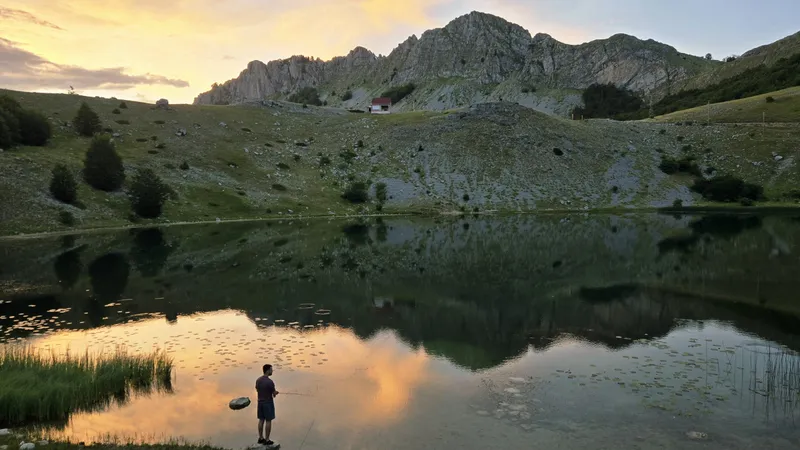
Members of the mountaineering and sports club Prošćenske planine from Mojkovac built the hut over three years, stone by stone, as a rest place and refuge for hikers. It stands at 1,423 m with 30 beds, water, a toilet and a kitchen, east of Ljeljeni vrh and north of Prošćenje village. Ask the club in Mojkovac about opening and keys before you count on a bed.
Protection
Sveviđe, Ljeljeni vrh and Konjska lastva are listed among the geomorphological values of the protective zone of Durmitor National Park, which lies across the Tara.
Prošćenje village
Prošćenje is also a village on the right bank of the Tara, one of the Mojkovac villages at the foot of Bjelasica, Sinjajevina and these mountains. The registered rural household Prošćenske žari there offers hiking, cycling and horse riding, with views of the Tara canyon, Sinjajevina, Bjelasica, Ljubišnja and Komovi, and is the base in the village.
Getting there
Mojkovac is the town for the range. The hut lies east of Ljeljeni vrh and north of Prošćenje village, which is on the right bank of the Tara. The easy way across towards Pljevlja and Bijelo Polje runs over this upland.
Nearby
Sinjajevina lies across the Tara to the south-west and Bjelasica to the east; both have marked trails. The Tara canyon begins below Ljeljeni vrh, and Durmitor National Park is on its far side. Other ranges are on the hiking page.

Questions
How high are the Prošćenje mountains?
Ljeljeni vrh, 1,856 m, is the highest point; the upland lies at about 1,600 m.
Is there a hut?
Yes, the Prošćenske planine hut at 1,423 m with 30 beds, water, a toilet and a kitchen, built by the Mojkovac club of the same name.
Where does the Tara canyon start?
Below Ljeljeni vrh: the Veliki Do valley on its south side ends in a limestone edge that drops into the canyon.
Draft, not yet checked · How we check facts
Sources
TO Mojkovac: Prirodne atrakcije · TO Mojkovac: Zaštićena područja · TO Mojkovac: Mojkovačka sela · TO Mojkovac: Život u katunu · PSCG (Mountaineering Association of Montenegro): mountain huts · Montenegro Village Explorer: Seosko domaćinstvo Prošćenske žari · MONSTAT, Statistical Yearbook 2025, table 1-8 Mountain peaks over 1800 m · OpenStreetMap node 26863273 "Ljeljeni vrh" and way 1433897304 "Planinarski dom Prošćenske planine", ODbL · EKIP, 112 emergency number press release, Feb 2023