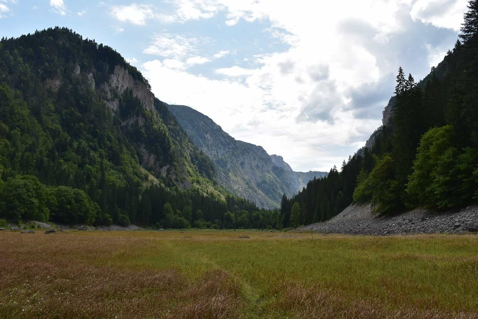
Sušica (Durmitor)
A Durmitor river that starts in a lake which dries up in summer and ends in the Tara, through a canyon 15 km long and up to 700 m deep that once carried a timber railway.
Northern Montenegro, Durmitor · Canyon river from a seasonal lake
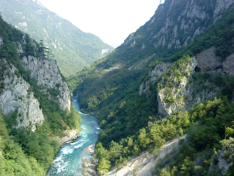
Photo: Daniel.fox123 · CC BY 4.0
- Canyon depth
- 700 m
- Canyon length
- 15 km
The Sušica is the river of the Sušica canyon on the west side of the Durmitor massif. It leaves Sušica lake (Sušičko jezero), a seasonal lake at 1,140 m, and drops through a canyon 15 km long and up to 700 m deep to the Tara, which it reaches at about 515 m, the lowest point of Durmitor National Park. Two villages face each other across the gorge, Mala Crna Gora on the Žabljak side and Nedajno in Plužine, 16 km apart by road; the Durmitor Ring links them and gives the easiest look into the canyon. It is not the Sušica near Nikšić, a tributary of the Zeta.
The lake
Sušica lake lies on the boundary of Mala Crna Gora and Nedajno, and so inside both Durmitor National Park and Nature Park Piva. The Skakala stream feeds it, and the lake dries up when the stream stops running, so in late summer there may be no lake at all. When full it covers about 0.08 km² and is 4 to 5 m deep at most. The park's Sušica hut stands beside it, open from the end of June to the end of September at €10 per person per day, and Sušica is one of the park's designated camping places; camping anywhere else in the park is prohibited. The lake and the valley below it, down to the Tara canyon, form with the Škrka lakes a strict nature reserve of about 2,360 ha.

The canyon
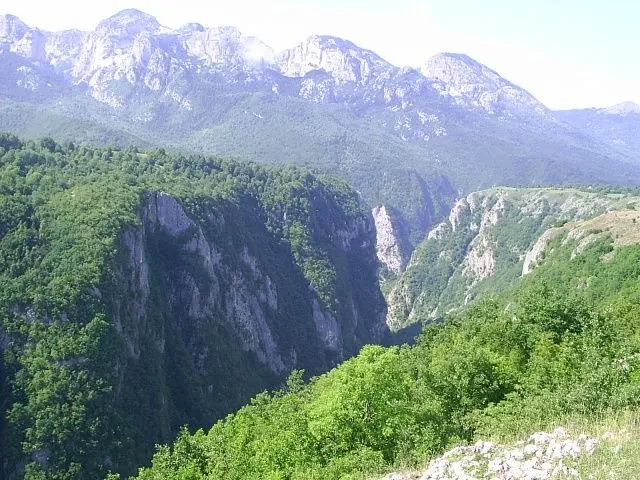
The canyon takes its name from the river: 15 km long and up to 700 m deep, with Nedajno and Mala Crna Gora on plateaus on opposite rims. The park counts it with the Tara, the Draga and the upper Komarnica among its four canyons, and the view into it from Nedajno, at 1,480 m, is one of the three viewpoints the park recommends: the canyon, Mala Crna Gora across the gorge and the summer pastures around it, with the distant point where the Sušica canyon meets the Tara canyon.

The timber railway
From 1919 to 1939 rails ran through the canyon. Timber was carried down them to the Tara and rafted on towards the Danube. The rails are gone, and of the 11 mills that stood in the canyon almost all have disappeared.

Getting there
The canyon lies on the Durmitor Ring, the panoramic loop from Žabljak through Mala Crna Gora, Nedajno, Trsa and Pišče. Past the turn for Mala Crna Gora the Ring heads downhill towards the canyon and the asphalt narrows to 2.5 m. About 2 km on, a gravel road branches right into the canyon; a walk of about 100 m to the right of that junction leads to a spot among the pines with a view into the gorge, where the cliff edge is unguarded. The gravel road itself drops to the river and climbs the opposite wall to Nedajno, and it is loose and prone to landslides. Nedajno is also reached from the Trsa side, about 5 km from the junction on Milogora, with asphalt to the village centre and a further 900 m of gravel up to the viewpoint. Durmitor National Park charges €5 per person per day, free under 15, sold at its checkpoints, Sušica among them, and online. The mountain and its trails are on the Durmitor and Durmitor hiking pages.
Fishing
The park's fishing rules cover Black Lake and the Tara canyon only, with a daily permit from the duty ranger from May to October; the Sušica is not a fishing water. On the Tara, the right bank from Splavište down to the Sušica mouth is closed to fishing under the national order of 2026 (Sl. list CG 75/2026, in force 11 June 2026). The fishing page has the rest of the park's rules.
Questions
Why is Sušica lake sometimes missing?
It is seasonal: it dries up when the Skakala stream that feeds it stops running.
How deep is the Sušica canyon?
Up to 700 m, over a length of 15 km.
Where does the Sušica end?
In the Tara, at about 515 m, the lowest point of Durmitor National Park.
Can you drive through the canyon?
A gravel road leaves the Durmitor Ring below Mala Crna Gora, drops into the canyon and climbs the far wall to Nedajno; it is loose and prone to landslides, and the asphalt approach narrows to 2.5 m.
Things to do
Sušica lake
Seasonal lake at 1,140 m at the head of the canyon; it dries when the Skakala stream stops. Park hut and camping place beside it.
Canyon rims
Nedajno (1,480 m) and Mala Crna Gora, on opposite rims, 16 km apart by road; the Durmitor Ring links them.
Protected areas
- Durmitor National Park (Žabljak side)
- Piva Nature Park (Plužine side)
Sources
Tourist Organisation of Žabljak, Rivers and canyons · Water Administration of Montenegro, Registar voda od značaja za Crnu Goru, 2nd ed. (July 2024), entry Sušičko jezero · Water management plans for the Danube and Adriatic basin areas, 2021 (data.gov.me, CC BY) · TO Žabljak, Panoramski putevi (the Ministry's panoramic-road guide: Durmitor Ring, Sušica canyon, Nedajno) · JPNPCG, Durmitor active holidays (viewpoints, huts, camping, fishing) · JPNPCG, Durmitor price list (park ticket, checkpoints, Sušica hut) · JPNPCG, Management Plan NP Durmitor 2026-2030 (PDF): canyons, lowest point, nature reserves · Nature Park Piva, O parku · Ministarstvo poljoprivrede, šumarstva i vodoprivrede, Naredba o ribolovnim zabranima, lovostaju i minimalnim veličinama riba (Sl. list CG 75/2026), Art. 2 · Wikipedia, Sušica Canyon (secondary, pointer only)