Moračke planine
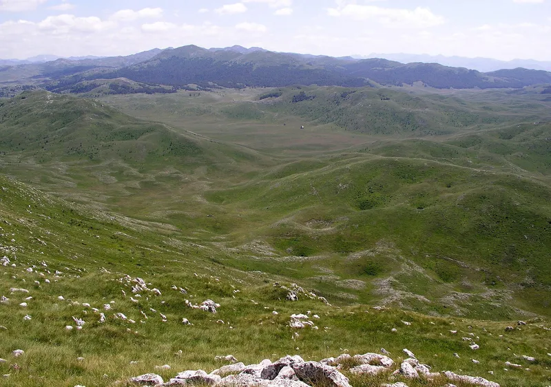
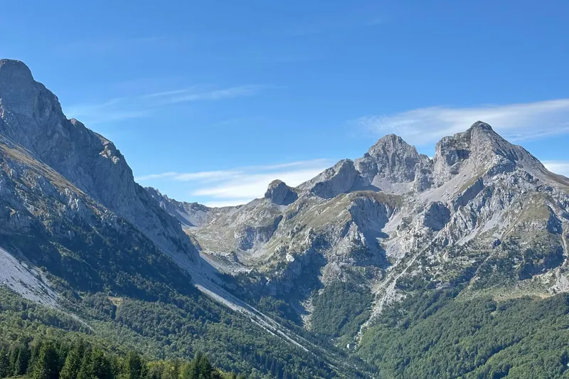
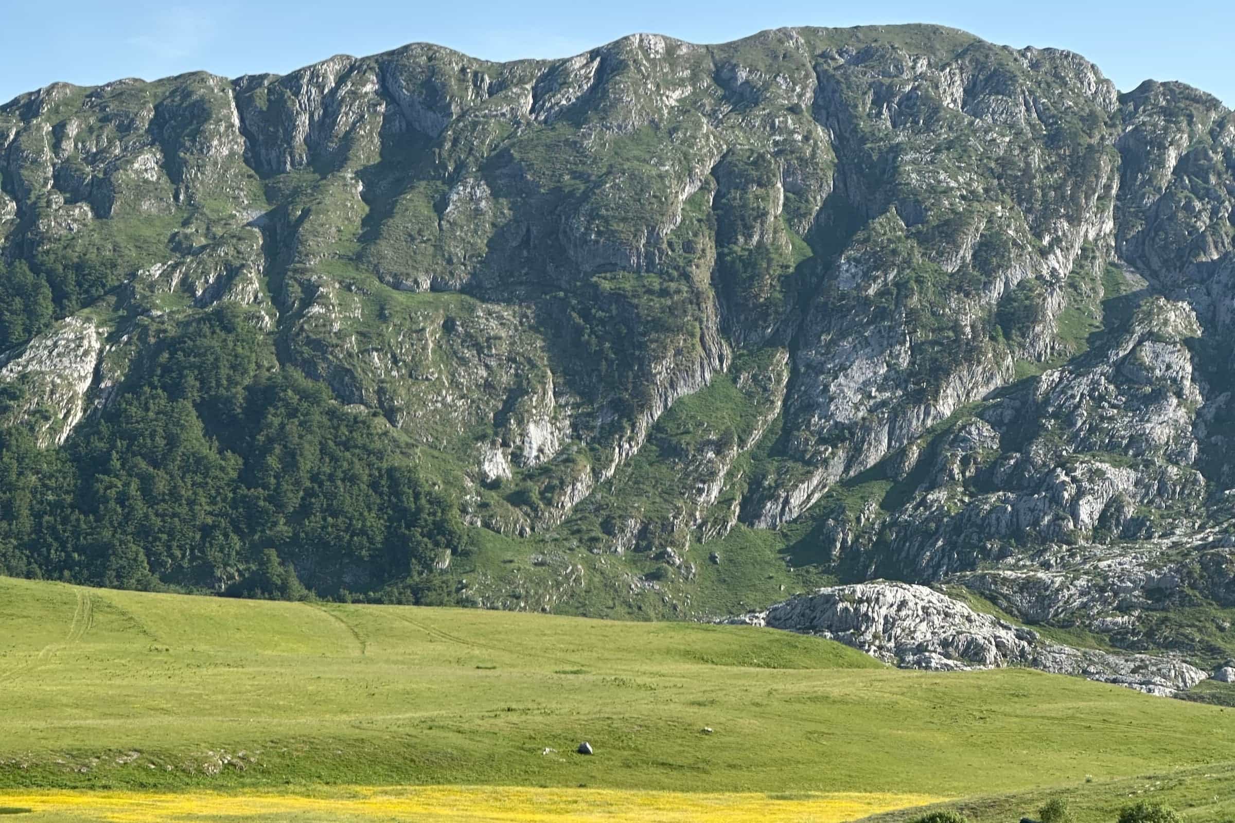
Range above the upper Morača with Kapa Moračka (2,227 m), the marked Ljevišta loop over the Morača spring, Kapetanovo jezero on Lukavica and the Mrtvica canyon on its western edge.
2,227 m · Central Region
The Moračke planine are the range above the upper Morača in Kolašin municipality: Mount Lola closes it to the north, Maganik to the south and the Mrtvica canyon to the west, and on the Lukavica side it reaches the Nikšić boundary. The highest point is Kapa Moračka, 2,227 m. One marked route crosses the range, the Ljevišta loop over the spring of the Morača and three tops of 2,000 m and more: 16.4 km, 1,466 m of ascent, about 5 hours, graded hard. Kapetanovo jezero on Lukavica, at 1,678 m, is reached only on foot. The season is summer and autumn.
Key facts
| Highest point | Kapa Moračka, 2,227 m |
| Other peaks | Lastva 2,226 m, Zagradac 2,217 m, Štit 2,191 m, Zebalac 2,157 m, Stožac 2,141 m |
| Marked trail | Ljevišta loop: 16.4 km, 1,466 m of ascent, about 5 h, hard |
| Trailhead | the school in Ljevišta, Gornja Morača, 922 m |
| Lake | Kapetanovo jezero, 1,678 m, on the Nikšić-Kolašin boundary, on foot only |
| Season | summer and autumn |
| Base town | Kolašin |
| Emergency | 112, which covers mountain rescue |

Peaks
The range runs on from Lola without a clear break. Its southern edge is the Kapa Moračka group, whose named peaks are Lastva, 2,226 m, Zagradac, 2,217 m, with cliffs above the steep Grlo section and Mali Štit close by, Štit, 2,191 m, Krutaš, 2,133 m, and Pocki vrh, 2,069 m; Kapa Moračka itself is the 2,227 m high point. Lola, to the north, has Zebalac, 2,157 m, Lijevno, 2,081 m, and Mali Zebalac, 2,073 m. Stožac, 2,141 m, and Vojnovac, 2,072 m, complete the list, and on Lukavica, above Kapetanovo jezero, Veliki Žurim reaches 2,030 m. The tops on the marked loop are lower: Rupočajska glava, 2,048 m, Šuplja greda, 2,030 m, and Šljeme, 2,000 m.

The Ljevišta loop
The loop starts at the school in Ljevišta, in Gornja Morača, at 922 m, and can be walked in either direction; the description below goes left, anticlockwise. The first 1.2 km follow a gravel road to the Morača bridge and a widening opposite the Dragić house, where a marked side path leads to the foot of the Gojkova sika waterfall. The route then climbs to the spring of the Morača, at the base of the Vragodo cirque, and on to the Vragodo katun, a cluster of ruined huts with a seasonal lake, Vragodolska jezerina, in the hollow below. About 1 km above the katun a junction splits the ways: straight on for the Trpezarije valley, Krutaš and Krnovo, right and steeply up for Šuplja greda, 2,030 m, where about 900 m of path gain roughly 400 m. The grassy summit has a vertical opening of about 10 by 3 m just below it.
From Šuplja greda the path keeps a safe distance from the ridge edge for about 700 m, drops some 90 m and climbs about 80 m to Rupočajska glava, 2,048 m, the highest point of the loop. A nearly level 400 m leads to its base, then 1.4 km with about 50 m of climb to the saddle between Veliki Zebalac and Šljeme; a side loop around Veliki Zebalac passes the Podzebalački spring. Šljeme, 2,000 m, with a stone marker on top, is 20 m of climb away over gravel road and grass. The view from it takes in Veliki and Mali Zebalac, the Ljeviške Bare katun, Lebršnik, the Javorje plateau, Lijevno, Bljušturni do, Durmitor, Sinjajevina, Komovi, Gornja Morača, Tali and the Kapa Moračka peaks. The descent loses over 200 m to the Dragić hut on Bljušturni do, crosses a small hill into the valley of the Rzački potok below Lijevno and drops about 800 m in the last 4 km to Ljevišta; 600 m to the Morača bridge and 1.2 km of gravel close the loop.

Water: taps at the school and the Dragić house in Ljevišta, the Morača spring and the Dragić hut on Bljušturni do. The loop is marked but has no stamp box or logbook. Other ways onto it: from Semolj over the Javorje plateau to the Ljeviške Bare katun, from Krnovo past the Ivanbegov katun and Krutaš to the Vragodo junction, from Bijela through Štirni do and the Podzebalački katun, and from Strug over Borova brda and Mali Zebalac.
Cross the stream gullies below Obla glava with care: the stones and the narrow tread need attention. Keep away from the ridge edges at Šuplja greda and Rupočajska glava. The emergency number 112 covers mountain rescue.

Lakes and canyons
Kapetanovo jezero lies on the Lukavica plateau at 1,678 m, on the Nikšić-Kolašin boundary: 480 m long and about 37 m deep, with trout in the water, chamois on the rocky shores and the remains of an abandoned katun at the foot of Veliki Žurim. It is reached only on foot. A longer, secluded route links the Lukavica valley, Kapetanovo jezero, the Mrtvica canyon and the Gate of Wishes. The canyon on the western edge is the best-known walk in the range: a marked trail from Međuriječje, 6.6 km and about 2 hours one way, between cliffs of 600 to 700 m.

Huts and katuns
There is no mountain hut on the range. The nearest, the Maganik hut at 1,356 m with 36 beds, stands on Maganik to the south. The katuns are the summer settlements of the range: Vragodo and Bljušturni do on the loop, Ljeviške Bare, reached by gravel road from the saddle below Šljeme, Ivanbegov on the way in from Krnovo and Podzebalački on the way in from Bijela. Summer rain keeps the pastures green.

Getting there and season
From Kolašin, take the Mioska-Semolj-Boan-Šavnik regional road; 12.1 km from Mioska, at Dragovića polje, turn left onto the local asphalt road to the centre of Ljevišta, about 6 km climbing roughly 260 m. The road passes above the school and the cemetery, crosses the Morača bridge and climbs in switchbacks past Starče; at the junction keep right towards Bojići, then left towards Ljevišta, and the school is about 700 m beyond the end of the village. The range can also be entered through the Mrtvica canyon from Međuriječje, about 30 km from Kolašin on the old road towards Podgorica, or by the northern gate at Dragovića polje. Summer and autumn are the season for the loop.

Nearby
Sinjajevina and Bjelasica are the other massifs walked from Kolašin. The Morača monastery stands on the river below the range, on the road to the canyon. Other marked routes are on the hiking page.
Questions
What is the highest peak of the Moračke planine?
Kapa Moračka, 2,227 m. Lastva, 2,226 m, and Zagradac, 2,217 m, are the highest named summits of the Kapa Moračka group on the southern edge of the range.
How long is the Ljevišta loop?
16.4 km with 1,466 m of ascent, about 5 hours, graded hard; it starts and ends at the school in Ljevišta, 922 m.
How do you reach Kapetanovo jezero?
Only on foot, over the Lukavica plateau; the lake sits at 1,678 m on the Nikšić-Kolašin boundary.
Sources
MONSTAT, Statistical Yearbook 2025, table 1-8 Mountain peaks over 1800 m · Tourist Organisation Kolašin, Moračke planine · Tourist Organisation Kolašin, Lakes · TO Kolašin, Ljevišta circular trail · TO Kolašin, Mrtvica canyon trail · National Tourism Organisation, Hiking and trekking · EKIP, 112 emergency number press release, Feb 2023 · PSCG (Mountaineering Association of Montenegro): mountain huts