Kapetanovo jezero (Kapetanovo Lake)
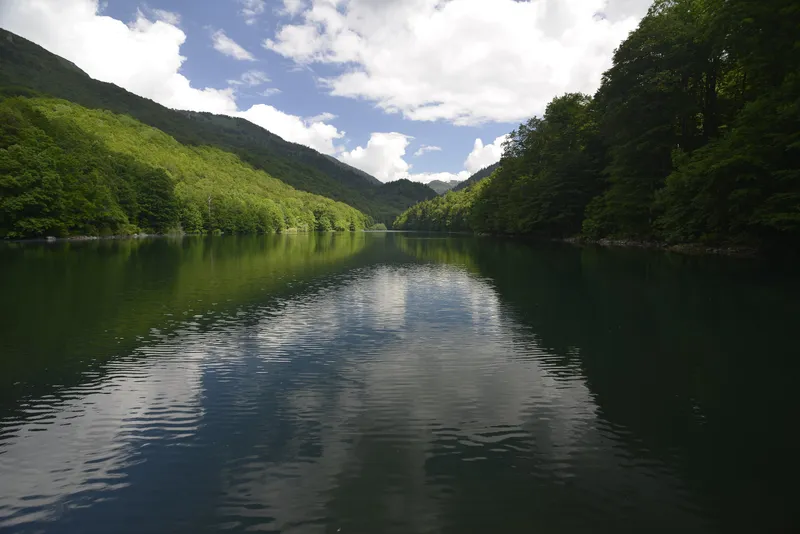
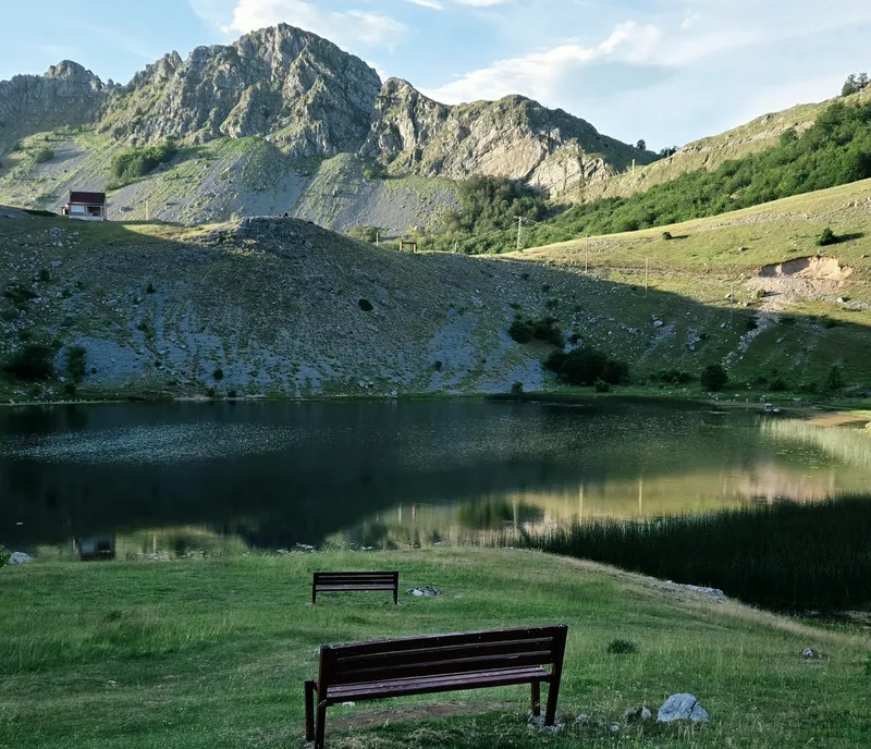
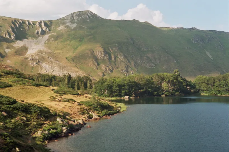
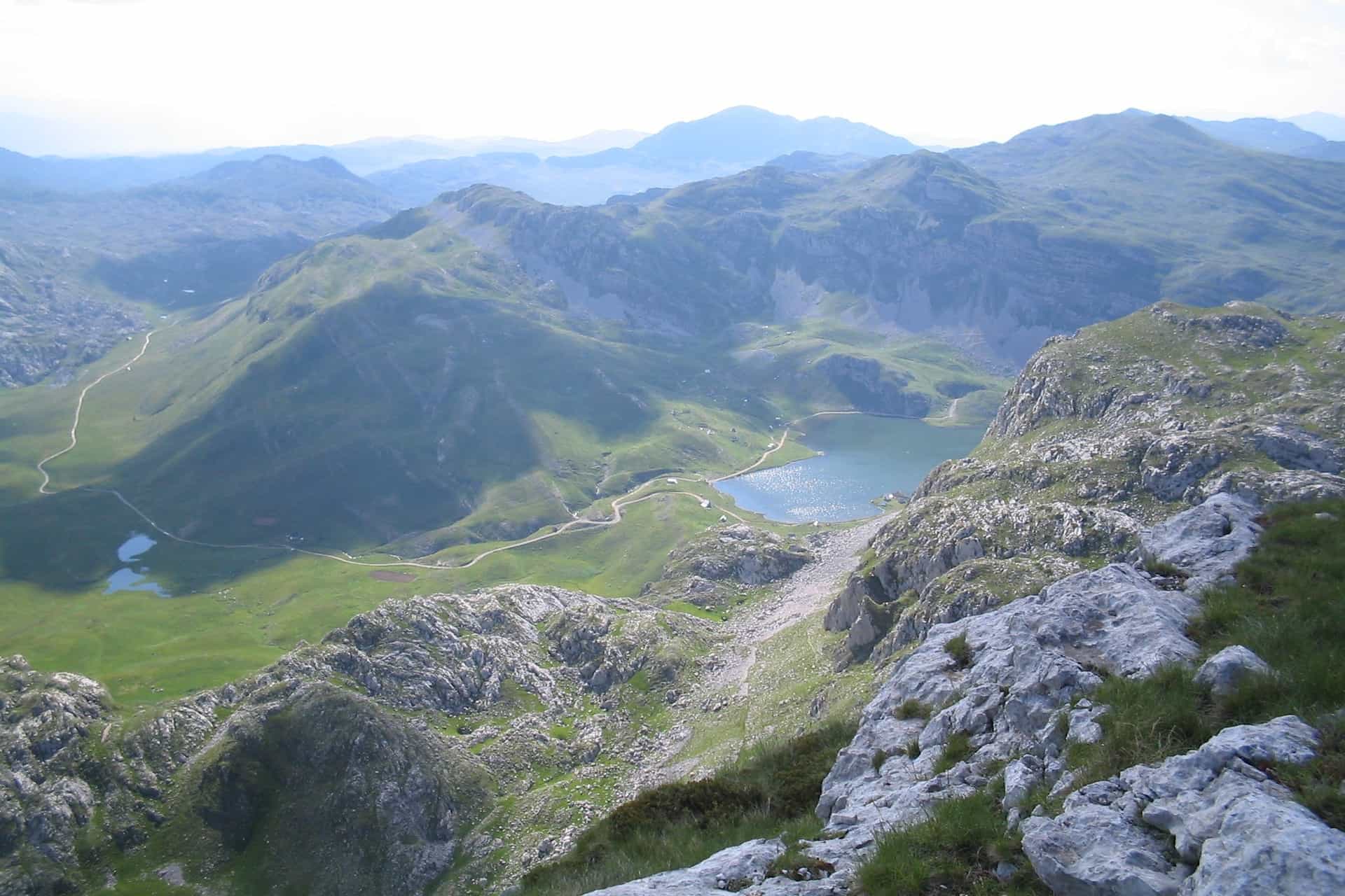
A glacial lake at 1,678 m on the Lukavica plateau in the Moračke planine, on the Nikšić-Kolašin boundary: 480 m long and 37 m deep, the deepest glacial lake in Montenegro after Black Lake, with trout, chamois, marked trails from the Nikšić side and about thirty katun houses on the shore.
Lukavica (Nikšić and Kolašin)
Photo: Emil Joanović · CC BY-SA 3.0
- Surface
- 0.092 km²
- Max depth
- 37 m
Kapetanovo jezero (Kapetanovo Lake) is a glacial lake at 1,678 m on the Lukavica plateau in the Moračke planine, on the boundary between the municipalities of Nikšić and Kolašin. At 37 m it is the deepest glacial lake in Montenegro after Black Lake. Trout live in it, chamois on the slopes above, marked trails lead in from the Nikšić side, and about thirty small houses stand around the shore.
The lake in figures
| Type | Glacial lake |
| Elevation | 1,678 m |
| Area | 0.092 km² |
| Length | 480 m |
| Shoreline | 1.42 km |
| Mean depth | 12.9 m |
| Maximum depth | 37 m |
| Volume | About 1.19 million m³ |
| Settlement | Velje Duboko, Kolašin municipality; the Nikšić boundary runs along the west shore |
Lukavica
The Lukavica plateau was used for sheep and cattle, and an abandoned katun still stands under Veliki Žurim (2,030 m), the highest point of the Lukavica group. Around the lake itself are about thirty small houses, the older ones from the herding days, the newer ones built for leisure, and a 200 m stretch of asphalt was laid along the west shore in 2022. A local legend tells of Captain Mušović and the mountain fairies.

Hiking
The Nikšić tourist board lists two marked trails to the lake: from Gradačka poljana (20 km) and from Zagarački katun (5.5 km). The Kolašin tourist board describes the walk in as demanding. A longer line runs across the Lukavica valley to the lake and on into the Mrtvica canyon, and horse-riding tours also go to the lake area. See the hiking hub for the national trail rules.
Fishing
Kapetanovo holds native and brook trout and is one of the two lakes the national tourism organisation names for trout fishing, with Biogradsko jezero. The Nikšić tourist board lists the lake among the Nikšić waters, where the angling club SRK Nikšić sells day, month and season permits. The fishing hub has the national rules.

Getting there
The lake is 34.3 km (about 1 h 20) from Nikšić and 84.8 km (about 2 h 20) from Podgorica by car; the slow times reflect a mountain road. A road reaches the lake from the Nikšić side, and about 200 m of asphalt was laid along the west shore in 2022. The Kolašin tourist board describes the lake as a hikers' goal; the marked trails from Gradačka poljana and Zagarački katun are the walking routes.
Manito jezero and Jezerina
Two smaller lakes lie above Kapetanovo. Manito jezero is about 1.2 km to the south-east and about 100 m higher, at 1,773 m: 0.026 km², up to 13.4 m deep, with no road and no buildings. Jezerina, a seasonal lake, lies a further 2 km south-east at 1,855 m.

Nearby
- The Moračke planine, the range Lukavica belongs to.
- Maganik, the massif to the south.
- The Mrtvica canyon, the far end of the Lukavica traverse.
- Nikšić, with Lake Krupac and Slano jezero on the field below.
- Kolašin on the Morača side.
- Other lakes on the lakes hub.
Questions
How deep is Kapetanovo jezero?
Up to 37 m, with a mean depth of 12.9 m. Only Black Lake on Durmitor is deeper among the glacial lakes of Montenegro.
Can you drive to the lake?
A road reaches the lake from the Nikšić side, with about 200 m of asphalt on the west shore. The marked trails from Gradačka poljana and Zagarački katun are the walking routes.
Which municipality is it in?
The water register places it in Velje Duboko, Kolašin municipality, with the Nikšić boundary along its west shore; the tourist boards describe it as on the Nikšić-Kolašin border.
Can you fish there?
Yes, for native and brook trout. Permits for the Nikšić waters come from the angling club SRK Nikšić.
Activities
- Hiking
- Fishing
Things to do
Hiking
Marked trails from Gradačka poljana (20 km) and Zagarački katun (5.5 km); a longer line continues to the Mrtvica canyon.
Trout fishing
Native and brook trout; permits for Nikšić waters from SRK Nikšić.
Katun country
An abandoned katun under Veliki Žurim and about thirty small houses around the lake.
Manito jezero
Manito jezero 1.2 km to the south-east at 1,773 m, with no road or buildings.
Sources
Government of Montenegro: Registar voda od značaja za Crnu Goru (2024), entry Kapetanovo jezero with Manito jezero and Jezerina (p. 56), read 2026-11-02 · TO Kolašin: Lakes (Kapetanovo jezero), read 2026-11-02 · TO Nikšić: Lakes and Hiking sections (Kapetanovo trails, SRK Nikšić permits), read 2026-11-02 · TO Mojkovac: Natural attractions (Zabojsko jezero as third deepest after Crno and Kapetanovo), read 2026-11-02 · NTO Montenegro: Fly fishing (trout at Biogradsko and Kapetanovo), read 2026-11-02 · NTO Montenegro: Hiking and trekking (Lukavica valley, Kapetanovo jezero, Mrtvica canyon), read 2026-11-02 · NTO Montenegro: Horse riding (tours to the Kapetanovo lake area), read 2026-11-02 · MONSTAT: Statistical Yearbook 2025, table 1-8 mountains (Lukavica, Veliki Žurim 2,030 m), read 2026-10-14 · Routes computed with OSRM on OpenStreetMap data (ODbL)