Skadar Lake
The largest lake in the Balkans, shared with Albania: about 370 km² in summer and 540 km² in winter, 6 m above sea level, 44 m at its deepest surveyed point and about 60 m at the Raduš spring. National park since 1983, Ramsar wetland since 1995, 281 bird species. Boats from Virpazar, Vranjina, Rijeka Crnojevića and Plavnica.
Tectonic Lake · 6 m · Podgorica / Cetinje / Bar
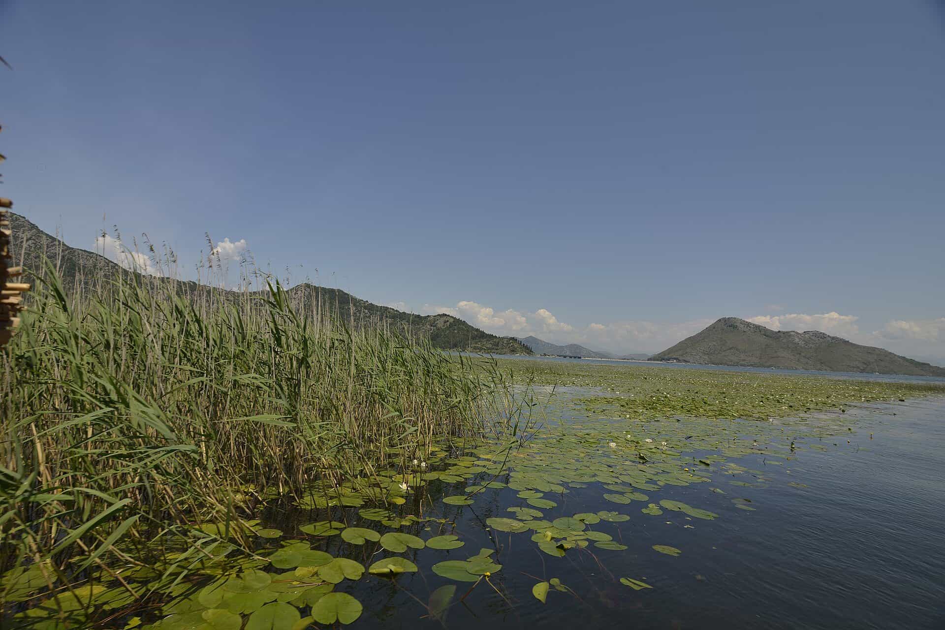
Photo: Miomir Magdevski · CC BY-SA 4.0
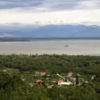
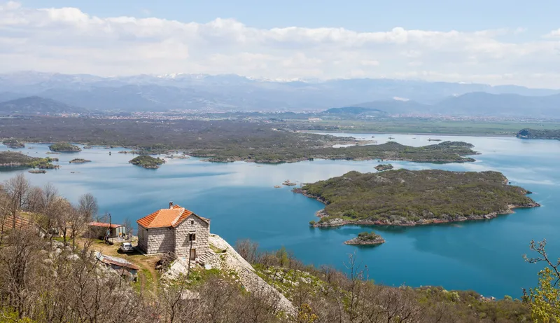
Skadar Lake (Skadarsko jezero) is the largest lake in the Balkans, shared between Montenegro and Albania on the plain south of Podgorica. It covers about 370 km² at its summer low and swells to around 540 km² in winter, when the floods push the shoreline far into the reed beds; the Montenegrin side has been Skadar Lake National Park since 1983. For a visitor it is above all a lake you go out on: boats leave from Virpazar, Vranjina, Rijeka Crnojevića and Plavnica for cruises with a swim, kayaks are for hire, 281 bird species have been recorded, and the shore villages look out on island monasteries and a fortress on an islet.
Skadar Lake tours
Sponsored Skadar Lake National Park Guided Boat Tour with Wooden BoatRating 4.8 (148)from €22.15
 Virpazar Skadar Lake Boat Tour with Wildlife & NatureRating 5 (35)from €22
 Skadar Lake National Park: Guided Boat Tour to Kom MonasteryRating 4.7 (64)from €32.15
 Private Skadar Lake National Park Tour with Wooden Boat and WineRating 4.9 (15)from €67.86
Tours, ratings and prices: Viator.
All tours in Skadar LakeSize and shape
About two thirds of the lake lie in Montenegro and one third in Albania: 63.2 % of the water and 110.5 km of the 168 km shoreline are Montenegrin. The lake is about 44 km long and 14 km wide, and its surface sits only 6 m above sea level. The official survey figure of 369.7 km² is close to the summer low; the winter floods add roughly 170 km², which is why maps of the lake never quite agree with what you see from the shore.
Average depth is only about 5 m, but the lake is a cryptodepression: about 30 underwater springs, called oka (eyes), reach below sea level. The deepest point measured in the survey is 44 m, and the Raduš spring goes down to about 60 m. The lake is of tectonic-karst origin. Its main parts carry their own names: Veliko blato, Malo blato, Vučko blato, Hotski zaliv, Gornje blato and the drowned valley of Rijeka Crnojevića. The Morača flows in from the Podgorica side; the Bojana carries the water out to the Adriatic. About 50 islands, islets and reefs sit mostly along the south-west shore, several of them with monasteries (Moračnik, Beška, Starčevo, Kom) and one with the Grmožur fortress.
Birds and protection
Three statuses apply to the Montenegrin side. The national park, declared on 27 November 1983, covers 40,000 ha of lake and shore in the municipalities of Podgorica, Cetinje and Bar; since the split of Podgorica's territory the shore municipalities are Bar, Tuzi, Zeta and Cetinje. The lake has been a Ramsar wetland of international importance since 1995 (site no. 784, 20,000 ha) and an Important Bird Area since 1989. It is not a UNESCO site.
281 bird species have been recorded, over 100 of them breeding. The Dalmatian pelican breeds here in at least 50 pairs, its main breeding site in Montenegro; the pygmy cormorant colony, over 2,920 pairs, is the largest in the country; whiskered terns nest in about 1,000 pairs, and more than 20,000 waterbirds winter on the lake. The ornithological reserves are Pančeva oka and Manastirska tapija. Bird-watching stations stand at Manastirska tapija, Grmožur, Omerova gorica, Crni žar and Pančevo oko, with a watch tower at Stanaj. Guided bird-watching with the park is booked a day ahead; April to June gives the widest range of species and winter the largest flocks. The lake also holds about 48 fish species, six of them endemic to the basin, 49 mammal species (the otter is the only semi-aquatic one), and large beds of water chestnut (kasoronja) along the north shore, a legally protected plant.

Boats, kayaks and beaches
Licensed operators run cruises from Vranjina, Virpazar, Rijeka Crnojevića and Plavnica; a swimming stop is part of the tour, and the boat tours hub lists the options. The park rents its own kayaks at the Vranjina visitor centre: €3 an hour for a single, €5 for a double, €20 a day, and electric bikes at the same place. The Skadar Lake kayaking page covers routes and operators. Three beaches have facilities: Pješačac, Pelinovo and Murići, on the Krajina shore below Rumija. Off Karuč bay lies the wreck of the steamship Skenderbeg, built in Trieste in 1916 and sunk in 1942, now a dive site.
 SponsoredKayaking on Skadar Lakeon Viator

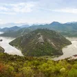
On land there are nine marked walking trails and five cycling and two mountain-bike routes (Dodoši-Žabljak Crnojevića and Virpazar-Orahovštica); maps are at the visitor centres in Vranjina and Virpazar. The old caravan road from Komarno to Rijeka Crnojevića is 10.1 km one way (about 6 hours, medium); Zabes to Godinje is 4.5 km (about 2 hours); Rijeka Crnojevića to Karuč is 9.5 km one way. The best-known view is Pavlova strana above Rijeka Crnojevića, where the river makes its wide bend towards the lake; Zekova glava (164 m) is the central lake viewpoint. Both are on the Skadar Lake viewpoints page.
Fishing
Sport fishing needs a permit, sold at the park office in Vranjina or by the ranger on duty: €5 for a day, €20 for seven days, €100 for a year (€50 for pensioners and students). Carp, bleak (ukljeva) and eel are the usual catch; carp is the most important freshwater fish in Montenegro, with about 250 t landed a year, and bleak about 200 t.
The closed seasons on the Skadar Lake fishing area come from the national fishing order in force since 11 June 2026: bleak 15 March-31 October, carp and other cyprinids 15 March-15 May, nase 15 March-1 June, kubla 1 March-15 May, eel 1 June-1 December, all trout 1 November-1 April. Minimum sizes are 12 cm for bleak, 40 cm for carp and 30 cm for eel. Night fishing is banned in all waters (spring 20:00-05:00, summer 21:00-04:00, autumn 19:00-06:00, winter 17:00-06:00), with night carp fishing the one exception, and from 15 May to 15 October no nets may be in the lake between 10:00 and 16:00. All fishing is banned until 15 May 2027 on the Rijeka Crnojevića from the Obod cave to Gradina and Lisinj, on the whole Plavnica river and in the Virpazar canal, and until 15 May 2029 at Raduš, Karuč, Bjace, Sijerča, Vaškaut and the Vranjina-Tanki rt bridge, as well as within 850 m of Pančeva oka, 500 m of Crni žar and Manastirska tapija, 200 m of Pjavnik and 150 m of Omerova gorica, Golubovo ostrvo, Manastirski vrbiš and Grmožur island. The fishing hub covers permits elsewhere in Montenegro.
Tickets and rules in brief
- Park entrance €5 per person per day, free under 15, 50 % off for groups of 20 or more; an annual ticket for all five national parks is €13.50. The ticket includes the visitor centres at Vranjina and Virpazar. Free entry on 22 April, 21, 22 and 24 May, the second Sunday of June, 13 July and 31 July.
- Boats over 10 hp need the park's approval; anchoring only at designated places; no underwater activity without approval. A private kayak costs €20 a year, recreational boats €100 to €200 a year by size.
- Camping only at designated places (tent pitch €3 a day).
- Drones need a permit from the Environmental Protection Agency, a Civil Aviation Agency permit above 249 g, and the park's approval.
The full price list, the zoning and the visitor centres are on the national park page.
Getting there
The lake begins about 19 km from Podgorica; by car, without traffic, Podgorica to Vranjina is 24.5 km (about 30 minutes), to Virpazar 30.7 km (about 35 minutes) and to Rijeka Crnojevića 27.6 km (about 35 minutes). From the coast: Bar to Virpazar 26.2 km (about 30 minutes), Budva to Virpazar 41.6 km (about 55 minutes), Ulcinj to Virpazar 50.1 km (about 65 minutes). From Cetinje the short way is to Rijeka Crnojevića, 16.4 km (about 25 minutes); Cetinje to Virpazar is 37.9 km (about 55 minutes). The park administration and main visitor centre are at Vranjina; the second visitor centre is in Virpazar, on the upper floor of the tourist office building. Boats leave from those two places and from Rijeka Crnojevića and Plavnica. Parking at park rates costs €1 an hour for a car.
Nearby
Virpazar, the small town at the Bar end of the lake, has the 13 July memorial and a grape festival in September. Rijeka Crnojevića keeps Prince Danilo's bridge of 1853 and the village memorial. Cetinje municipality holds the Pavlova strana viewpoint and Lovćen National Park; Bar municipality stretches from the lake over Rumija to the Adriatic, with Stari Bar as its old town. The shore and island monasteries protected as cultural property are Moračnik, Beška, Starčevo, Kom, Vranjina, Orahovo, Prečista Krajinska and Gornji and Donji Brčeli. Other lakes are on the lakes hub.

Questions
How big is Skadar Lake?
About 370 km² in summer and 540 km² in winter, about 44 km long and 14 km wide, with an average depth of about 5 m; the deepest surveyed point is 44 m and the Raduš spring reaches about 60 m.
Is it the largest lake in the Balkans?
Yes. It is the largest lake in the Balkan Peninsula; it is not the largest in Southern Europe.
Can you swim in the lake?
Yes, at the three equipped beaches (Pješačac, Pelinovo, Murići) and during the swimming stops on licensed boat tours.
Do I need a permit to fish, and when is fishing closed?
Yes: €5 a day, €20 a week or €100 a year (€50 for pensioners and students), from Vranjina or the duty ranger. Bleak is closed 15 March-31 October, carp 15 March-15 May, eel 1 June-1 December; the bird reserves and several named spots are off limits, and night fishing is banned except for night carp fishing.
How do I get to Virpazar from Podgorica?
30.7 km, about 35 minutes by car; Vranjina, with the main visitor centre, is 24.5 km.
Activities
- Boat Tours
- Birdwatching
- Kayaking
- Fishing
- Swimming
Things to do
Boat trip
Licensed operators from Vranjina, Virpazar, Rijeka Crnojevića and Plavnica, with a swimming stop.
Birdwatching
281 species; Dalmatian pelican and pygmy cormorant colonies. Book with the park a day ahead; widest variety April to June, largest flocks in winter.
Kayaking
Park kayaks at Vranjina: €3 or €5 an hour, €20 a day.
Fishing
Carp, bleak and eel with a permit from €5 a day, sold at Vranjina or by the ranger; closed seasons by species.
Swimming
Equipped beaches at Pješačac, Pelinovo and Murići, and the swimming stop on boat tours.
Walking and cycling
Nine marked trails and seven bike routes; maps at the visitor centres.
On these trips
Beaches on the lake
Sources
MONSTAT, Statistical Yearbook 2025, table 1-6 Natural lakes · JPNPCG, Management Plan NP Skadarsko jezero 2026-2030 (PDF) · JPNPCG, Skadarsko jezero price list · JPNPCG, Skadarsko jezero active holidays (boats, trails, fishing) · JPNPCG, Skadarsko jezero fauna and flora · Law on National Parks (Sl. list CG 28/2014, 39/16) · Decision on fees for the use of national park goods, consolidated text · JPNPCG, online tickets and exemptions · JPNPCG, rules on filming, photography and drones (1 Jul 2026) · Ramsar Sites Information Service, annotated list for Montenegro · National Tourism Organisation, Skadar Lake National Park · TO Bar, natural attractions · TO Bar, activities · TO Bar, events and festivals (Virpazar) · TO Podgorica, how to get there (distance to the lake) · Rijeka Crnojevića heritage site, Danilo's bridge · Naredba o zabrani lova ribe (Sl. list CG 75/2026, in force 11 June 2026): closed seasons, sizes, banned zones · OSRM routing (car, OpenStreetMap data, ODbL; times without traffic)