Skaline
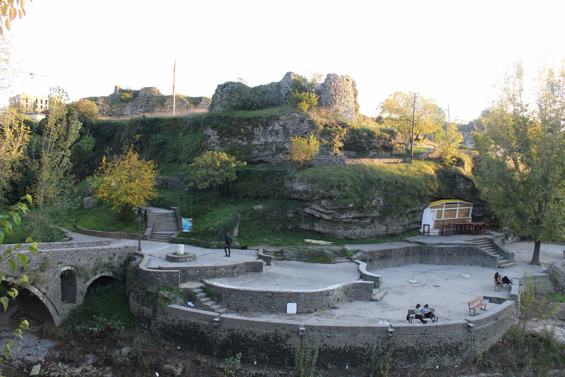
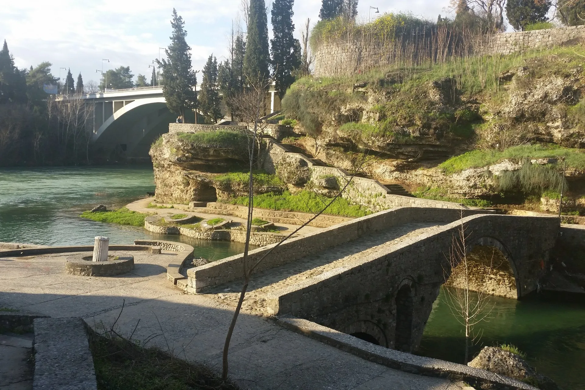
The stone steps down to Sastavci, where the Ribnica meets the Morača below Stara Varoš, with the old bridge at their foot and the fortress walls beside them.
Photo: Gerodot1986 · CC BY-SA 4.0
Skaline is the flight of stone steps down to Sastavci, where the Ribnica flows into the Morača in the centre of Podgorica, just below Stara Varoš. Sastavci is the older name, after the confluence; younger people call the place Skaline, the local word for steps. The top of the steps is about 500 m and 6 minutes on foot from Independence Square (Trg nezavisnosti), and the riverside is a public space, free to visit.
What you see
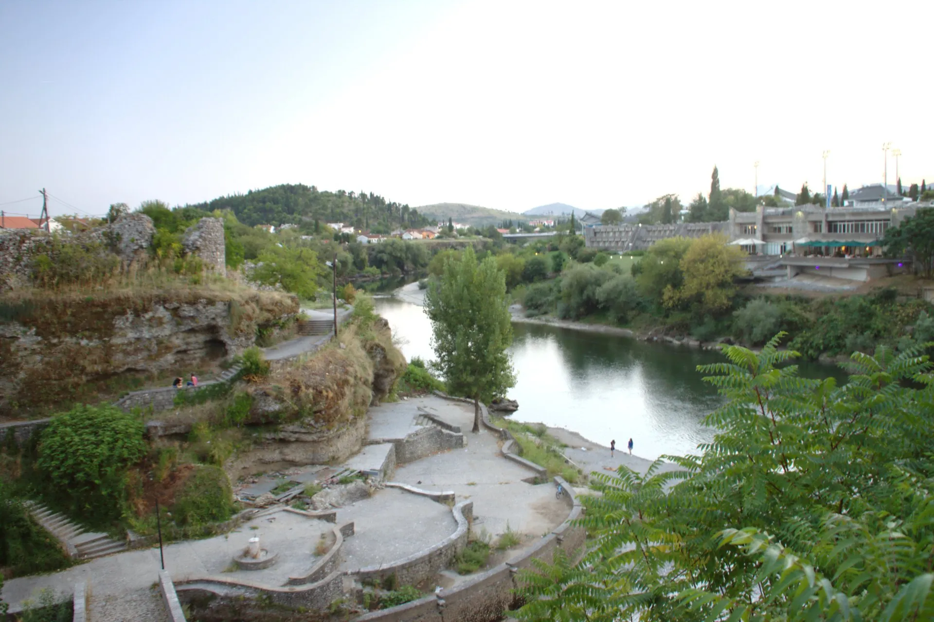
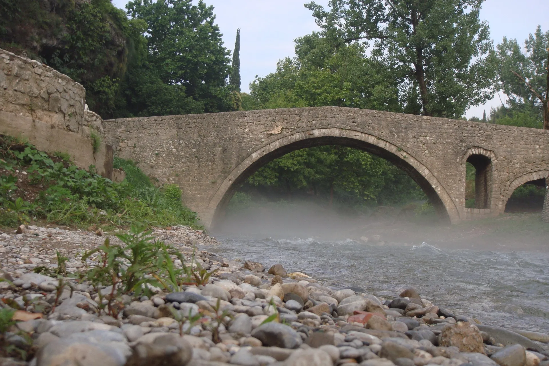
From the top of the steps you look down on the confluence of the Ribnica and the Morača, the stone terraces at river level and the rock banks of the Morača. At the foot of the steps the old bridge on the Ribnica, a low single stone arch and the oldest bridge in the city, crosses the Ribnica just before its mouth.
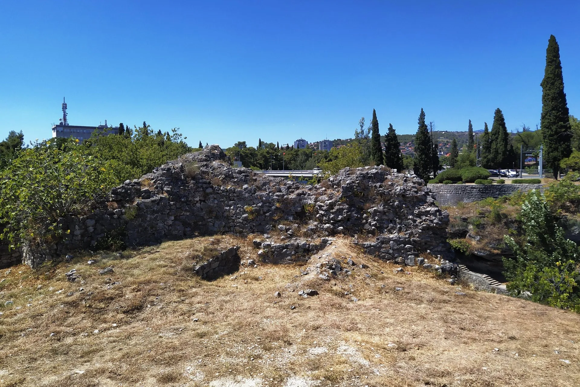
Beside the steps stand ruined walls of the Ottoman fortress (Ribnica, Depedogen) at the mouth of the Ribnica; the main site lies about 100 m south of the top of the steps.
The steps
The Skaline flight has 88 steps of square stone blocks. It starts in Stara Varoš and ends beside the north end of the old bridge. There is no handrail, no ramp and no lighting.
Two more flights lead down to the same confluence: one of 72 concrete steps, and one of 49 stone steps on the east side, towards the Monument to King Nikola. Both are lit; neither has a handrail. OpenStreetMap maps no step-free way down to the terraces.
The water through the year
The Ribnica usually dries up in summer, so its bed below the old bridge is then often dry. Outside summer the river carries water and runs into the Morača at the foot of the steps.
Sunset and evenings
Sastavci has long been a meeting place for couples and for young and old alike. The sunset seen from the old bridge, known as Podgorica's 'bridge of sighs', is the reason to come late in the day.
Tip: The Skaline steps have no lighting. After dark, the lit old bridge and the other two flights of steps (72 concrete, 49 stone) are the easier way back up to town.
How to get there
- From Independence Square (Trg nezavisnosti): about 500 m on foot, 6 minutes, to the top of the steps.
- From the clock tower in Stara Varoš: about 640 m, 8 minutes, to the top; to the bottom, by the old bridge, about 580 m, 7 minutes.
- GPS: top of the steps, 42.43987, 19.25874.
- Entry: free; a public riverside space with no gate.
Around Skaline
Walking distances from the top of the steps:
- Monument to King Nikola: about 190 m, 3 minutes.
- Monument to Pushkin and Natalia Goncharova: about 215 m, 3 minutes.
- Monument to Vladimir Vysotsky on the Morača bank: about 600 m, 7 minutes.
- Podgorica City Museum: about 630 m, 8 minutes.
- Clock tower (Sahat kula) in Stara Varoš: about 640 m, 8 minutes.
- Gorica hill, for a view from higher up over the Morača and the Millennium Bridge: about 1.9 km, 23 minutes.
Questions
Is Skaline the same as Sastavci?
Yes, Skaline and Sastavci are one place in Podgorica: Sastavci is the older name, after the confluence of the Ribnica and the Morača, and younger people call it Skaline, after the steps.
Where is Skaline in Podgorica?
Skaline is at the mouth of the Ribnica into the Morača, below Stara Varoš, about 500 m and 6 minutes on foot from Independence Square.
How many steps does Skaline have?
The Skaline flight in Podgorica has 88 stone steps, with no handrail and no lighting.
Does the Ribnica have water at Skaline in summer?
Usually not: at Skaline the Ribnica tends to dry up in summer, and outside summer it carries water into the Morača.
What are the walls beside Skaline?
The walls beside Skaline are the remains of the Ottoman fortress (Ribnica, Depedogen) at the mouth of the Ribnica.



More scenic viewpoints
Nearest by road first


Sources
Tourist Organisation Podgorica, Sastavci and Stone Bridge · Tourist Organisation Podgorica, Sastavci i most na Sastavcima · Capital City Podgorica, history (Ottoman fortress Depedogen at the mouth of the Ribnica) · OpenStreetMap way 224725679 Skaline (highway=steps: 88 steps, sett, no handrail, no ramp, not lit), ODbL · OpenStreetMap way 224723782 (steps: 72, concrete, lit, no handrail), ODbL · OpenStreetMap way 1181876786 (steps: 49, sett, lit, no handrail), ODbL · OpenStreetMap way 179918252 Depedogen (historic=archaeological_site), ODbL · OpenStreetMap way 179918253 (historic=ruins, the walls beside the Skaline steps), ODbL · OpenStreetMap way 28157847 (old bridge, lit footway), ODbL · Wikipedia, Ribnica (Morača) (secondary: dries up in summer) · Routes computed with OSRM on OpenStreetMap data (ODbL)