Via Dinarica White Trail in Montenegro
The Via Dinarica White Trail crosses Montenegro in stages 38 to 43, about 236 km from Maglić on the Bosnian border through Durmitor, Sinjajevina, Biogradska gora, Bjelasica and Komovi to Gusinje under Prokletije.
Northern Montenegro, Maglić to Gusinje · 6 stages, about 236 km
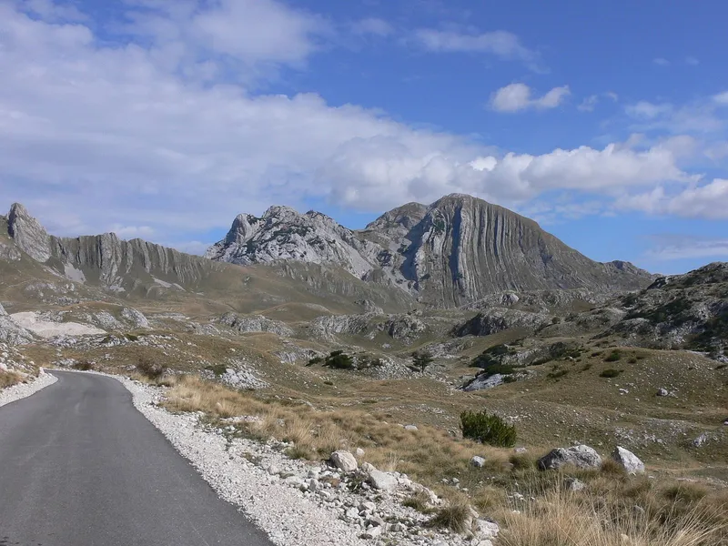
Photo: Julian Nyča · CC BY-SA 4.0
The Via Dinarica White Trail is the 1,261 km mountain route along the Dinaric Alps from Postojna in Slovenia to Valbona in Albania, and its six Montenegrin stages, 38 to 43, cross the country's highest ground: from Maglić on the Bosnian border through Durmitor, over the Sinjajevina plateau to Biogradska gora, across Bjelasica and the Komovi and down to Gusinje under the Prokletije. The six stages add up to about 236 km, three of Montenegro's five national parks lie on the way, and the trail crosses the borders with Bosnia and Herzegovina and with Albania at places with no border post, so every group contacts the border police before it sets off.
Key facts
| Whole White Trail | 1,261.2 km, Postojna (Slovenia) to Valbona (Albania), 45 stages, about 49,600 m of ascent; highest point Maja Jezerce, 2,694 m, in Albania |
| Montenegrin stages | 38-43, about 236 km; stage 38 is shared with Bosnia and Herzegovina |
| National parks on the trail | Durmitor, Biogradska gora, Prokletije; the Komovi nature park |
| Entry and exit | in from Bosnia and Herzegovina over Maglić; out of Gusinje over Maja Jezerce to Theth and Valbona in Albania |
| Border police | contact before the hike wherever the trail crosses without an official crossing |
| Overnights | mountain huts and rural households, booked ahead |
| Park tickets | Durmitor €5, Biogradska gora €4, Prokletije €3 per person per day; annual ticket for all five parks €13.50 |
Stages in Montenegro

| Stage | Route | Length |
|---|---|---|
| 38 | Maglić to Pivska planina, through the Piva canyon (Bosnia and Herzegovina / Montenegro) | 29.9 km |
| 39 | Durmitor | 41.7 km |
| 40 | Žabljak via Sinjajevina to Biogradska gora | 78.2 km |
| 41 | Biogradska gora via Bjelasica to Komovi | 41.3 km |
| 42 | Komovi to Vermosh (Albania) | 32.5 km |
| 43 | Vermosh to Gusinje | 12.8 km |
Stage 37 ends at Trnovačko jezero below Maglić; stage 38 crosses the mountain the two countries share and drops through the Piva canyon to the Piva plateau. Stage 39 crosses Durmitor, the most visited of the national parks, to Žabljak, the highest town in the Balkans. Stage 40, at 78.2 km the longest of the six, crosses the pastures of Sinjajevina to Biogradska gora and its old-growth forest around Biogradsko jezero. Stage 41 climbs over Bjelasica, whose meadows and glacial lakes are the gentlest ground on the Montenegrin section, to the Komovi, a nature park; the katuns along the way offer their own produce. Stage 42 leaves the Komovi for Vermosh in Albania and stage 43 comes back over the border to Gusinje under the Prokletije, the wildest and hardest range on the trail. From Gusinje the White Trail goes on over Maja Jezerce, 2,694 m, its highest point, to Theth and Valbona in Albania: stages 44 and 45, 32 and 20 km.
Borders
The trail crosses the borders with Bosnia and Herzegovina and with Albania at places with no official border crossing point; contacting the border police before the hike is mandatory. The Peaks of the Balkans page describes the notification the Plav border police use for the Prokletije crossings. In the Prokletije the main bases are Plav and Gusinje; the mountain crossing to Albania leads towards Zla kolata on the border, and the road crossing is Grnčar near Gusinje, towards Vermosh, for passengers only. All crossings are on the border crossings page.
Overnights and parks
Nights are spent in mountain huts and rural households along the route, arranged in advance; the park pages list the huts, shelters and camping places on Durmitor, at Biogradsko jezero and in the Prokletije. Each park charges its own daily ticket, Durmitor €5, Biogradska gora €4 and Prokletije €3 per person per day, or one annual ticket for all five national parks at €13.50, sold online at ulaznice.nparkovi.me. A GPX file of the Montenegrin route is published by the Accursed Mountains cross-border project.
When to go
The high massifs are walked from June to the end of October: Durmitor is at its best from July to September, Sinjajevina and Bjelasica are walked from May to October, and snow can lie on the Prokletije even in summer. Plan the stages to your own fitness and walk in a group; a licensed mountain guide is the recommended company on the high routes, and the Mountaineering Association of Montenegro lists the certified guides.
Safety
Stage 40 is 78.2 km across the Sinjajevina plateau, the longest of the six; plan it over more than one day. Carry a map, compass or GPS, weather protection, a torch, enough water and food, a first-aid kit and a whistle. The emergency number is 112.

Nearby
Each Montenegrin stage has its own pages here: the Durmitor massif and hiking in Durmitor, Sinjajevina, Biogradsko jezero and Bjelasica, the circular trail around the Komovi and Kučki kom, and in the Prokletije the Grebaje valley above Gusinje and Plav on Plav Lake. The Peaks of the Balkans is the other long-distance route, a loop through Montenegro, Albania and Kosovo; all marked routes are on the hiking hub.
Questions
How long is the Via Dinarica in Montenegro?
About 236 km in six stages, 38 to 43, from Maglić to Gusinje; the first of them is shared with Bosnia and Herzegovina.
Which national parks does it cross?
Durmitor, Biogradska gora and Prokletije, plus the Komovi nature park.
Do I need to register with the border police?
Yes, wherever the trail crosses the border away from an official crossing point: contact the border police before the hike.
Where do I sleep?
In mountain huts and rural households, booked ahead; the three parks' own huts, shelters and camping places are on their pages.
Highlights
- Stages 38-43 of the 1,261 km White Trail
- About 236 km from Maglić to Gusinje
- Durmitor, Biogradska gora and Prokletije national parks
- Border police contact mandatory at the unofficial crossings
Sources
Via Dinarica trail portal: White Trail route page · Via Dinarica: Montenegro · Accursed Mountains (EU CBC project site): Via Dinarica · NTO: Hiking and trekking · National Parks of Montenegro: Durmitor price list · National Parks of Montenegro: Biogradska gora price list · National Parks of Montenegro: Prokletije price list · National Parks of Montenegro: online tickets · Uprava policije: Granični prelazi (archived gov.me page)